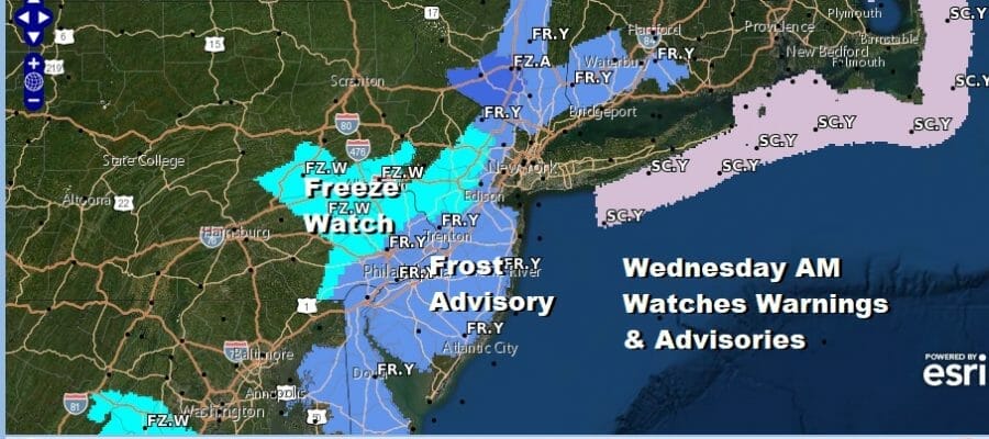
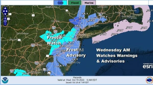
Frost Advisories For Wednesday Morning, Colder Air Arriving Today
Colder air is arrving today and we can see on the satellite loop the strong upper air storm over the Eastern Great Lakes just rotating away and not moving very much to the east or, if it is, it is doing it very slowly. Arms of showers have shifted east and brought a Yankee playoff game cancellation last night. There are still some rain showers over Eastern New England today with heavy rains in parts of Maine. We are also seeing what will be some lake effect snow showers developing around Southwest NY and NW Pennsylvania.
SATELLITE

WEATHER RADAR

In between the rain bands to the east and the lake effect to the west will be a nice day of sunshine with just some passing clouds. There will be a bit of a breeze and temperatures are not likely to go much of anywhere today. Highs will be in the low to middle 50s with some inland areas probably not getting much above 50.

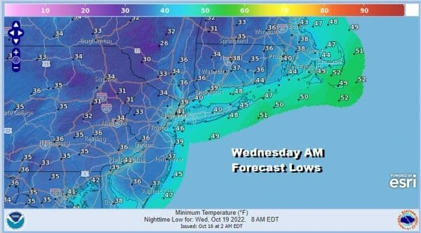
Tonight will be cold and we have various frost advisories and freeze watches up for Wednesday morning. Some additional areas will likely be added later today. Remember that these sorts of watches and warnings only go up for the first frost of freeze event to mark the end of the growing season. Lows will be in the 30s with warmer urban areas will be close to 40.
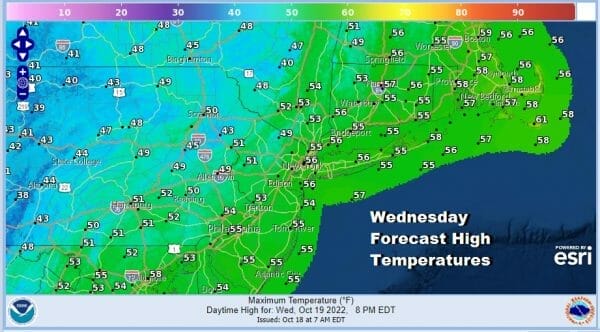
Wednesday we are look at a chilly day with sunshine and highs reaching the upper 40s to near 50 inland and 50 to 55 degrees everywhere else. Then it will be another cold night of clear skies and temperatures down in the low to mid 30s inland and again near 40 warmer urban areas and along the coast.
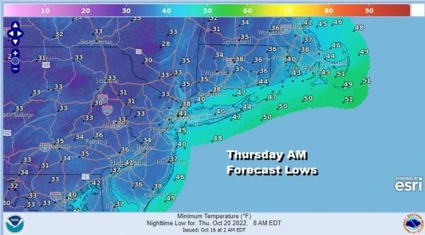
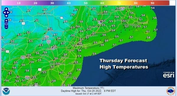
The core of this cold air mass, and remember cold is relative to the time of year, will be along the coast Thursday so we will start to see temperatures moderate a bit. Sunshine will take highs to the mid to upper 50s Thursday afternoon.
Friday starts the move higher with temperatures reaching back into the 60s in most places. We should have a sunny finish to the week and I think the weekend should be mostly okay. There are some questions regarding a low developing off the Southeast US coast and creeping northward which is something the European has been showing while the GFS model has been slower with this feature and not an issue. Even the European’s view would keep the weekend dry with sunshine Saturday and no worse than sun and arriving clouds on Sunday. Highs both days will be in the mid to upper 60s.
BE SURE TO DOWNLOAD THE FREE METEOROLOGIST JOE CIOFFI WEATHER APP &
ANGRY BEN’S FREE WEATHER APP “THE ANGRY WEATHERMAN!
MANY THANKS TO TROPICAL TIDBITS & F5 WEATHER FOR THE USE OF MAPS
Please note that with regards to any severe weather, tropical storms, or hurricanes, should a storm be threatening, please consult your local National Weather Service office or your local government officials about what action you should be taking to protect life and property.


