DOWNLOAD MY NEW FREE JOESTRADAMUS WEATHER APP FOR ALL DEVICES
THE APP IS ABSOLUTELY FREE TO ALL BUT CONSIDERING SUBSCRIBING TO PATREON FOR A WEATHER EXPERIENCE FREE OF ADS, EXCLUSIVE VIDEOS FOR MEMBERS ONLY AND MUCH MORE…STARTS AT $2 A MONTH..MESSAGE ME AT ANY TIME
Cold Abates 2 Weather Systems Ahead
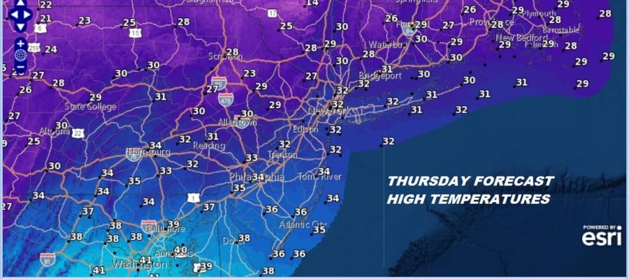
We bottomed in the teens and single digits this morning as our stretch of very cold weather continues for a third day. We haven’t seen the freezing mark in many areas since Monday but we might be able to sneak above the freezing mark in a few places this afternoon. This will all depend on cloud cover today but 32 is the goal for today with sunshine and some patchy clouds. A passing snow shower can’t be ruled out as the air is still a touch unstable.

In the meantime the regional radar is relatively quiet other than a narrow band of lake effect snow around Syracuse and Interstate 81 which has been sitting there for the last 2 1/2 days. This should finally shut down later today as the wind flow relaxes.
REGIONAL RADAR

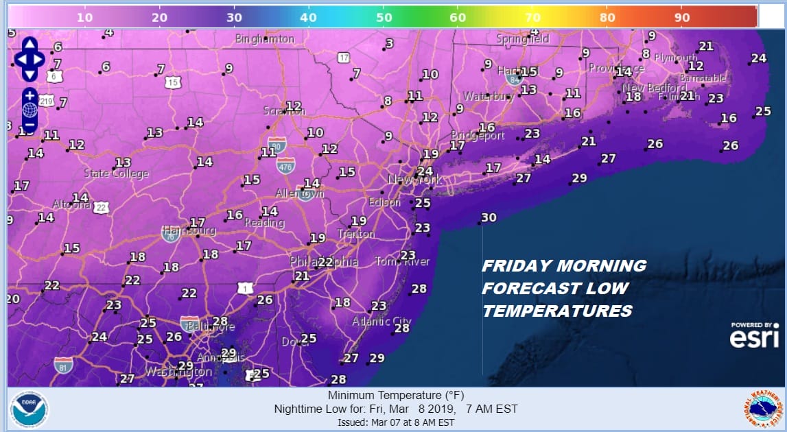
The core of the cold air mass is finally overhead and we have one more cold night ahead of us with mainly clear skies and lows in the teens in the warmer urban locations to lower teens and single digits again inland.
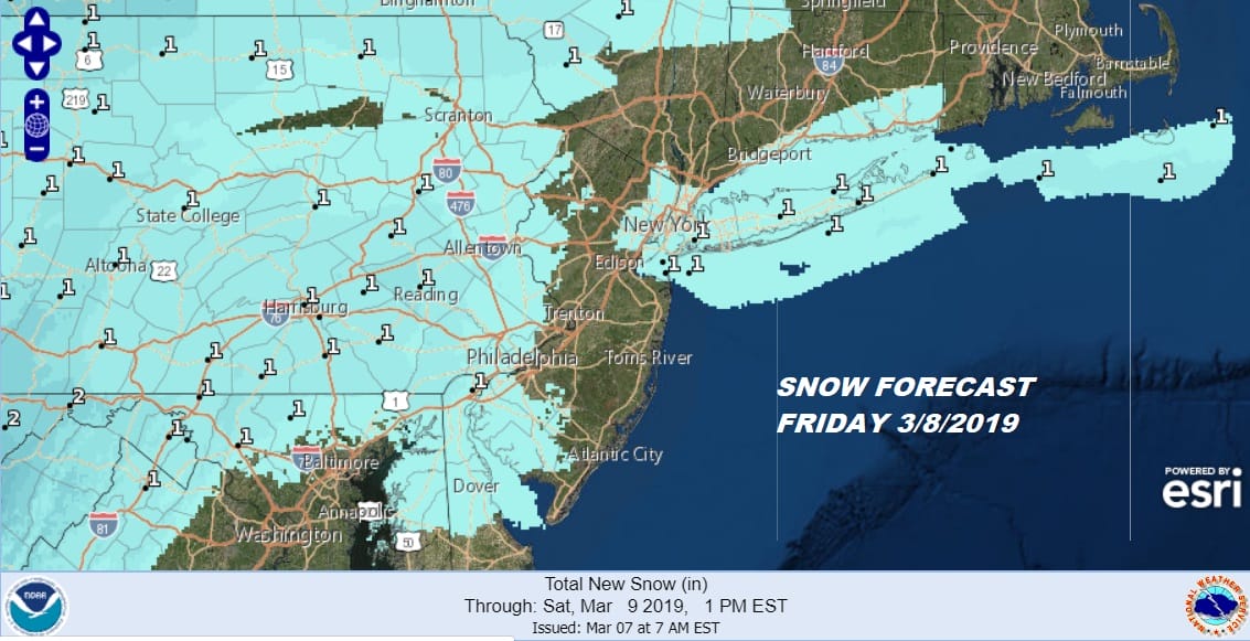
Friday we see the first of 2 weather systems headed our way. This first system is the weaker of the two. The air will be cold but the amount of moisture available will be limited. The low doesn’t really fire up much as it moves off the Virginia coast and heads out to the east. With limited moisture and development we are covering for a coating to at most an inch of accumulation for the area from Eastern Pennsylvania to Southern New England. Some areas will see little or nothing out of this. We don’t see much opportunity for upside here.
At least temperatures should start to nudge slowly higher on Friday though we will still be just in the 30s. There will still be some cold air around Saturday with some sunshine and clouds though clouds will start to take over late in the day. Highs in the upper 30s and lower 40s.

The system for Saturday night into Sunday morning will be a big snow producer in the Northern Plains but for us the storm is so far west and north that the impact here might not be too bad. It looks more like a warm front moving through. The NAM model and others are showing a narrow band of snow/sleet/ice ahead of it and there could be a brief round of frozen/freezing precipitation when it arrives Saturday night but most of this is gone by early to mid morning Sunday and we might see weather conditions begin to improve Sunday afternoon. Sunday’s highs will be in the 40s. Dry weather kicks off the first 3 days of next week but it seems that at least from the standpoint of temperatures, it will be much more reasonable for this time of year.
MANY THANKS TO TROPICAL TIDBITS FOR THE USE OF MAPS
Please note that with regards to any tropical storms or hurricanes, should a storm be threatening, please consult your local National Weather Service office or your local government officials about what action you should be taking to protect life and property.


