
Coating to an Inch of Snow As Cold Front Passes Christmas Eve
Christmas Day Dry & Chilly

Coating to an Inch of Snow As Cold Front Passes Christmas Eve
Christmas Day Dry & Chilly

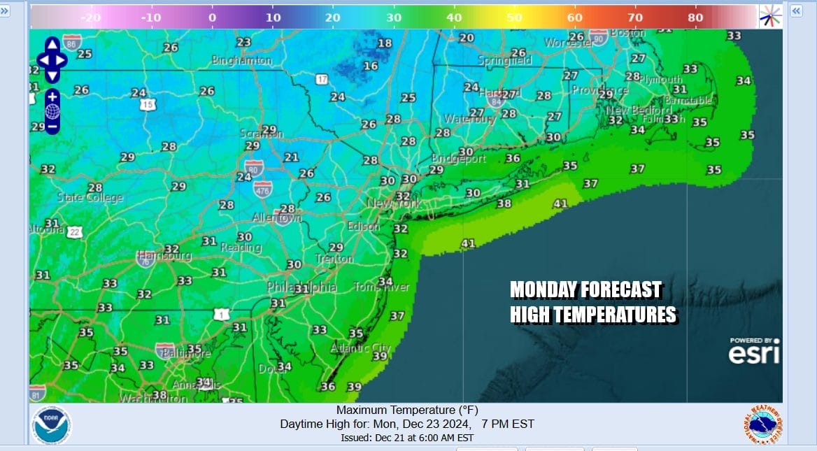
We have the chance for a little bit of snow late tonight and Tuesday morning thanks to a cold front that will be moving east into what is left of the bitter cold air. We hit bottom this morning with very cold lows this morning in the low teens and single numbers but we will recover somewhat today with sunshine for much of the day. High temperatures will reach the mid 20s in areas north and west of the coast and upper 20s and lower 30s as you head south toward Southern New Jersey.
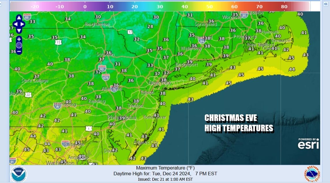
We are seeing skies mainly clear up and down the East Coast today but we can also see the next weather system moving through the Great Lakes. There isn’t much moisture available with this weather front so we are not concerned about any upside surprises. Clouds will increase tonight and a frontal line of snow showers will be approaching, reaching the coast Tuesday morning around or just after daybreak. As skies may be clear for awhile tonight, temperatures will drop to the upper teens to mid 20s and then they will stop going down once the clouds move in.
SATELLITE WITH LIGHTNING STRIKES

WEATHER RADAR

We will see some light snow in the morning hours between 6am and 10am so this will be rather short as far as duration goes. In areas across Southwest NJ and Southeastern Pennsylvania we could see the snow mix or change to some freezing rain and Winter Weather Advisories are posted. Once the front passes offshore we will see some improvement in the afternoon. As for temperatures we could see highs in the mid to upper 30s by late afternoon.
The air behind the front is no where near as cold as the air ahead of it so we will clear out Tuesday night and there are no precipitation issues to worry about. Christmas morning you will wake up to lows in the upper teens to mid 20s. Christmas Day should be nice and sunny with temperatures about where they should be for this time of year, Most highs will be in the 30s.

The rest of the week will be dry and chilly as high pressure builds across Upstate NY and New England and that will keep temperatures from rising much. Thursday and Friday we should see some sunshine and highs both days will be in the 30s. Over next weekend Saturday looks to be dry but Sunday sees low pressure heading from the Lower Mississippi Valley to the Great Lakes and that brings some rain to finish off the weekend.
BE SURE TO DOWNLOAD THE FREE METEOROLOGIST JOE CIOFFI WEATHER APP &
ANGRY BEN’S FREE WEATHER APP “THE ANGRY WEATHERMAN!
MANY THANKS TO TROPICAL TIDBITS FOR THE USE OF MAPS
Please note that with regards to any severe weather, tropical storms, or hurricanes, should a storm be threatening, please consult your local National Weather Service office or your local government officials about what action you should be taking to protect life and property.


