Coastal Storm Remains Offshore Sunshine Inland Cloudy Windy East of NYC
Our coastal storm remains offshore this morning about 300 miles of New Jersey and about 250 or so miles south of Cape Cod. The low has been orchestrating a tight counterclockwise loop over very warm water and as a result it seems to be acquiring tropical characteristics this morning. The western edge of the clouds are lining up right along the immediate coast so this looks to be another day of mostly sunny skies inland and west of the immediate coastline. The cloud line cuts across Northwest Connecticut so the Hudson Valley looks nice and sunny again as does much of Pennsylvania, Maryland and Delaware. Clouds are hanging tough along the coasts of Southern New England and Long Island. Temperatures today will be in the upper 50s and lower 60s where there is cloud cover and mid 60s to near 70 inland where it is going to be sunny.
SATELLITE

REGIONAL RADAR

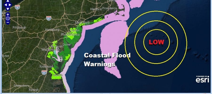
The biggest issue remains coastl flooding with coastal flood warnings continuing up and down the New Jersey coast to Delmarva. Also coastal flooding continues from Long Island can coastal Connecticut eastward to Southeastern Massachusetts. Rain is not an issue today except for Southeastern New England where we are seeing the northwest arc of the storm pushing in some rain. Otherwise for everyone else there are no radar issues today.
LOCAL RADAR NEW YORK CITY

LOCAL RADAR PHILADELPHIA


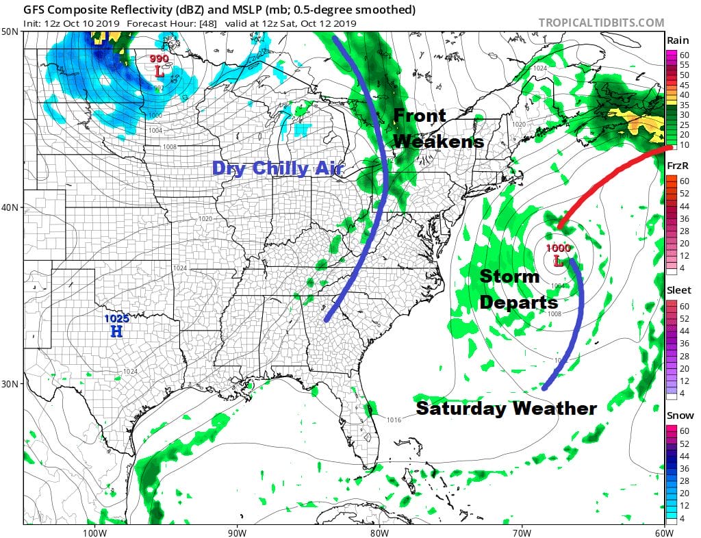
There will be several more high tide cycles to work through with the storm still offshore tonight and early Saturday before finally getting kicked away to the east northeast. Saturday we should see clouds and some sunshine in most areas. Even coastal areas should see a decrease in cloud cover and increasing amounts of sun from west to east (fingers crossed). Highs will be in the mid 60s to near 70 inland.
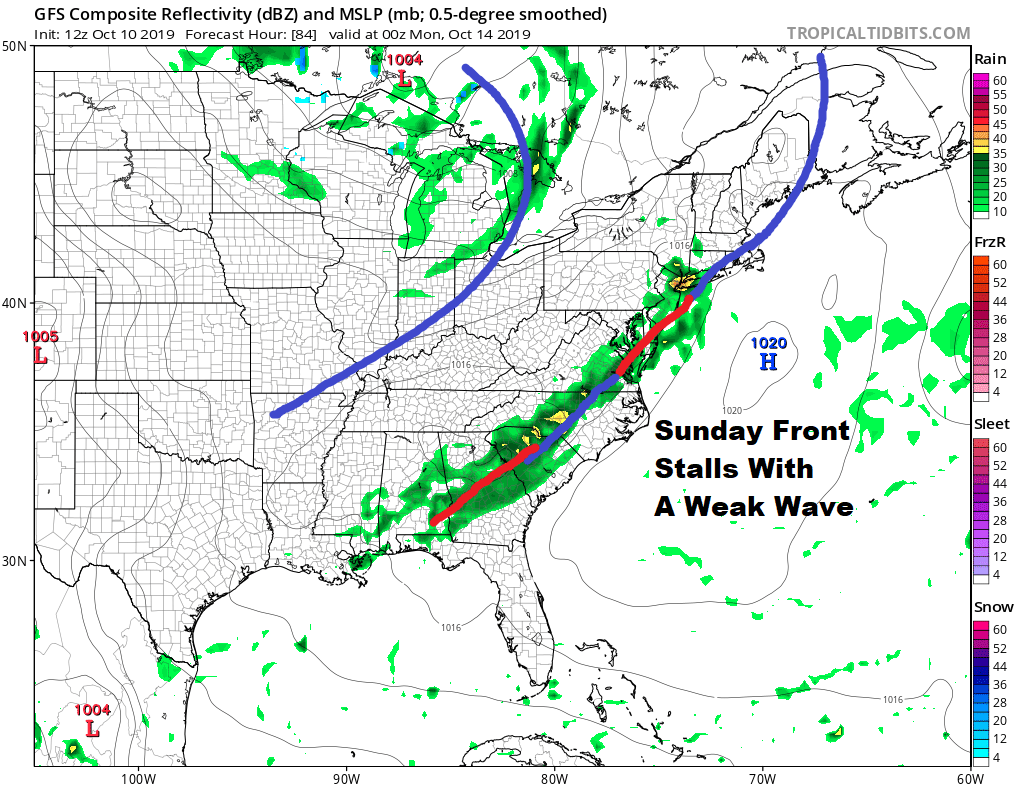
Sunday brings the issue of a weak weather front that stalls to the south early Sunday morning and the prospects for a weak wave and an area of rain developing along that frontal boundary. Look for arriving clouds Sunday with highs in the 60s and the chance for some rain Sunday night.
Monday Columbus Day is actually shaping up to be quite nice with sunshine and highs reaching the upper 60s to lower 70s. Tuesday is looking good for the most part with sunshine giving way to arriving clouds. The next cold front arrives Wednesday and this looks to be a decent rain producer with the chance for a developing wave on the southern end of the front to enhance rainfall here. We will talk more about this later today.
MANY THANKS TO TROPICAL TIDBITS FOR THE USE OF MAPS
Please note that with regards to any severe weather, tropical storms, or hurricanes, should a storm be threatening, please consult your local National Weather Service office or your local government officials about what action you should be taking to protect life and property.


