Coastal Storm Rain Wind Likely Late Saturday Into Sunday Morning
Coastal Storm Rain Wind Likely Late Saturday Into Sunday Morning
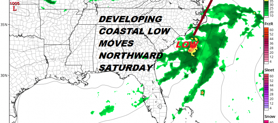
We are beginning to see the start of low pressure that will be developing off the Southeast Coast over the next 2 days. This low is going to ride up the coast northward over the weekend and it seems like a round of heavy rain, and along the coast, some strong winds is growing more likely. The satellite picture this afternoon (technical issues are preventing loops at the moment) is showing a growing area of clouds and covection from the Northeast Gulf of Mexcio northeastward to off the Carolinas.
SOUTHEAST TROPICAL SATELLITE

JACKSONVILLE RADAR LOOP

We aren’t seeing any turning here as yet but the amount of convection that has developed is rather impressive this afternoon. Weather models begin to organize a low during the day on Friday.
Coastal Storm Rain Wind NAM MODEL FRIDAY JULY 20, 8PM

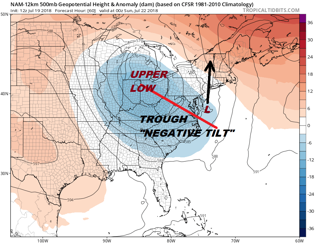
We have a rather dynamic upper air pattern that is supporting the development of this coastal low as it moves northward. A strong upper air storm is digging southeastward into the Ohio Valley. The trough is tilted negatively (northwest southeast) which lifts the low northward rather than kicking it out northeastward.
Coastal Storm Rain Wind NAM MODEL SATURDAY JULY 21, 8PM
This storm will have a strong moist southeast inflow and plenty of energy to work with. This really looks more like a system that you see outside the tropical season. The track close to the coast and the speed of movement northward seems to argue against this system becoming a warm core system but it might be “tropical-like”. Either way it will produce the same weather outcome with heavy rain for areas from the Coastal Mid Atlantic to New Jersey, NYC to Southern New England & the Hudson Valley and gales for the coastal waters from Delaware to Long Island.
Coastal Storm Rain Wind NAM MODEL SATURDAY JULY 21, 8PM
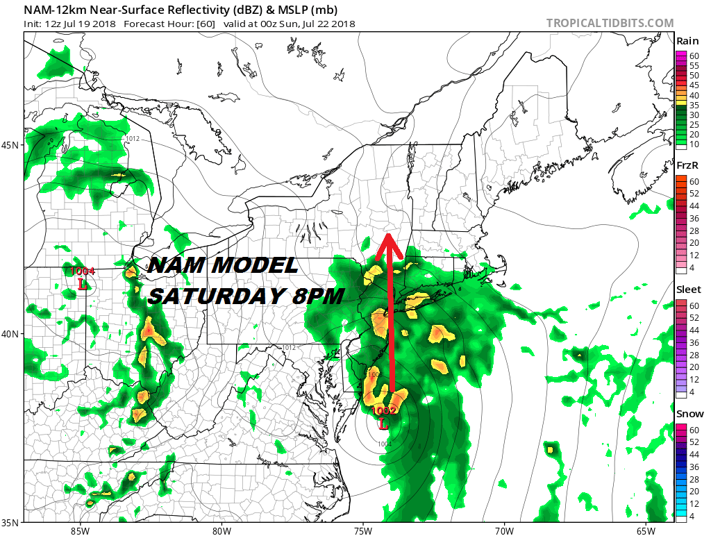
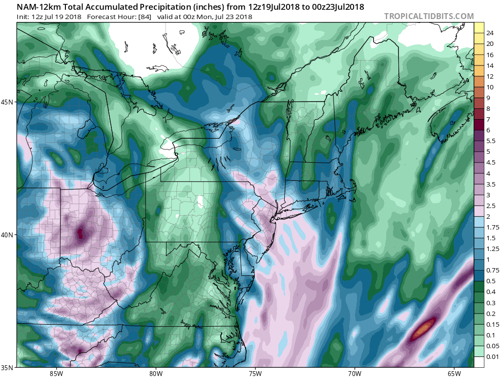
Judging by what is in front of us this aftenroon weather conditions will deteriorate from South to North during Saturday and weather conditions will improve rapidly by Sunday morning daybreak. At this point the low show be north of NYC. The NAM model is the most aggressive with rainfall amount showing a large area getting 2 to 4 inches of rain. The GFS has a narrower area of the heaviest rain but the idea is similar.
We will monitor models this afternoon to watch for trends as the weekend grows closer. If you have to choose a weekend day for better weather conditions Sunday is the choice though another shower or thunderstorm in the afternoon can’t be ruled out.
Please consult your local National Weather Service office at weather.gov for the latest information on any tropical or storms or hurricanes that could be a threat to your area. Consult your local government officials regarding action you may need to take to secure life and property
FiOS1 News Weather Forecast For Long Island
FiOS1 News Weather Forecast For New Jersey
FiOS1 News Weather Forecast For Hudson Valley