Coastal Storm Finally Exits 70s This Afternoon With Sunshine
Mostly Dry Weather Into Next Week
It was beginning to seem as if it was never going to happen but in the weather world, nothing stays the same forever. Our stalled out coastal storm was waiting for the traffic jam in the upper atmosphere to break down and it finally has after 5 days. The good news regarding the rain of the last 5 days is that it was sizeable with several to 6 inches in many locations. More importantly it was spread out over 5 days so there was very little rainfall induced flooding and most of the rain was allowed to soak in. This has gone a long way to alleviating the dry to drought conditions that developed this summer.
SATELLITE

WEATHER RADAR

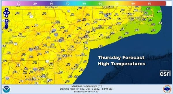
The satellite loop shows the circulation of the coastal storm is now further east and that has allowed dry air to move southward on northwest winds. Radars are nice and quiet for the first time in over a week and we have sunshine in the forecast for today. Now that we have sunshine temperatures will reflexively bounce back to the lower 70s for highs this afternoon.

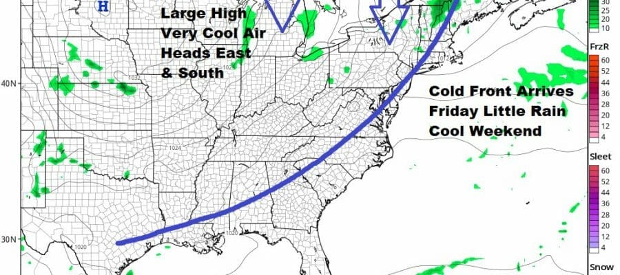
Here comes the next cold front and behind it is a rather strong cool high that is coming out of Canada. Since Autumn arrived on September 22, we have have seen a consistent pattern of below normal temperatures. In fact the stretch from Sept 23 to October 3 was the 8th coldest on record for that time frame in many areas. Friday ahead of the front it will be sunny to partly sunny. Other than a wind shift to the northwest, the front comes through with little fanfare. Highs will be into the 70s.

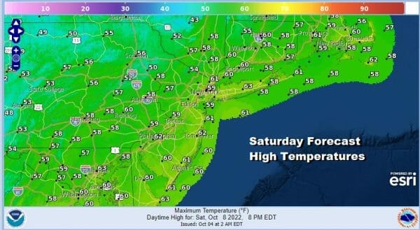
The new cool air mass will send temperatures down to the 40s to around 50 Saturday morning and Saturday will feature some sunshine to start. There is an upper trough moving throgh and there is the outside chance for an isolated shower in one or two spots. For most though it will be a nice fall day with highs just in the 50s.
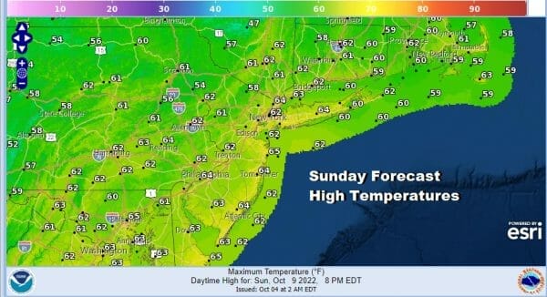
Saturday night will be nice and clear with lows in the 40s and look for 30s in colder inland spots north and northwest of the coast. Sunday the core of the cool air will slide out to our south as high pressure builds into the Mid Atlantic states. Sunshine Sunday should take highs back to the low and middle 60s.
Next week looks mostly dry and seasonal temperature wise. Not much is going to happen until late in the week when another cold front arrives. The first chance for any meaningful shower activity won’t come until Thursday night into Friday and that will be followed by a very chilly air mass for next week. Weather systems are moving along so there is no chance of another storm or front stalling out for days at a time.
BE SURE TO DOWNLOAD THE FREE METEOROLOGIST JOE CIOFFI WEATHER APP &
ANGRY BEN’S FREE WEATHER APP “THE ANGRY WEATHERMAN!
MANY THANKS TO TROPICAL TIDBITS & F5 WEATHER FOR THE USE OF MAPS
Please note that with regards to any severe weather, tropical storms, or hurricanes, should a storm be threatening, please consult your local National Weather Service office or your local government officials about what action you should be taking to protect life and property.


