Coastal Storm Drags Cold Air Mass Southward Sunday Monday
Coastal Storm Drags Cold Air Mass Southward Sunday Monday
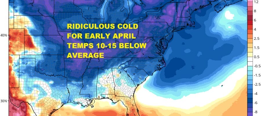
We are still dealing with cloud cover from the developing coastal storm to south. Radars do show some precipitation at least aloft into Southern New Jersey & Delaware but don’t expect any surprises here as the low begins to move east northeast from the Carolinas to well southeast of New England. What the storm does do for us is allow cold air to drain southward tonight into Sunday and Monday morning.
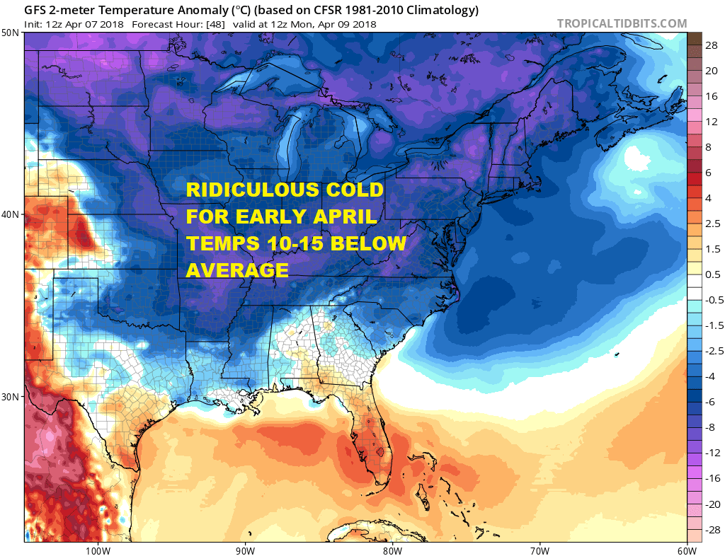
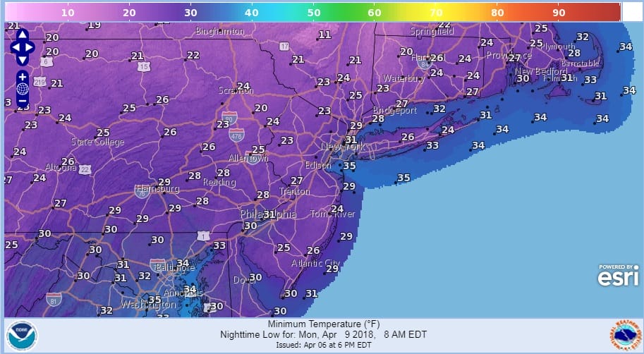
At least it is also mostly dry air so skies should clear out late tonight and we should be no worse than partly sunny on Sunday. Morning lows should be in the upper 20s to middle 30s. Sunday afternoon temperatures are not going to be doing much however with highs mostly in the 40s. Then its down to the mid 20s to lower 30s on Monday morning under a clear sky.
MONDAY MORNING FORECAST LOW TEMPERATURES
US SATELLITE

REGIONAL RADAR

LOCAL RADAR NEW YORK CITY

LOCAL RADAR PHILADELPHIA


We don’t see any big issues next week other than dealing with weak systems, clouds and below average temperatures at least into Wednesday. There is the chance for a few passing showers early Tuesday morning and again Tuesday night but they will be minor at best.
SATURDAY APRIL 14, 2018 FORECAST HIGH TEMPERATURES

As far as a warm up is concerned there will be an attempt to warm things up next weekend but it will depend on a warm front moving northward and passing us so we can get into the warm air. If not as we look into the long long range, blocking is forecast to return for the week of April 16th which will mean another stretch of below average temperatures. No rest for the winter weary!
 GET JOE A CIGAR IF YOU LIKE

FiOS1 News Weather Forecast For Long Island
FiOS1 News Weather Forecast For New Jersey
FiOS1 News Weather Forecast For Hudson Valley


