Coastal Flooding New Jersey Long Island a possibility at high tide during the next 2 days. Minor flooding is expected on Thursday. Coastal Flood Advisories are posted for the New Jersey shore and Long Island.
MARINE FORECAST FOR LONG ISLAND
SMALL CRAFT ADVISORY IN EFFECT FOR THE OCEAN WATERS
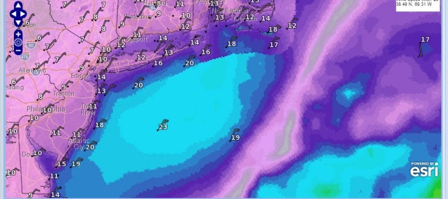
Synopsis: MULTIPLE WAVES OF LOW PRESSURE WILL PASS SOUTH AND EAST OF LONG ISLAND THROUGH SATURDAY. A COLD FRONT APPROACHES FROM THE NORTHWEST SATURDAY NIGHT…THEN CROSSES THE AREA ON SUNDAY. HIGH PRESSURE BUILDS SOUTH OF THE WATERS FOR THE START OF THE NEW WEEK.
Overnight
NE winds 15 to 20 kt with gusts up to 30 kt. Seas 6 to 7 ft…subsiding to 4 to 7 ft. Chance of light rain and drizzle.
Thu
NE winds 15 to 20 kt with gusts up to 25 kt. Seas 4 to 7 ft. Chance of light rain and drizzle.
Thu Night
NE winds 15 to 20 kt…diminishing to 10 to 15 kt after midnight. Seas 4 to 6 ft. Chance of light rain and drizzle.
Fri
NE winds around 15 kt with gusts up to 25 kt. Seas 5 to 7 ft. Chance of light rain and drizzle in the morning…then rain likely in the afternoon. Patchy fog. Vsby 1 to 3 nm.
Fri Night
NE winds 15 to 20 kt with gusts up to 25 kt… Becoming E 5 to 10 kt after midnight. Seas 5 to 7 ft. Chance of showers.
Sat
E winds 5 to 10 kt…becoming SE in the afternoon. Seas around 5 ft.
Sat Night
S winds 5 to 10 kt. Seas 4 to 5 ft. Chance of showers after midnight.
Sun
W winds 10 to 15 kt. Seas 4 to 5 ft. Chance of showers in the morning.
Mon
W winds 10 to 15 kt…diminishing to 5 to 10 kt after midnight. Seas 4 to 5 ft.
SMALL CRAFT ADVISORY FOR THE NEW JERSEY COASTAL WATERS
MARINE FORECAST FOR THE NEW JERSEY COASTAL WATERS
SMALL CRAFT ADVISORY FOR THE NEW JERSEY COASTAL WATERS
Synopsis: A TROUGH OF LOW PRESSURE WILL EXTEND EASTWARD FROM THE OHIO VALLEY TO THE MID-ATLANTIC COASTLINE TONIGHT. DUAL LOW PRESSURE SYSTEMS LOCATED JUST OFFSHORE AND ACROSS THE OHIO VALLEY WILL BE SLOW TO MOVE THROUGH THE REGION FOR THE LATER HALF OF THIS WEEK. A LOW PRESSURE SYSTEM IS LIKELY TO LINGER JUST OFFSHORE INTO THE WEEKEND. BY SUNDAY, A COLD FRONT IS EXPECTED TO MOVE SOUTHEAST THROUGH THE REGION. THIS WILL BE FOLLOWED BY WELCOMED HIGH PRESSURE BUILDING NORTHEAST INTO THE REGION FOR THE FIRST PART OF NEXT WEEK.
Tonight
NE winds 20 to 25 kt…diminishing to 15 to 20 kt late. Seas 4 to 7 ft. Mainly in NE swell with a dominant period of 6 seconds. Showers this evening. Patchy drizzle. Scattered showers after midnight. Vsby 1 to 3 nm late this evening and overnight.
Thu
NE winds 15 to 20 kt with gusts up to 30 kt. Seas 4 to 7 ft. Mainly in NE swell with a dominant period of 6 seconds. patchy drizzle early in the morning. A slight chance of showers in the morning…then a chance of showers in the afternoon. Vsby 1 to 3 nm early in the morning.
Thu Night
NE winds 15 to 20 kt with gusts up to 25 kt. Seas 4 to 7 ft. Mainly in NE swell with a dominant period of 6 seconds. a chance of showers.
Fri
NE winds 15 to 20 kt with gusts up to 25 kt. Seas 5 to 8 ft. Mainly in NE swell with a dominant period of 6 seconds. showers likely.
Fri Night
E winds 10 to 15 kt with gusts up to 25 kt… Becoming SE 5 to 10 kt after midnight. Seas 4 to 7 ft. Showers likely…mainly in the evening.
Sat
NE winds 5 to 10 kt…becoming SE in the afternoon. Seas 3 to 5 ft. A chance of showers.
Sat Night
S winds 5 to 10 kt. Seas 3 to 5 ft. A chance of showers.
Sun
W winds 10 to 15 kt. Seas 3 to 4 ft. A chance of showers in the morning.
Sun Night
W winds 5 to 10 kt. Seas 3 to 4 ft.
Mon
W winds 5 to 10 kt. Seas 3 to 4 ft.
Mon Night
SW winds 10 to 15 kt…diminishing to 5 to 10 kt after midnight. Seas 3 to 4 ft.