Clouds Some Rain Tonight Dry Thursday Friday
Clouds Some Rain Tonight Dry Thursday Friday
Some clouds have already begun to arrive this morning as we watch low pressure develop on the old frontal boundary to the south. We may still be able to squeeze some breaks of sun this morning before skies become overcast. Temperatures today will be held back somewhat with most highs in the 70s to around 80 though it might be a tad warmer inland.
EASTERN SATELLITE

REGIONAL RADAR

There isn’t much yet on either the regional and local radars but we will start to see some echos pop up this afternoon to the west in Pennsylvania and look for a few showers this evening to move through along with some more rain overnight. This will not amount to much rain wise though a few heavier downpours could be in the mix.
LOCAL RADAR NEW YORK CITY

LOCAL RADAR PHILADELPHIA


Once this wave moves by it the rain will end before daybreak Thursday and we will see increasing amounts of sunshine Thursday with humidity dropping and highs in the low to a few middle 80s. High pressure and an east wind will bring sunshine and arriving clouds for Friday with most highs in the 70s to near 80.
FRIDAY MORNING GFS FORECAST JUNE 22, 2018

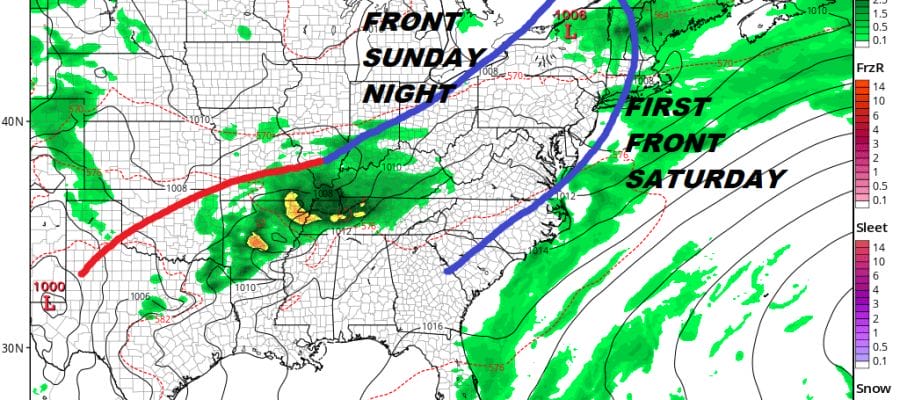
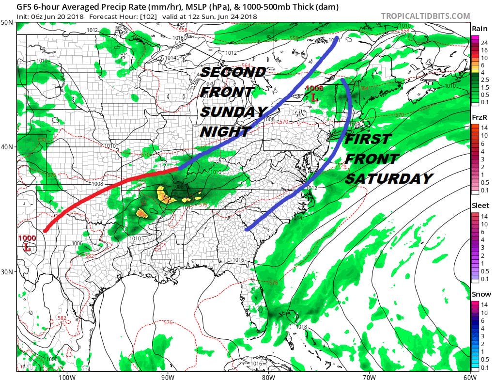
Not much has changed regarding our idea for the weekend regarding Saturday. There will be some showers on Saturday as that warm front comes up from the south. The question is for late Sunday or Sunday night as a second front approaches with some showers. The issue is whether Sunday will be rain free. Right now I’m leaning toward a dry Sunday day side with a few showers Sunday night into Monday morning.
SUNDAY GFS FORECAST JUNE 24. 2018
Next week should start dry and on the cool side for a couple of days but we could be going into a warm humid pattern at the end of the month and for the first few days of July. We will tackle this issue with a long range post later today.
 GET JOE A CIGAR IF YOU LIKE

LATEST JOESTRADAMUS ON THE LONG RANGE


