Clouds Showers Today Rain Saturday Night Into Sunday Dry Start Thanksgiving Week
The next round of changes are underway and this round is like a one two punch as we have a cold front moving through today. The front stalls out and a developing storm will move northeast on it and bring some rain for Eastern Pennsylvania to Southern New England Saturday night and Sunday morning. Then we move into next week with a dry Monday and Tuesday. We are already in the clouds from the approaching cold front today as they came in overnight.
SATELLITE

REGIONAL RADAR

Now we wait for the showers which are on the regional radar well to the west but we will likely see some showers develop overhead later this morning and into this afternoon. Keep an eye on local radars in the meantime which should start getting busy.
LOCAL RADAR NEW YORK CITY

LOCAL RADAR PHILADELPHIA


These showers play through rather quickly and they will be long gone before the evening commute. Temperatures today will be in the upper 40s and lower 50s in most places. Then we clear out tonight and it turns colder behind the front. Lows will be in the upper 20s and lower 30s in most places. On to Saturday where we will have sunshine giving way to arriving clouds with highs just in the low to mid 40s.

This next low coming out of the lower Mississippi Valley moves northeast into West Virginia and redevelops off the Delaware coast. Deeper into the winter season a system like this would likely be a snow producer and while we do have temperatures that are well below average right now, they aren’t cold enough. Rain will arrive early Sunday morning before daybreak and it looks like now that the system is a little slower and a little stronger so it will likely rain at least into the afternoon and possible not end until late in the day or evening on Sunday from west to east. There is a chance that as precipitation arrives in NW New Jersey, Northeast Pennsylvania, the Catskills, the Hudson Valley north of Route 84, and into NW Connecticut it could start as a little freezing rain or sleet. It could also end with some wet snow in the mix but I don’t see it amounting to much. Sunday’s highs will be just in the 40s.
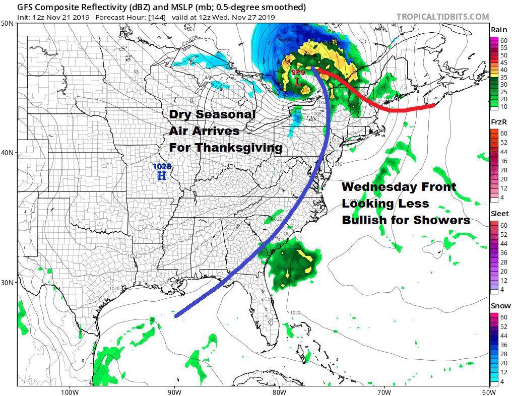
Thanksgiving week starts out fine with some sunshine and seasonal temperatures for Monday and Tuesday with highs reaching upper 40s and lower 50s on Monday and low to mid 50s on Tuesday. The next cold front comes with very little to work with as low pressure from the Great Lakes passes well to the north and heads into Eastern Canada. Look for clouds Wednesday with maybe a passing shower with highs in the 50s.
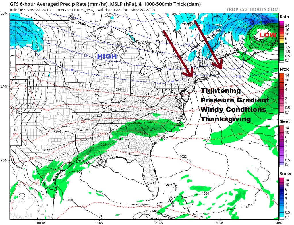
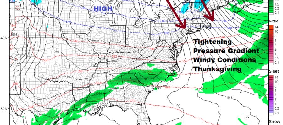
This storm looks to strengthen considerably as it heads into New Brunswick and with a rather large high dropping into the Great Lakes, it sets up a very tight pressure gradient across the Northeast Thanksgiving Day especially in the morning. Strong gusty winds of 30 mph or more are likely on Thursday. Thanksgiving day parades in NYC feature balloons and balloons don’t like strong winds so there may be some issues here. Weather wise other than wind it will be dry with some sunshine Thanksgiving day with highs just into the 40s. We will have more on the weather for Thanksgiving week on our weather in 5 video later today.
BE SURE TO DOWNLOAD THE FREE METEOROLOGIST JOE CIOFFI WEATHER APP &
ANGRY BEN’S FREE WEATHER APP “THE ANGRY WEATHERMAN!
MANY THANKS TO TROPICAL TIDBITS FOR THE USE OF MAPS
Please note that with regards to any severe weather, tropical storms, or hurricanes, should a storm be threatening, please consult your local National Weather Service office or your local government officials about what action you should be taking to protect life and property.


