Clouds Showers Chances Thunderstorms Late Today Tonight

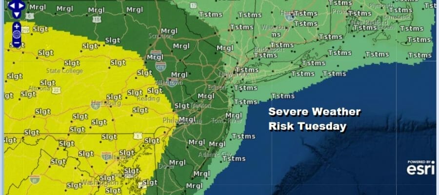
After what probably goes down as the best 4th of July weather day in many years we are undergoing the next round of changes. This is coming with a bit of severe weather risk with a marginal risk west of the coast and a slight risk from the Western New Jersey/Pennslyania state line westward and southward.
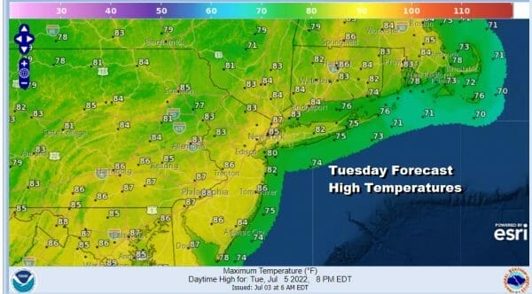
I’m not especially concerened with the severe weather risk since I think that severe level thunderstorms will be more isolated than anything else. Well inland it could be a bit more robust but I’m not execpting a widespread outbreak. We have one of these warm front cold front combinations. With more clouds it will cut daytime heating down and also we are coming out of a very dry air mass so it may take some work to bring dew points up into the 60s. Highs today will be mostly in the low to mid 80s. Showers and some thunderstorms will spread across Pennsylvania this morning and elsewhere later this morning and this afternoon.
SATELLITE

WEATHER RADAR

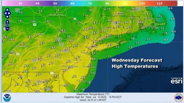
We will some showers around this evening and into tonight before this all winds down. Most lows will be in the 60s to near 70. There isn’t much in the way of dry air behind this weather system so Wednesday will be a rather humid day with sunshine coming back. Highs will be in the mid to upper 80s.
Thursday we have the next warm from cold front combination that will being to approach. This will put us in arriving clouds and the chance for some showers and perhaps a thunderstorm. Highs will be in the 80s. Then Friday after the warm front passes to our north we deal with the cold front and the risk for showers and thunderstorms to finish off the week. Highs will be in the 80s to perhaps some places closer to 90.
There are some model differences with the end of the week and the weekend. The European has a more robust cold front and a larger stronger cool dry air mass that will build in for the weekend. Since that seems to be the trend recently that cooler and less humid is winning out we will lean in that direction. Temperatures over the weekend will be a little below average and humidity levels will be low.
It also should mean we get a sunny weekend with most highs into the 80s and nighttime lows in the 60s and even some 50s inland. If everything goes according to the European model’s plan (again we are leanding in this direction) it should be a nice weekend.
BE SURE TO DOWNLOAD THE FREE METEOROLOGIST JOE CIOFFI WEATHER APP &
ANGRY BEN’S FREE WEATHER APP “THE ANGRY WEATHERMAN!
MANY THANKS TO TROPICAL TIDBITS & F5 WEATHER FOR THE USE OF MAPS
Please note that with regards to any severe weather, tropical storms, or hurricanes, should a storm be threatening, please consult your local National Weather Service office or your local government officials about what action you should be taking to protect life and property.


