
Christmas Tree Cutting Weather Into Thanksgiving
It might be a little early for going out locally in your area and Christmas Tree cutting but you never know. Some like to do it early. Perhaps you are spending the weekend raking the leaves. This weekend certainly continues to be nice with just the temperatures changes as cold air is set to arrive later Sunday into Monday.
While we wait for the cold front to bring in the polar air, a snowstorm continues today across the midwest. This is part of the National Weather Service summary.
“With plenty of cold air in place across the north-central U.S., the first significant snow storm of the season continues across the central Great Lakes region. This storm has already produced on the order of 8 to 16 inches of snow in a band from southeastern South Dakota to southern Wisconsin. A low pressure system tracking across the Ohio Valley is forecast to develop further as it tracks across the Great Lakes region this weekend. A wide band of moderate to heavy snow is expected north of the low from northern Illinois to central Michigan. Snowfall amounts of 4 to 8 inches are likely in those areas.”

So far Chicago O’Hare has gotten over 5 inches as of 7am this morning and it has been snowing there all morning. They may wind up with a compressed 10 inches or so given the wet snow and temperatures close to freezing. For us it is just a simple cold front with not much moisture that will be coming through Sunday morning with perhaps a shower or two. Then its breezy and colder for the rest of the day Sunday.


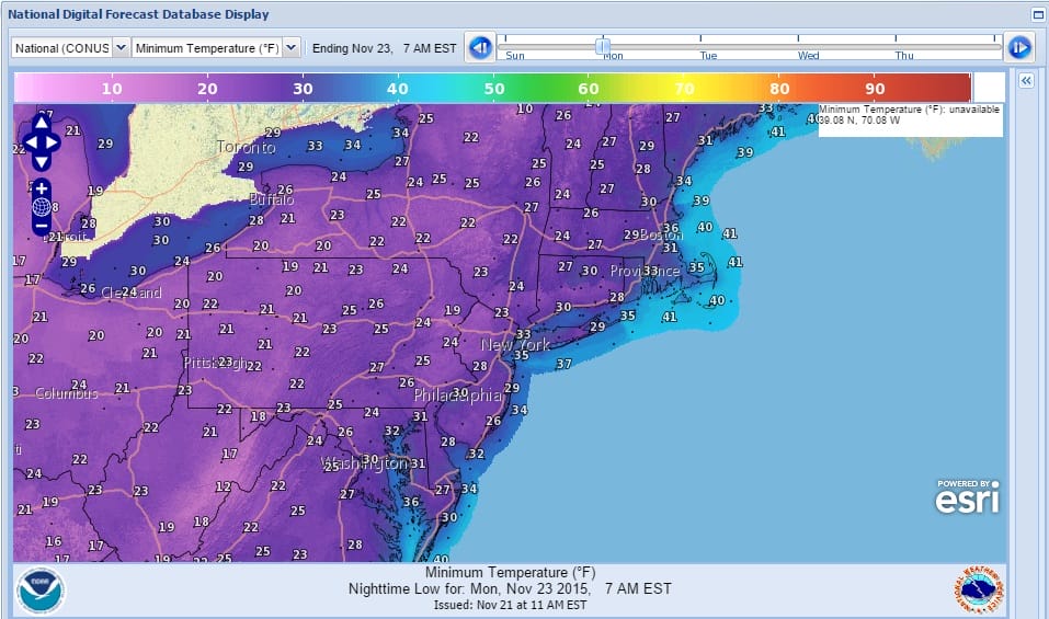
By Monday morning we will see our temperatures bottoming out in the mid 20s to low 30s everywhere and highs Monday won’t get much above the lower 40s. Tuesday and Wednesday will be cold with cold mornings and chilly afternoons with highs just in the 40s. Thanksgiving will be dry with some sunshine and we should reach 50 or better by Thanksgiving afternoon.
Lots of things going on in the long range including a developing split flow pattern which should make things more active though as we have been explaining, it is always a delicate battle between cold air and subtropical air so we will see how it sets up. The next chance for rain comes next Saturday with an approaching cold front with colder air behind it. That front might come with a cheap thrill at the end which is all that I can see happening at this point unless there is a frontal complication after it goes by. Be sure to check my video on this that I made this morning.
JOESTRDAMUS ON DEVELOPING SPLIT FLOW
DO WARM NOVEMBERS LEAD TO SNOWLESS WINTERS?