
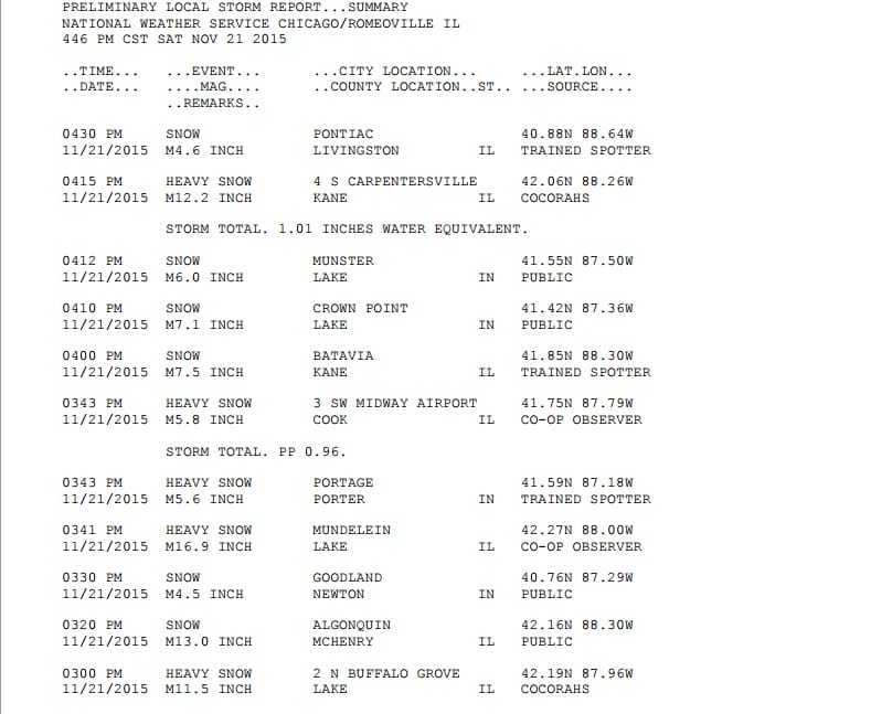
Snow Removal Continues In Chicago
Chicago and areas nearby west of Lake Michigan are digging out of a foot plus of snow from a rather small system that just managed to grind it out and then add a little lake effect and you wind up with a very substantial snowfall. While snow removal crews get an early workout we continue to bask in quiet calm weather here in the east. However that is not going to last for much longer. Here are some snowfall reports from this afternoon.
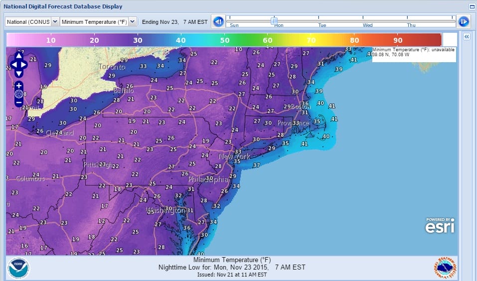
Short range it is pretty straight forward. We have a cold front coming through Sunday morning and there could be a shower with that. After it passes in comes colder air that takes temperatures here down into the 20s in many locations by Monday morning.
It will remain cold Monday and Tuesday and then moderate a bit toward the end of the week. At this point we will see the next cold front approach and it will produce showers on Saturday before the front comes through. After that it looks as if we will begin to see a shift in the upper air pattern. The subtropical jet is waking up as is the split flow that will be developing as shown by all the models today and confirmed by the late afternoon GFS model.
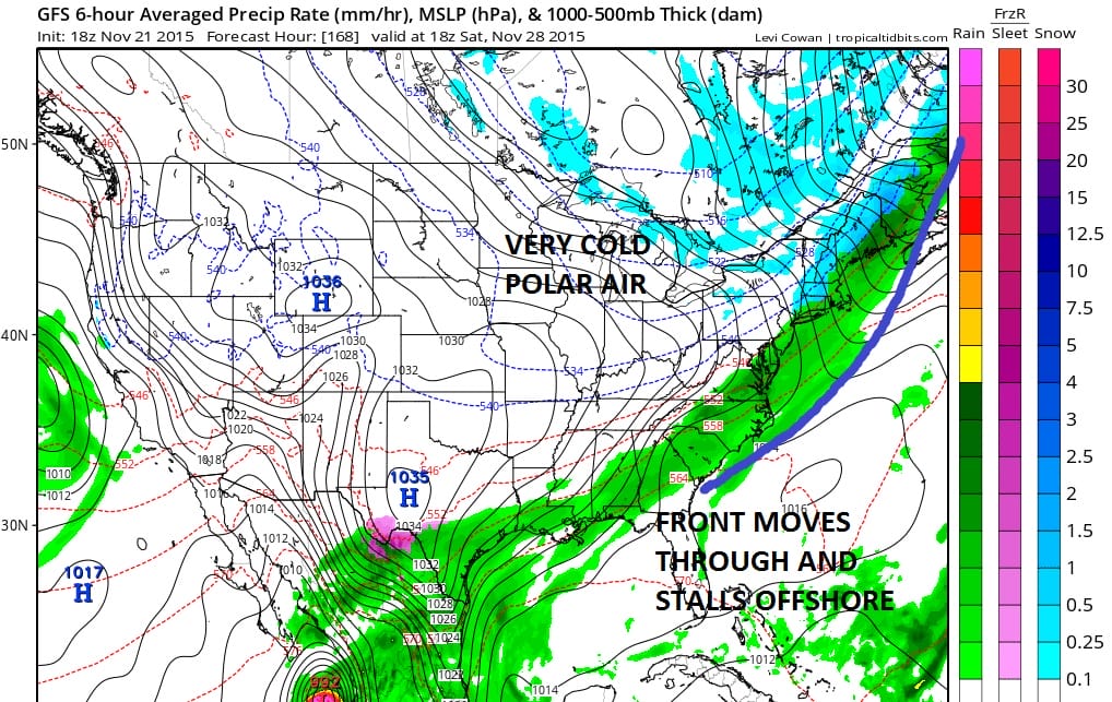
The first thing we will be looking to see is if this cold front, once it moves through in the early afternoon on Saturday. The southern end of that front will likely stall out with a wave that will probably develop on it. Cold air will move into the northeast next Sunday and for the week that follows.
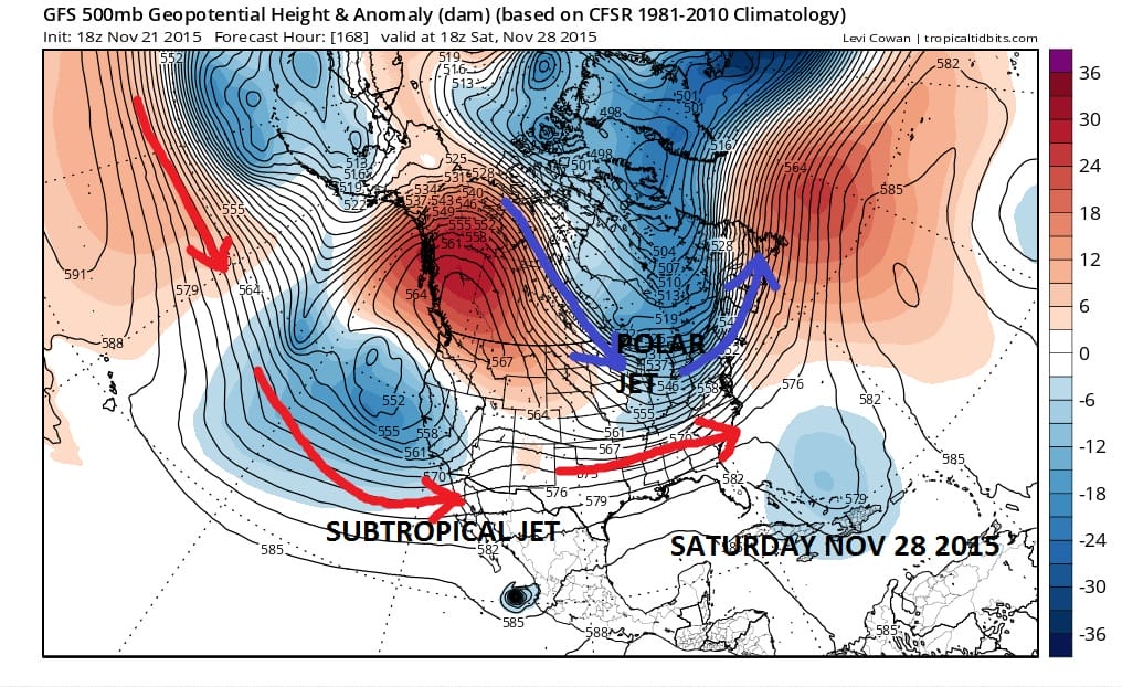
Several variables will come into play during the first week of December. While the 18z GFS was very bullish on the possibility of 2 storms, I’m not at all certain on whether it is even close to being correct. However I will say that the setup in this pattern does open the door to possibilities. The first question will be whether there is energy in that polar jet to carve out something along the coast around the December 1st time frame. The model certainly has the look where something could happen but there is a large margin for error here and this won’t be known for days. The second question is the subtropical jet itself as it begins to send weather systems into the southwest and marching across. How those 2 jets interact will hold the key to our weather during the first 10 days of December. We can certainly say the weather pattern in the east has been very quiet for the last 6 months or so. As the model trends have shown us over the last week or so, the period of tranquil weather may be coming to end. Again I would caution all model watchers that to focus on each run as correct is folly. Rather one should focus on what is going on in the big picture. The details will gradually come together as we move through next week and beyond.
LATEST NATIONAL WEATHER SERVICE INFORMATION FROM CHICAGO
SHORT RANGE FORECAST FOR SUNDAY
JOESTRDAMUS ON DEVELOPING SPLIT FLOW
DO WARM NOVEMBERS LEAD TO SNOWLESS WINTERS?