Chilly Start For Spring Storm System Looms Friday Night & Saturday

Chilly Start For Spring Storm System Looms Friday Night & Saturday
Today is the first day of spring, Saint Joseph’s Day, and a chilly weather day all wrapped up into one. We continue to see a breezy pattern across the Northeast and Northern Mid Atlantic states thanks to an offshore low to the east and high pressure to the west. We will see sunshine mixing with a few clouds. Lake effect snow showers are continuing in parts of Northwest Pennsylvania and Upstate NY but we don’t expect to see anything in Eastern Pennsylvania to Southern New England other than patchy clouds. Highs will be mostly in the low to middle 40s. Winds will be gusting 20 to occasionally 30 mph at times especially along the coast.
SATELLITE WITH LIGHTNING STRIKES

WEATHER RADAR

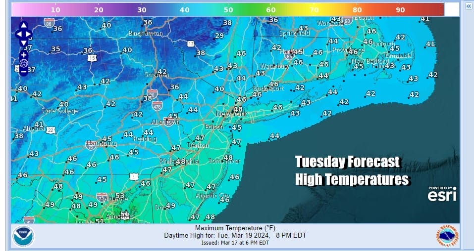
Winds will be turning more westerly tonight and Wednesday which will allow the first push of chilly air to exit to the east. Temperatures tonight will likely not fall much and that sets us up for a milder Wednesday. We will see sunshine and clouds and it will be breezy again. West winds will gusts to 25 to occasionally 30 mph but highs will be in the 50s. A cold front passes with little fanfare Wednesday evening.

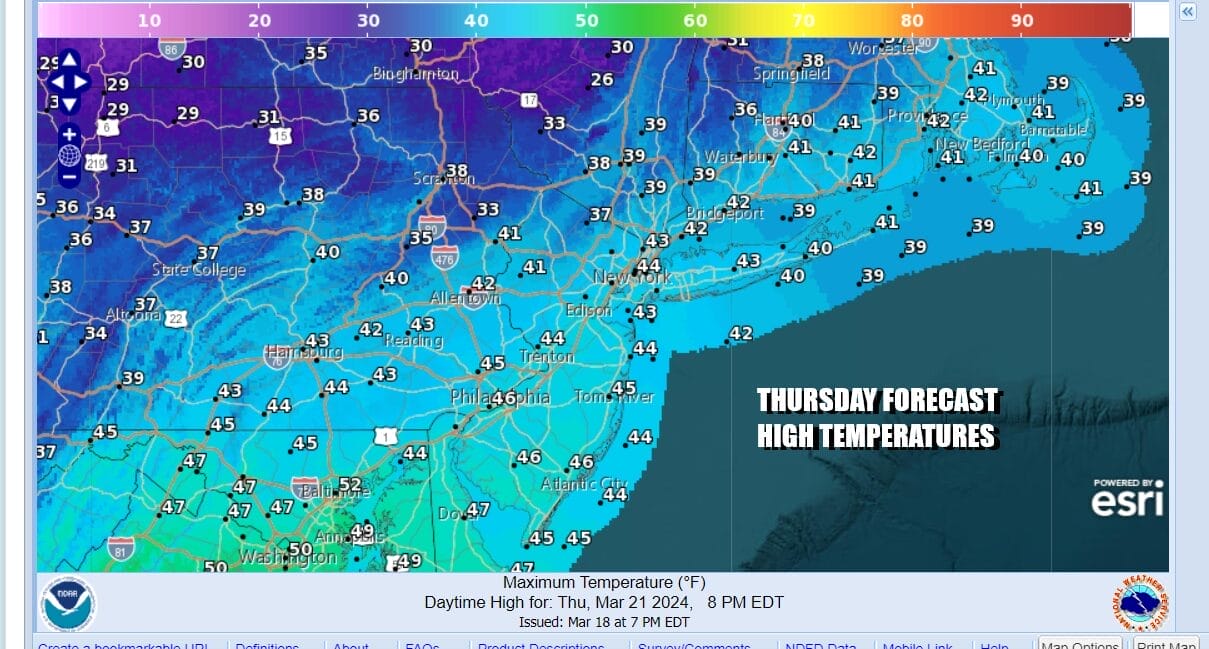
Thursday is going to be the coldest day of the week. Skies will clear Wednesday night and again it will remain breezy. Most lows in the Eastern Pennsylvania will be in the mid 20s to lower 30s. Thursday we will see sunshine and it will still be on the breezy side as another high builds in. Thursday highs will be just in the low to middle 40s in most places.
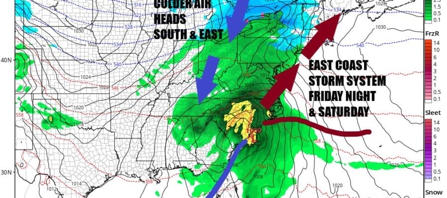
Attention turns to low pressure that will be developing in the Western Gulf of Mexico and heading eastward Thursday night and Friday before turning northeast across North Florida to off the Southeast Coast Friday night. Rain spreads across the Gulf States along with some thunderstorms and then our attention turns to this low moving up the coast bringing rain Friday and and for much of the daytime Saturday.

We are going to discount the European model idea of a complex nor’easter developing with a long period of rain and wind developing and lasting through the weekend and into Monday and go with the idea of a deepening low moving up the coast with rain developing during Friday night. Inland areas north of Route 84 could see it start as wet snow but it should be mostly rain everywhere else. Rain could fall heavy at times into Saturday afternoon and this could be an inch or more rain producer. Friday temperatures will be just in the 40s. Temperatures Saturday should reach upper 40s and lower 50s. Once the low goes by some improvement should settle in for Sunday though the onshore flow remains so clearing may be slow to occur. However Sunday should be rain free with highs in the upper 40s and lower 50s.
BE SURE TO DOWNLOAD THE FREE METEOROLOGIST JOE CIOFFI WEATHER APP &
ANGRY BEN’S FREE WEATHER APP “THE ANGRY WEATHERMAN!
MANY THANKS TO TROPICAL TIDBITS FOR THE USE OF MAPS
Please note that with regards to any severe weather, tropical storms, or hurricanes, should a storm be threatening, please consult your local National Weather Service office or your local government officials about what action you should be taking to protect life and property.
(Amazon is an affilate of Meteorologist Joe Cioffi & earns commissions on sales.)


