East Coast Storm Risks Rise Heavy Rain
Strong Onshore Flow Coastal Flooding Friday Night Saturday

East Coast Storm Risks Rise Heavy Rain
Strong Onshore Flow Coastal Flooding Friday Night Saturday
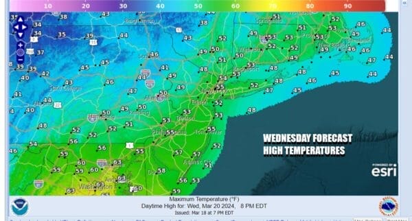
Today will be the warmest day of the week as we have a west wind and an approaching cold front. This is going to allow temperatures to max out in the 50s today. A warm front to our northeast will keep clouds and precipitation away during the day. We will see some sunshine today and yes the winds will still be on the gusty side, 20 to 30 mph at times. Late today a cold front will approach and going into the evening hours we could see some scattered rain showers over Eastern Pennsylvania to Southern New England. Tonight winds go northwest as cold high pressure drops southward from Central Canada and spreading across the Great Lakes and New England.
SATELLITE WITH LIGHTNING STRIKES
WEATHER RADAR
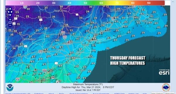
By Thursday morning we will be waking up to temperatures in the mid 20s inland and lower 30s coast and warmer urban locations. Thursday will be the coldest day of the week with a new cold air mass in the Eastern US. Sunshine is forecast along with another day of gusty northwest winds in the 20 to occasionally 30 mph range. High temperatures will just be in the low to mid 40s in most places.
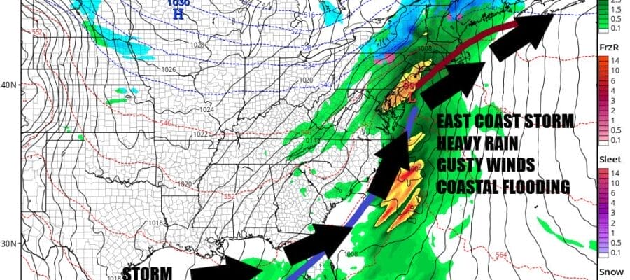
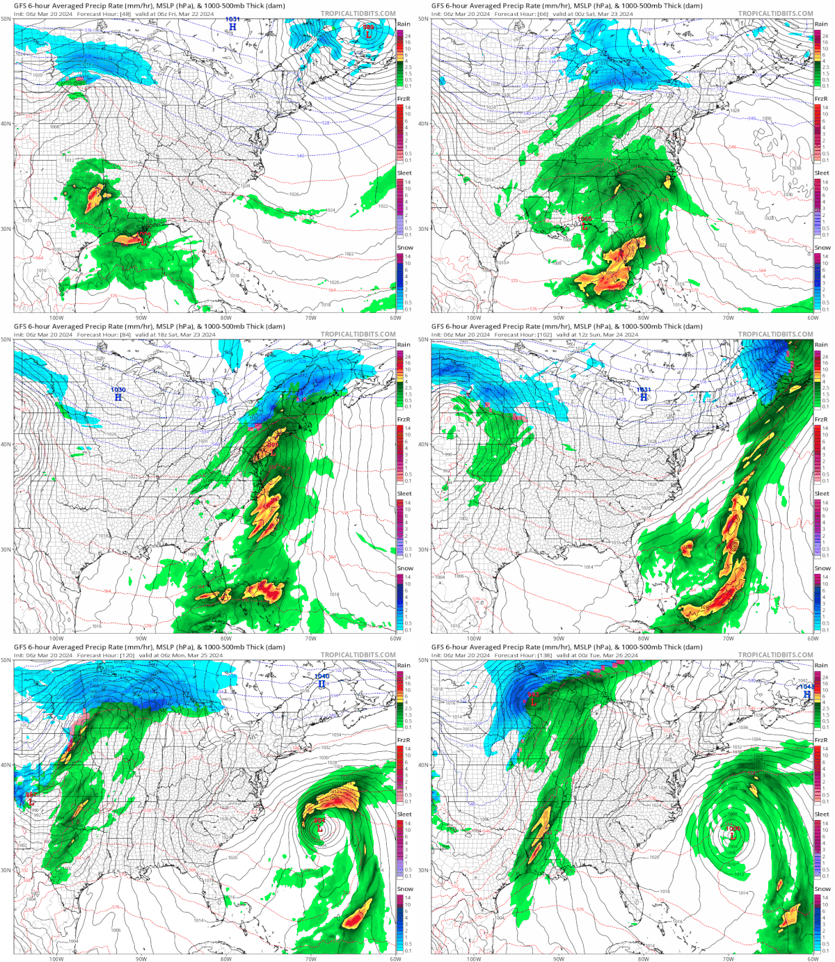
Friday morning starts cold and the day will start with sunshine but we will see clouds increasing from south to north as the day wears on. Most highs Friday will be in the 40s. High pressure moves offshore Friday and our attention turns southward. During Thursday low pressure develops in the Western Gulf of Mexico and heads eastward across the Gulf and then makes its way to just off the Southeast US Coast Friday night. Rain will spread across the South and Southeast and then head northward as the low heads up the coast, strengthening along the way.
There are a few things going on this weekend that will be important regarding the outcome. First is the fact that we may have coastal flooding issues this weekend. We are headed into a full moon, and we have seasonally high spring tides. The track of the low suggests east to southeast winds Friday night and Saturday which means that coastal New Jersey and Long Island as well as Southern and Southeastern New England will have issues with moderate coastal flooding risk.
Heavy rain will be an issue with the Weather Prediction Center as well as model guidance indicating an area of 2 to 3 inch rainfall from the Eastern Carolinas northeast to Eastern Virginia to New Jersey. The 2 to 3 inch zone continues northeast across NYC, Long Island, Southern and Southeastern New England. Timing suggests rain develops from south to north Friday night in the Northern Mid Atlantic and spreads into New England. The heaviest rain will be during the day Saturday. Temperatures will be in the raw upper 40s and lower 50s at best Saturday. Winds will be gusting 20t to 30 mph from the east or east southeast. The rain will end from south to north later Saturday afternoon and evening. If the GFS model is correct, we should see improving weather conditions Sunday with leftover early clouds, developing sunshine, and highs in the 40s. Onshore flow issues won’t be going away as a strong high builds in Southeastern Canada and low pressure forms off the Middle Atlantic and sits there early next week. This will keep the flow off the ocean and that means coastal flood risks continue into next week. For now we look to be dry Monday and Tuesday.
BE SURE TO DOWNLOAD THE FREE METEOROLOGIST JOE CIOFFI WEATHER APP &
ANGRY BEN’S FREE WEATHER APP “THE ANGRY WEATHERMAN!
MANY THANKS TO TROPICAL TIDBITS FOR THE USE OF MAPS
Please note that with regards to any severe weather, tropical storms, or hurricanes, should a storm be threatening, please consult your local National Weather Service office or your local government officials about what action you should be taking to protect life and property.
(Amazon is an affilate of Meteorologist Joe Cioffi & earns commissions on sales.)

