Chilly Dry Mainly Sunny Weekend Colder Pattern Develops Late Next Week
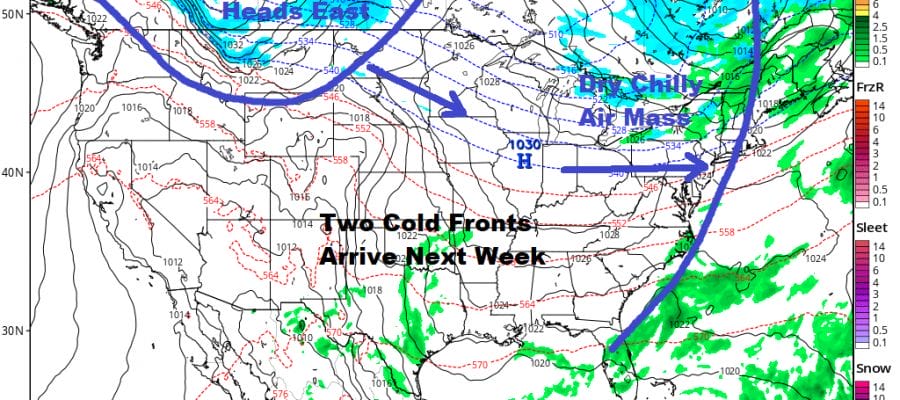
Thursday’s storm system, massive cold front and severe weather outbreak was a slight game changer in that it was apparently the last in a series of storms that began with the wall of rain from Tropical Storm Nestor a few weeks ago. This event has nudged a few chess pieces around in the atmosphere and we seem to be into a relatively calm stretch. Busy periods are usually followed by benign ones as the atmosphere essentially runs out of gas for awhile. This minor adjustment will be bringing cold fronts through from time to time with varying intensities but most won’t be doing very much. Behind each front is a shot of chilly air and we are seeing that this weekend and into Monday of the new week.
SATELLITE

REGIONAL RADAR

We have a nice day of sunshine for this Saturday but it is chilly out there today as highs will just reach into the 50s this afternoon and a few places inland will likely struggle to get to 50. There is a wave of low pressure on a front offshore that will head northeast today and tonight. It might throw back a few clouds along the coast this afternoon but other than that, there are no issues and no radar issues to concern ourselves with either. Tonight should be mainly clear and cold with lows in the 20s to low 30s inland and mid to upper 30s along the coast.
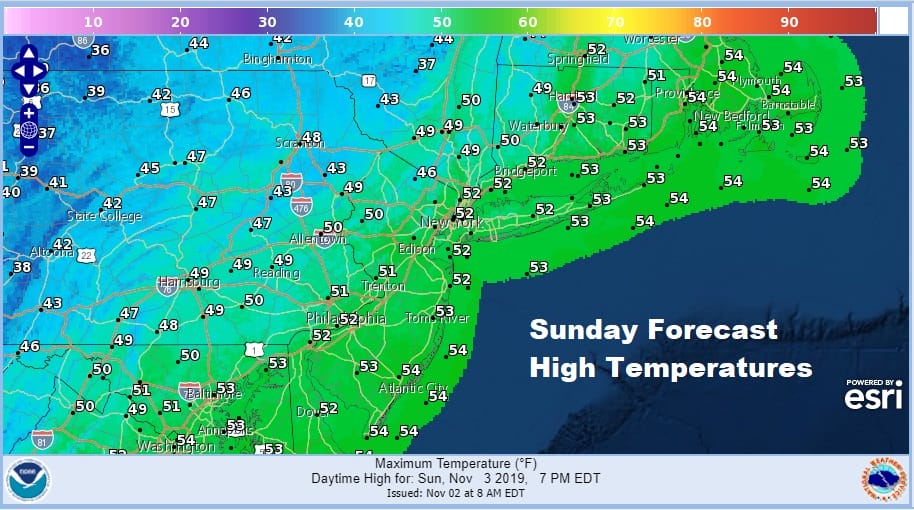
Sunday will be mainly sunny and chilly much like today with highs in the upper 40s and lower 50s. Another chilly night is ahead of us for Sunday night into Monday morning and another sunny day is on the table for Monday with highs reaching the low and middle 50s.
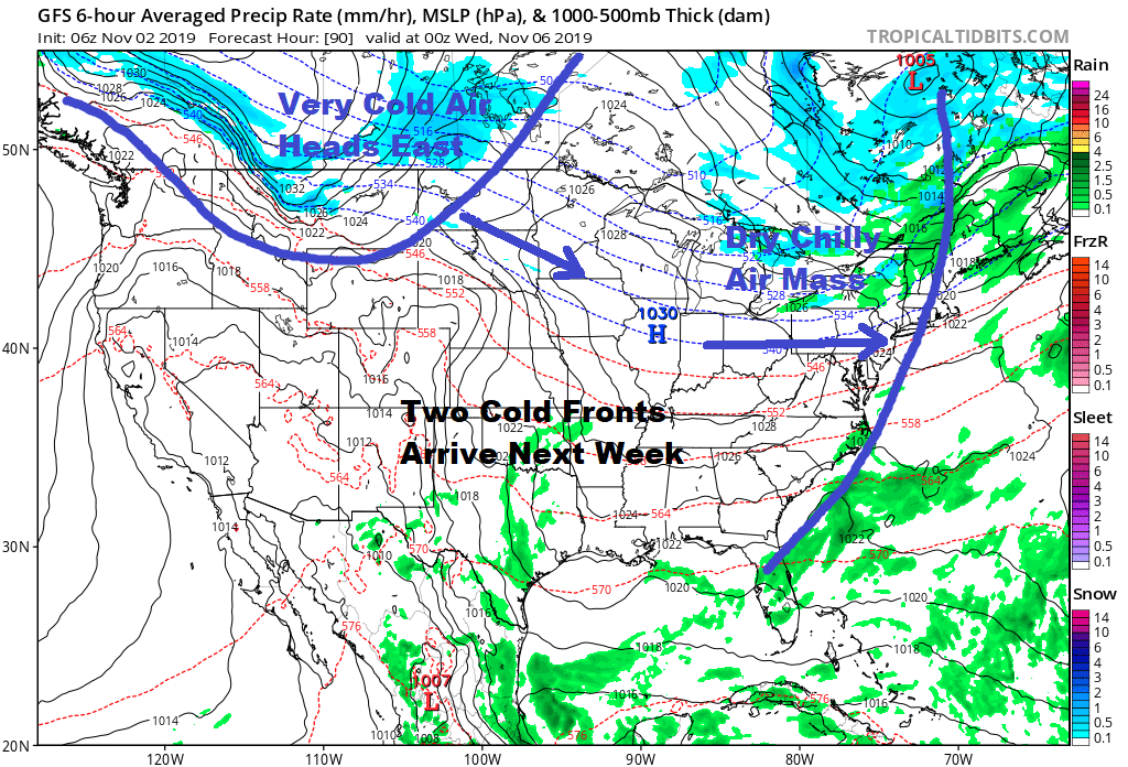
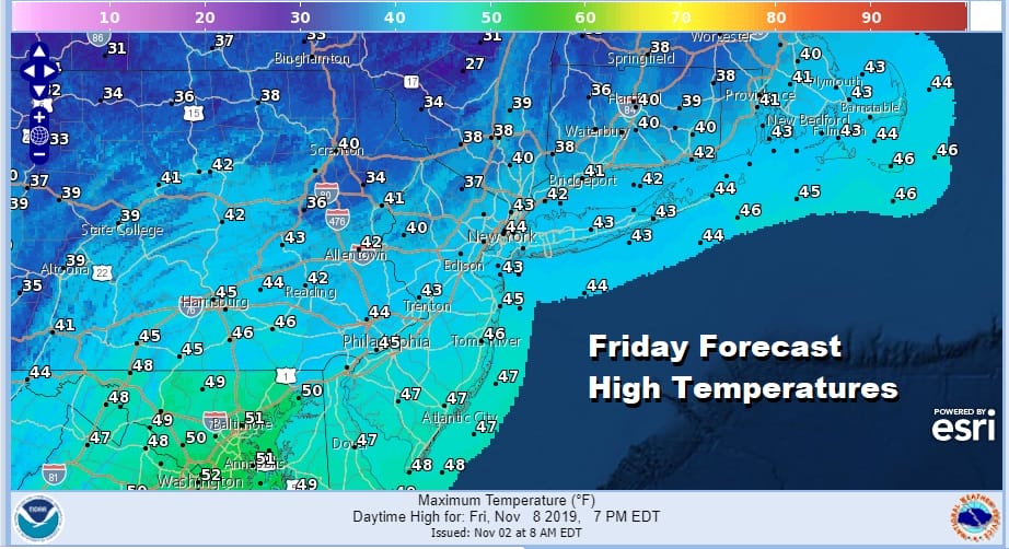
Tuesday the first of two cold front approaches. It comes through mostly dry with just some clouds with it. Tuesday’s highs will be in the upper 50s to lower 60s. Behind it is a another shot of chilly air for Wednesday into Thursday but the next cold front coming down from Western Canada is due to arrive later Thursday with perhaps a brief shower. The air behind this front is cold and an early look at next Friday suggests that it will be a day where temperatures will have a tough time getting out of the low to mid 40s for highs and some places won’t be getting out of the 30s north and west of the coast.
This air mass will likely take care of the remaining areas that have not seen their temperatures go below freezing yet this Autumn. The overall pattern is one where we have a dominate northwest flow with trough after trough coming through. This means cold front after cold front at the surface and with northwest winds aloft it is certainly difficult to get any kind of moisture involved with these systems.

It appears this pattern holds for while which would favor below average temperatures overall for the first 10 days of this month and perhaps at least the first half of the month. From a storm system perspective we probably will see things pick up in the second half of the month as the upper pattern undergoes another round of adjustments. We will address the long range pattern at some point this weekend.
WEATHER IN 5! 5 DAYS IN 5 MINUTES
BE SURE TO DOWNLOAD THE FREE METEOROLOGIST JOE CIOFFI WEATHER APP &
ANGRY BEN’S FREE WEATHER APP “THE ANGRY WEATHERMAN!
MANY THANKS TO TROPICAL TIDBITS FOR THE USE OF MAPS
Please note that with regards to any severe weather, tropical storms, or hurricanes, should a storm be threatening, please consult your local National Weather Service office or your local government officials about what action you should be taking to protect life and property.


