Chance For Showers Tonight into Friday Morning Colder Into the Weekend

Chance For Showers Tonight into Friday Morning Colder Into the Weekend
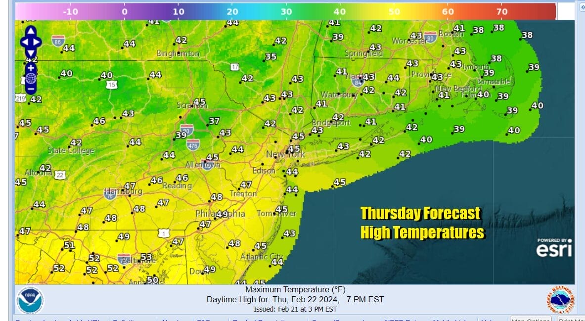
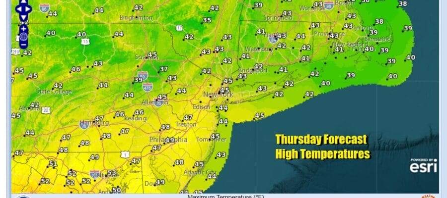
Weather systems have been stuck for the last few days thanks to low pressure offshore and the satellite loops show that offshore low strengthening today as it moves north and then northeast. To the west we have an approaching cold front with some showers but they won’t get here until late this afternoon and this evening. In the meantime sunshine gives way to arriving clouds and temperatures this afternoon will be in the 40s with some warm spots in South Jersey and points south making it close to 50.
SATELLITE WITH LIGHTNING STRIKES

WEATHER RADAR

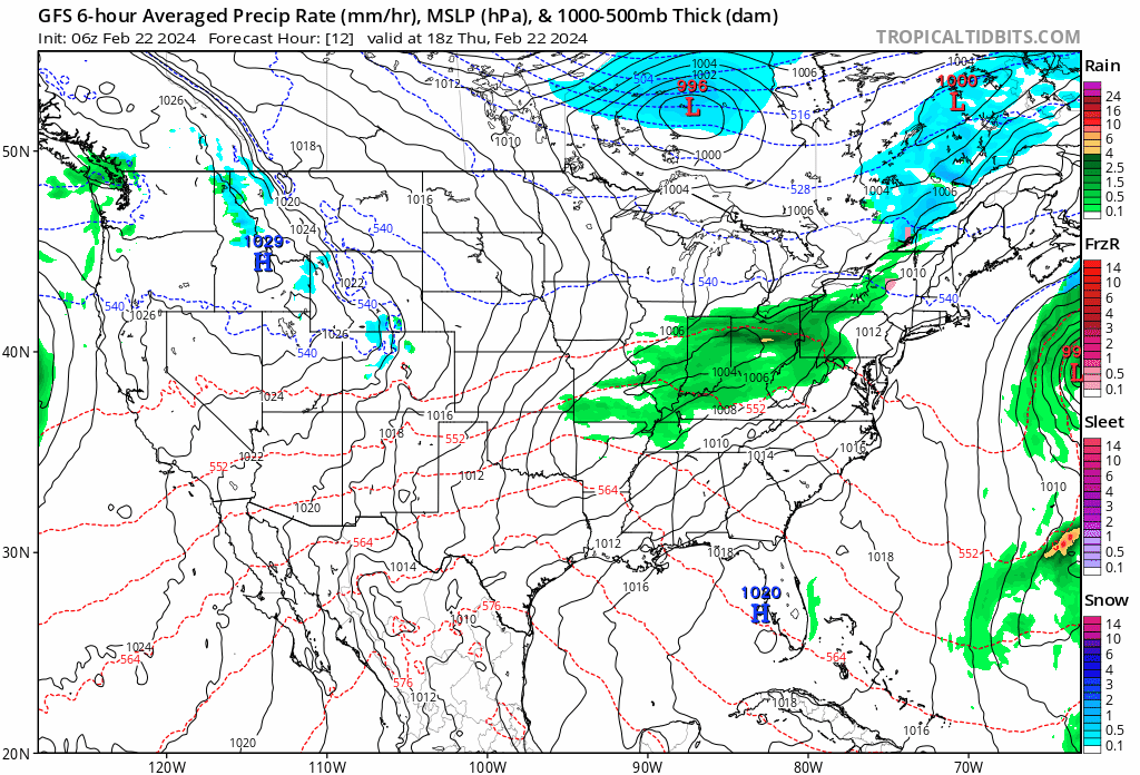
Radar is showing showers moving east across Pennsylvania and Western NY. This system will move through relatively quickly and we aren’t looking for anything major rainfall wise. Perhaps a quarter of an inch fo rain or less will do it. Then the front moves offshore and we will get into a northwest flow of colder air though a second front will need to pass later on Friday to usher in the coldest air for Friday night into Saturday.
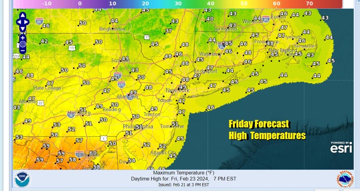
Clouds and showers that will be lingering around Friday morning will end from west to east and then we will have leftover clouds giving way to some breaks of afternoon sunshine. The second front we mention earlier won’t have much to it but it will help to clear skies out once that passes Friday afternoon. Highs Friday will be into the 50s.
it will be breezy and colder Friday night into Saturday morning on northwest winds and clear skies. Saturday morning lows will be in the 20s to around 30. Saturday is going to be a cold day with sunshine but temperatures will likley be hard pressed to get out of the 30s in most places.

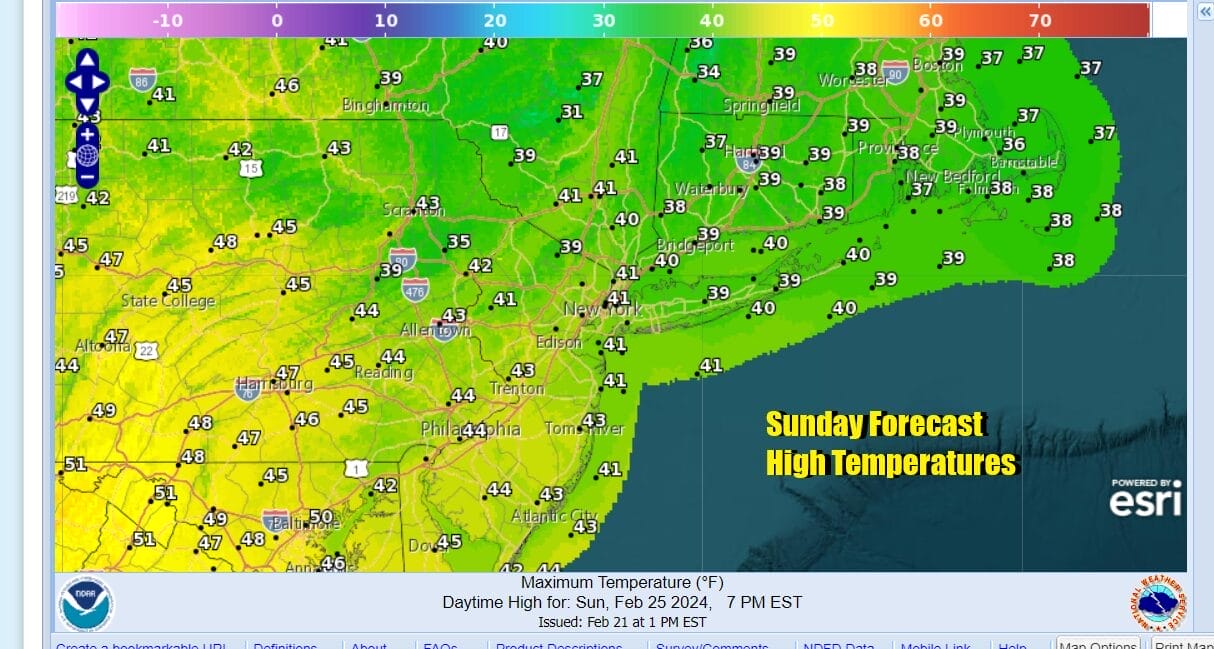
It will be cold Saturday night into Sunday morning with most lows in the 20s. The cold shot of air will be quick in moving in and moving out so that temperatures Sunday will start to moderate. We will have a mainly sunny day for Sunday. High temperatures should climb back to the low and middle 40s in most places. No rain is forecast for the weekend.
Next week will be a week of warmer temperatures and south to southwest flow of air that will last through at least Thursday. We will likely see winds pick up as the week wears on however it may not be until late Thursday of next week when then next storm system and cold front come close enough to bring through some showers. No major storms are on the horizon at least over the next week or longer.
BE SURE TO DOWNLOAD THE FREE METEOROLOGIST JOE CIOFFI WEATHER APP &
ANGRY BEN’S FREE WEATHER APP “THE ANGRY WEATHERMAN!
MANY THANKS TO TROPICAL TIDBITS FOR THE USE OF MAPS
Please note that with regards to any severe weather, tropical storms, or hurricanes, should a storm be threatening, please consult your local National Weather Service office or your local government officials about what action you should be taking to protect life and property.
(Amazon is an affilate of Meteorologist Joe Cioffi & earns commissions on sales.)