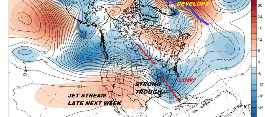
BLOCKY PATTERN APPEARS Weather models remain on course with idea of some high latitude blocking developing over the next couple
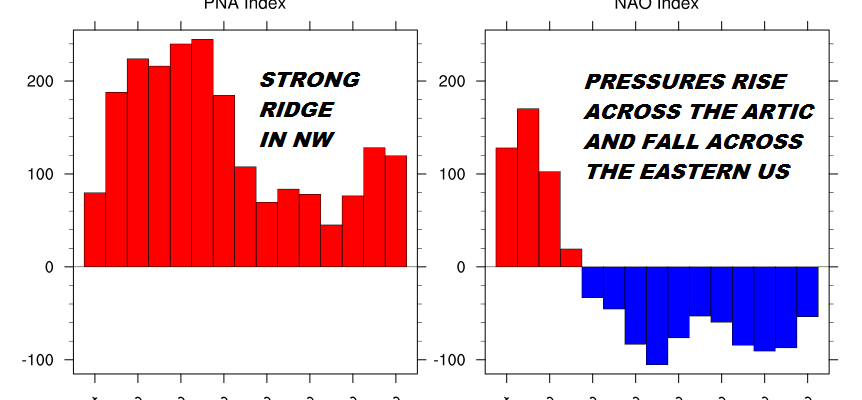
BLOCKY PATTERN APPEARS Weather models remain on course with idea of some high latitude blocking developing over the next couple
We have that trough in the East Ridge in the west pattern long range and this creates a chance for
FROST & FREEZES TONIGHT IN SOME AREAS WARMER FRIDAY SATURDAY BEFORE COLD ARRIVES SUNDAY Tonight’s frosts & freezes will hinge

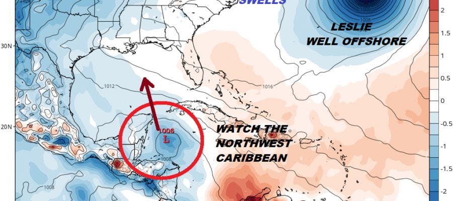
…MICHAEL PRODUCING FLASH FLOODING ACROSS PORTIONS OF NORTH CAROLINA AND SOUTH-CENTRAL VIRGINIA… …TROPICAL-STORM-FORCE WIND GUSTS OCCURRING OVER PORTIONS OF NORTHEAST
WARM AHEAD OF COLD FRONT TODAY WATCH FOR PASSING SHOWERS TONIGHT COOLER FRIDAY SATURDAY WARMER SUNDAY We are looking at
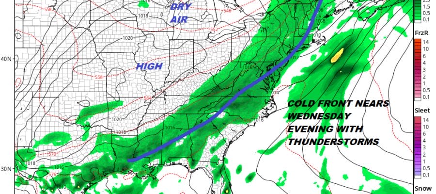
RAIN LATER TONIGHT INTO TUESDAY AFTERNOON 1-2 INCHES WARM HUMID WEDNESDAY THUNDERSTORMS EVENING COULD BE SEVERE DRY WEATHER RETURNS LATE