Brutally Hot Humid Afternoon Minimal Thunderstorm Activity
We were set for blastoff this morning when lows barely broke under the 80 degree mark in warmer urban locations and most lows were in the low to mid 70s. So we are on our way to a very hot afternoon. We are seeing lots of sunshine on the satellite picture with not much in the way of cloud cover around. Midday temperatures are already into the 80s and the humidity is high. Temperatures will top in the mid to upper 90s this afternoon. As far as thunderstorms go it seems they will be few and far between for much of the area from Eastern Pennsylvania to Southern New England. There is the outside chance for an isolated thunderstorm mainly inland north and east of NYC and also south and west of Philadelphia. In between those two points it should be thunderstorm free.
SATELLITE
REGIONAL RADAR
We have run our streak of 90s to three days and it seems that Tuesday will make it 4. It will be warm and humid tonight with lows in the 70s in most places. Warmer urban centers will have a tough time getting much below 80. Tuesday look for sunshine and hot conditions with highs in the low to mid 90s so we should be a few degrees lower on Tuesday.
Once again we will see the chance for an isolated pop up thunderstorm in the afternoon but any storms will be few and far between. That should change on Wednesday as we have the first of two cold fronts headed our way.
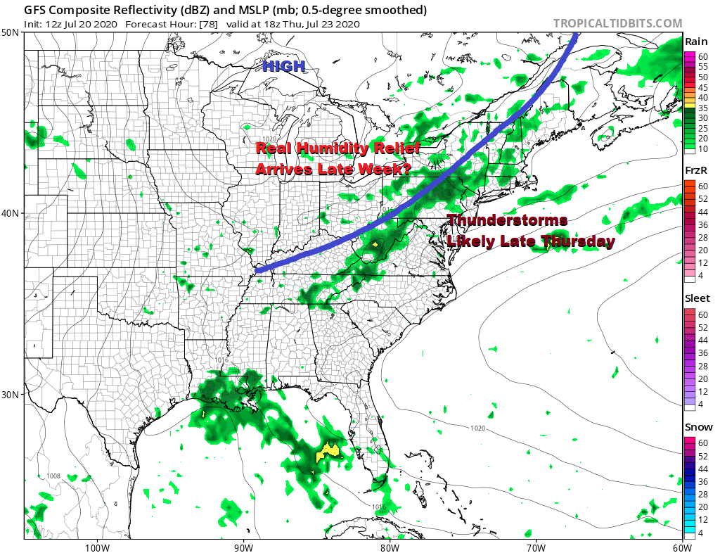
We will throw in a chance for showers and thunderstorms on Wednesday but there will also be some sunshine very warm to hot conditions. Highs will be in the upper 80s and lower 90s. Thursday we will see a stronger cold front approach and move through with some late day showers and thunderstorms. Highs will be in the mid 80s to near 90 degrees.
It uwill likely still be very warm Friday and into the weekend with highs in the mid 80s to near 90 each afternoon but we should get some humidity relief at the end of the week as high pressure builds in from the Great Lakes.
It would appear we should get 3 days of humidity relief Friday through Sunday before humidity levels come back up a week from today. The weather pattern in the longer term shows a northwest flow from Canada nearby and that will likely bring cold fronts through every 3 or 4 days with short warm ups and shots of low humidity behind each front. Rain will be lacking other than what is produced by showers and thunderstorms over the next couple of weeks. Those chances only come with the arriving fronts so it would see it will be dry and rain free much of the time over the next 2 weeks.
BE SURE TO DOWNLOAD THE FREE METEOROLOGIST JOE CIOFFI WEATHER APP &
ANGRY BEN’S FREE WEATHER APP “THE ANGRY WEATHERMAN!
MANY THANKS TO TROPICAL TIDBITS FOR THE USE OF MAPS
Please note that with regards to any severe weather, tropical storms, or hurricanes, should a storm be threatening, please consult your local National Weather Service office or your local government officials about what action you should be taking to protect life and property.


