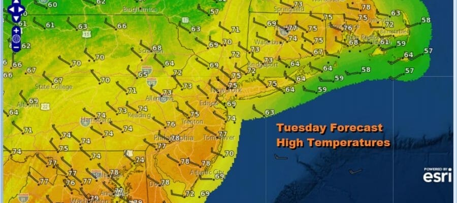
Better Weather Today into Wednesday Then
Transition To Warmer Air Mass Late Week

Better Weather Today into Wednesday Then
Transition To Warmer Air Mass Late Week

The highlight of this week may be the end of the week and into the weekend. We have not had would I would call a decent weekend coupled with warm spring temperatures but it seems we are on our way to getting just that. In the meantime with yesterday’s cold front now to the east and offshore, it is all about improving weather conditions today with sunshine, a few clouds, a bit of a breeze at times and highs about where they should be for this time of year, into the 70s. Satellite and radar views are quiet and we don’t see any issues today into the first part of Wednesday.
SATELLITE

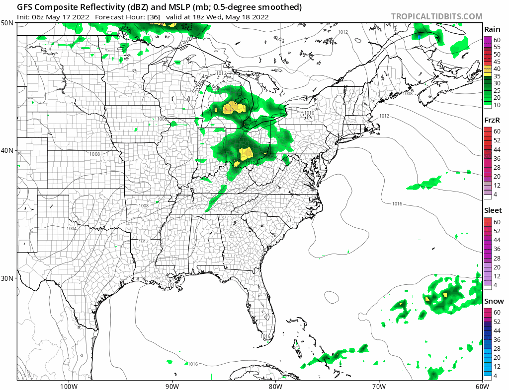
WEATHER RADAR

Tonight should be nice and clear with lows mostly in the upper 40s and lower 50s. Wednesday starts with sunshine but we will see that give way to arriving clouds as the next weather system heads our way from the west. This system will begin the process of transitioning us into a very warm air mass for the end of the week and into the weekend. Wednesday highs with be once again into the 70s.
That transition puts us in line for clouds and showers for Wednesday night into Thursday morning with changeable sky conditions to follow. This is basically a warm front as low pressure goes by to our north and a ridge of high pressure builds along the East Coast. Highs Thursday should be in the 70s.
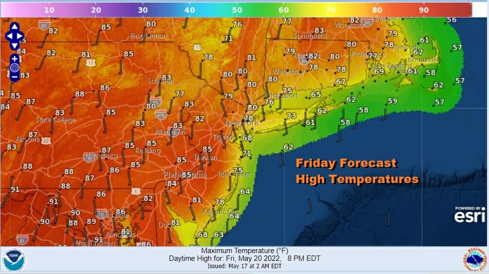
It had to happen eventually and here it is. We have a ridge along the East Coast that should hold into the weekend. The next cold front is not due until perhaps late Sunday when we could see some showers and thunderstorms. In between we have some sunshine and we have very warm conditions developing especially inland. Friday’s winds will be from the south which means south and east facing shorelines areas like Southern New England and Long Island will be in the 70s but everyone and everywhere else will be in the 80s.
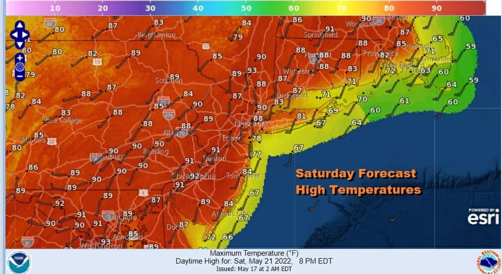
Saturday we will bend the wind around to the southwest and that will mean sunshine should take highs well into the 80s and for the first time this season, some places inland should see 90 degrees. Even the coast should be able to warm up into the 80s except for the immediate coastal areas of Long Island, Southern, and Southeastern New England. Sunday should see sunshine for most of the day with a threat for late day thunderstorms with the next cold front. Highs will be in the 80s. Not bad for the weekend before the Memorial Day holiday weekend and at least we don’t see blocking coming back.
BE SURE TO DOWNLOAD THE FREE METEOROLOGIST JOE CIOFFI WEATHER APP &
ANGRY BEN’S FREE WEATHER APP “THE ANGRY WEATHERMAN!
MANY THANKS TO TROPICAL TIDBITS & F5 WEATHER FOR THE USE OF MAPS
Please note that with regards to any severe weather, tropical storms, or hurricanes, should a storm be threatening, please consult your local National Weather Service office or your local government officials about what action you should be taking to protect life and property.


