Best Day of the Week Before Gloom & Doom Return
Rain & Wind Thursday Into Friday

Best Day of the Week Before Gloom & Doom Return
Rain & Wind Thursday Into Friday
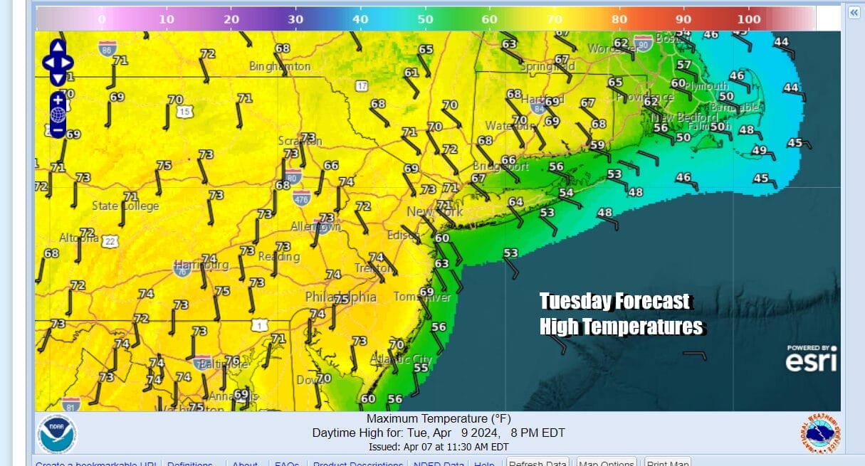
Today will be the warmest day of the spring season so far as we have a set up for sunshine and a rather solid launching pad. The one thing that holds temperatures back today will be a south wind but this is a time of year where temperatures can certainly outperform. Also there will wide ranges with most highs along the immediate coast in the 50s to near 60 but once you head inland and west of the coast, temperatures will reach the low and middle 70s. Sunshine will be plentiful and we should see nothing more than some passing clouds from time to time. Radars are nice and quiet and should stay that way through tonight. Most lows tonight will be in the 40s.
SATELLITE WITH LIGHTNING STRIKES

WEATHER RADAR

Wednesday we begin our descent into the land of gloom & doom. There should be more clouds. We will also have a warm front that will be setting up across New Jersey and Pennsylvania so this will be one of those days where high temperatures will depend on which side of the developing warm front you are on.
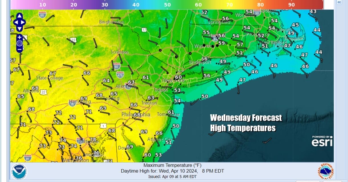
Looking at the forecast highs for Wednesday if you are Northern New Jersey & Northeast Pennsylvania north and east you will likely see clouds, an ocean wind, and temperatures in the 50s to near 60. South and west of there across Southern Pennsylvania to Southern New Jersey and Points southward we could see highs reach into the 70s. There should be breaks of sunshine in this area to help the cause. Also there will be some scattered showers around and that may complicate the forecast a bit.

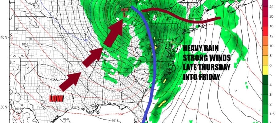
Low pressure develops in East Texas and takes a track toward the Great Lakes Wednesday into Friday. This system is forecast to produce a swath fo widespread severe weather across the Gulf States today and Wednesday and we will see elevated tornado risk in a zone from East Texas to Alabama. Heavy rain will develop in the Tennessee and Ohio Valley and eventually rain and thunderstorms will reach the Northeast and Middle Atlantic states late Thursday and lasting into Friday. This system could be another inch to an inch and half producer and there is always the risk that this system outperforms. Winds will also increase late Thursday into early Friday and we could see southerly winds gusting to 40 mph or more especially along the coast. The cold front passes through Friday so we will still have rain and showers around but weather conditions should improve overall for the weekend.
BE SURE TO DOWNLOAD THE FREE METEOROLOGIST JOE CIOFFI WEATHER APP &
ANGRY BEN’S FREE WEATHER APP “THE ANGRY WEATHERMAN!
MANY THANKS TO TROPICAL TIDBITS FOR THE USE OF MAPS
Please note that with regards to any severe weather, tropical storms, or hurricanes, should a storm be threatening, please consult your local National Weather Service office or your local government officials about what action you should be taking to protect life and property.
(Amazon is an affilate of Meteorologist Joe Cioffi & earns commissions on sales.)


