Beautiful Weather Through Friday Very Low Humidity
Father’s Day Weekend Mostly Good

Weather in 5/Joe & Joe Weather Show Latest Podcast
Beautiful Weather Through Friday Very Low Humidity Father’s Day Weekend Mostly Good
The humidity began dropping yesterday and it continued overnight and it continues for the next 3 days. We are seeing a somewhat unusual pattern in the upper atmosphere that has carved out a deep trough in the Eastern US. The strong northwest flow carries very dry air from Canada and that dry air has made it as far south as the Florida Panhandle! The result is a clear sky on the satellite and absolutely quiet radars that will remain so for the next several days. Highs today will be in the mid to upper 70s. Most importantly is that humidity levels will be down in the 30-40 percent range!
SATELLITE

WEATHER RADAR

Nice dry air masses this time of year can make for nice cool nights with no air conditioning. Skies will be clear tonight. Most lows will be in the 50s and there will be 40s inland away from warmer urban settings. Thursday is a wash rinse repeat day of sunshine with highs again in the mid to upper 70s. Friday look for highs in the upper 70s to lower 80s with one last day of low humidity and lots of sunshine.
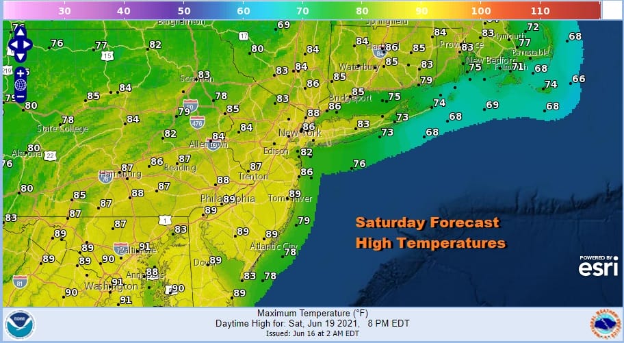
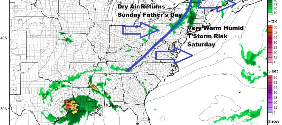
Inevitably air masses pull out and replaced by new ones and in the transition in between takes us to Saturday. It will be a very warm to borderline hot day with highs reaching 85 to 90 degrees. The humidity will be coming up but for not it doesn’t appear to be anything unmanageable.
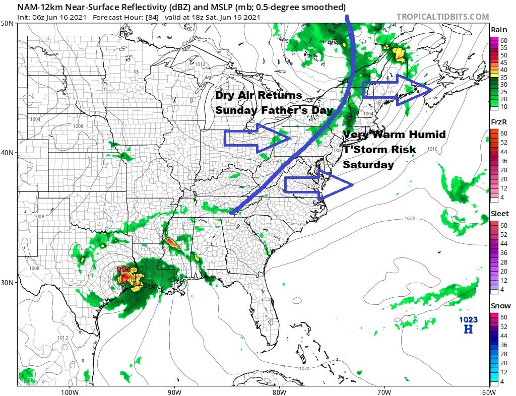
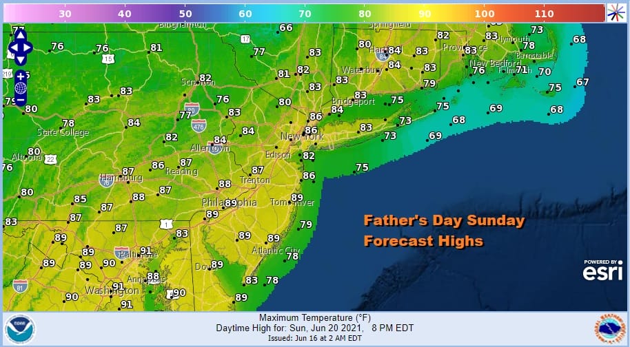
Before the humidity can get out of hand we have a cold front approaching and moving through and there is the chance for a thunderstorm as the front passes. Behind the front is another push of dry air and the humidity will drop off for Sunday. Father’s Day is looking good with sunshine and warm temperatures and reasonable humidity. Highs will be in the 80s.
This unusual pattern continues into next week. It appears another cold front will approach and Monday ahead of that front we will see a warm front push northward. Some moisture from the Gulf States, possibly from a tropical system could bring clouds and some passing showers Monday afternoon as the humidity rises. On Tuesday we will see a cold front pass with a good chance for showers and thunderstorms and then another dry air mass follows. We will be watching the Gulf of Mexico for possible tropical storm formation in the next couple of days. More on this is on our weather platform on Patreon.
BE SURE TO DOWNLOAD THE FREE METEOROLOGIST JOE CIOFFI WEATHER APP &
ANGRY BEN’S FREE WEATHER APP “THE ANGRY WEATHERMAN!

MANY THANKS TO TROPICAL TIDBITS & F5 WEATHER FOR THE USE OF MAPS
Please note that with regards to any severe weather, tropical storms, or hurricanes, should a storm be threatening, please consult your local National Weather Service office or your local government officials about what action you should be taking to protect life and property.


