Beautiful Tuesday Chance Thunderstorms Wednesday Night Drying Out Late Week
The gorgeous dry air mass that moved in yesterday is here for a repeat performance today. We have a cloud clear satellite for the most part and we should enjoy a good deal of sunshine for most of the day. We bottomed this morning in the cool 40s and lower 50s and we should see highs again this afternoon, much like yesterday in the upper 60s and lower 70s. There are clouds across the Great Lakes. Most of those will move to our north. There are some high clouds to the south. Most of those will pass to the south. Radars are nice and quiet. The bottom line is enjoy the day!
SATELLITE

REGIONAL RADAR

We don’t expect any issues tonight or during the day on Wednesday. Skies should be clear tonight with lows settling in the 50s to lower 60s. We are going to be facing the next cold front approaching on Wednesday but i don’t see anything happening during the day. Look for sun and clouds and warmer temperatures with highs in the mid 70s to lower 80s. A cold front approaches Wednesday night and showers & thunderstorms will get close during Wednesday evening. They should be into Eastern Pennsylvania by early evening then spread eastward after that.
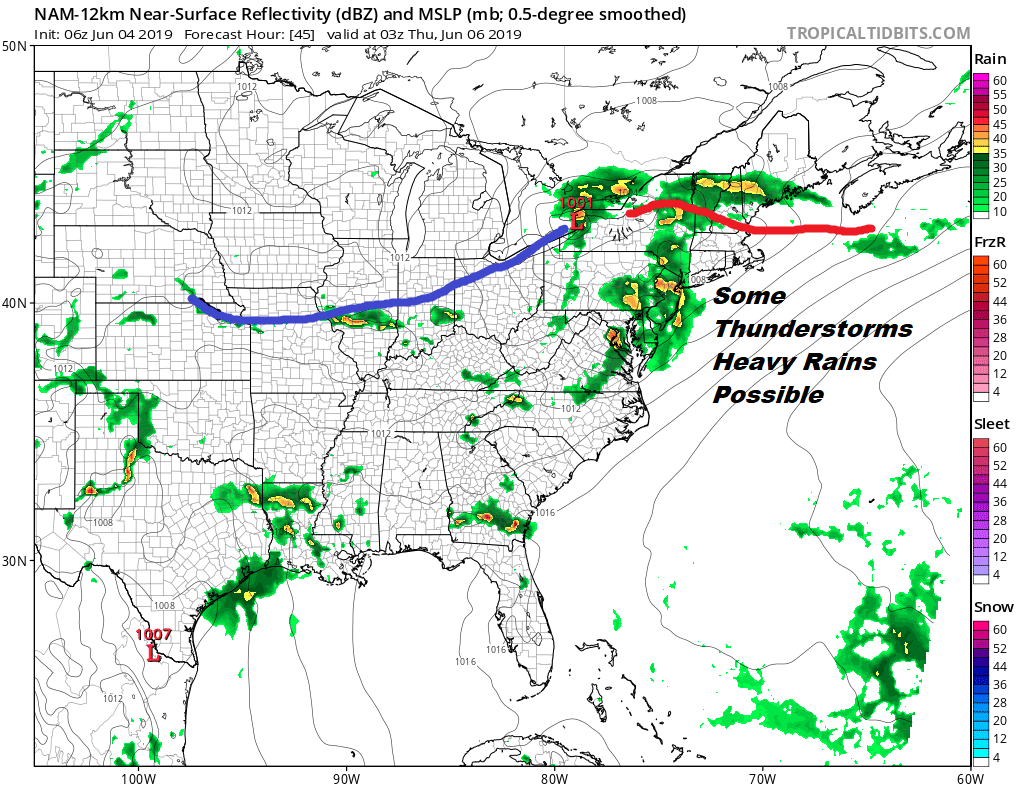
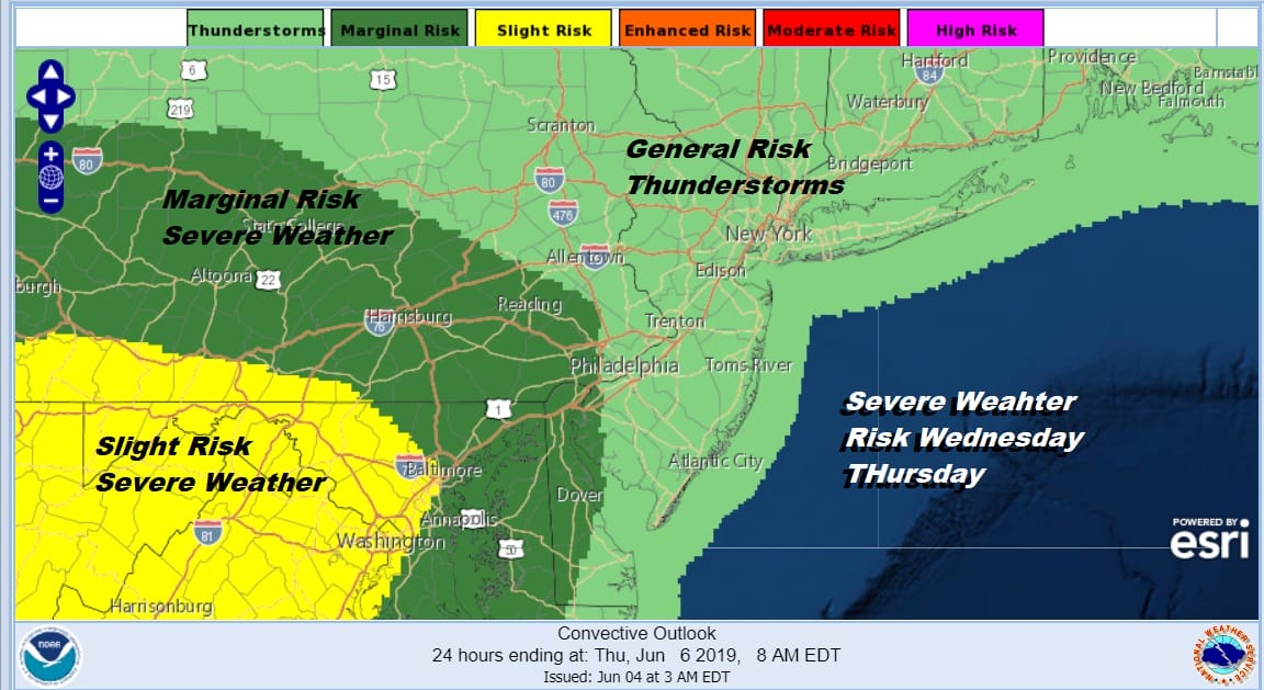
This cold front is going to move through Thursday morning. The nature of the thunderstorms to me suggests that rain could be the bigger issue here for most of the area with heavy rain possible Wednesday night in heavier thunderstorms. There is also some severe weather risk and have noticed that the Storm Prediction Center has nudged the risk area a bit further east and north Wednesday evening and overnight.
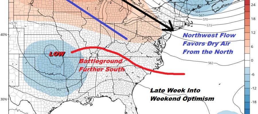
We have been discussing what happens after this front passing regarding stalling and how far south does the front get before stalling. You will notice on the map below that that jet stream pattern suggests a more favorable outcome for our area for late this week. There is a enough of a northern jet stream present to suppress the “battleground” zone for showers and thunderstorms for late week and this coming weekend.
What is especially encouraging about this is that the northwest flow holds on all weekend and that the short wave upper low back in Oklahoma won’t be able to lift northeastward until early next week. This could keep us rain free from later Thursday right through Sunday at least. Temperatures in this stretch will be seasonal but we aren’t talking hot weather and humidity will be relatively comfortable most of the time. It will be nice to get a 3 day or longer stretch of decent weather for a decent June weekend.
MANY THANKS TO TROPICAL TIDBITS FOR THE USE OF MAPS
Please note that with regards to any tropical storms or hurricanes, should a storm be threatening, please consult your local National Weather Service office or your local government officials about what action you should be taking to protect life and property.


