Beautiful July 4th Before Clouds Rain
Beautiful July 4th Before Clouds Rain
After fighting the battle of high clouds yesterday dry air overnight forced all the high clouds to the south. Skies are mostly sunny everywhere at the time of this post with deep blue skies and low humidity. Temperatures are in the 70s. Now during this afternoon clouds to the south and west will begin to move in and increase going into this evening. However there is no rain anywhere close by and for the most part we should be rain free through this evening from Northern New Jersey northeastward to Long Island and Southern New England.

Low pressure is developing in the lower Ohio Valley and heading just to our south by Tuesday morning. Regional radar showing rain spreading across the Middle Atlantic States and will gradually turn northeast and head our way. The question is when does the rain move in and does it move in before fireworks begin.
Beautiful July 4th Before Clouds Rain
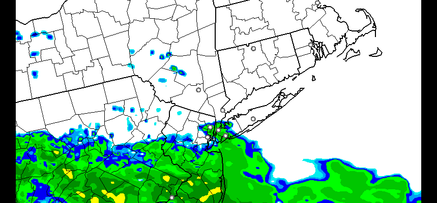
Regional Radar

Beautiful July 4th Before Clouds Rain
Local Radar


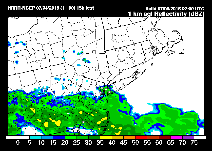
The HRRR model is very close with regards to the rain tonight as it is on the doorstep of New York City by 10pm. So it will be a matter of an hour or so here that makes a difference. At least it is not where it starts right off as a heavy rain as this looks to be more overrunning in nature and not convective.
HRRR MODEL 10PM TONIGHT
Rain will be tapering off around daybreak Tuesday. One or two more showers could follow as the day wears on but the bulk of the rain falls Monday night.
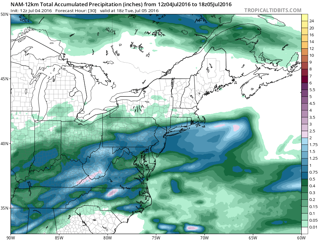
The NAM model rainfall forecast is pretty aggressive with rainfall amounts. Most areas are shown to get 1 to 2 inches from Southeastern Pennsylvania to Coastal Southern New England and Long Island. Im still skeptical on this since we have event after event where models overdo reality. We will see if it is different this time around.
FiOS1 News Weather Forecast For Long Island
FiOS1 News Weather Forecast For New Jersey
FiOS1 News Weather Forecast For Hudson Valley
NATIONAL WEATHER SERVICE SNOW FORECASTS
LATEST JOESTRADAMUS ON THE LONG RANGE
Weather App

Don’t be without Meteorologist Joe Cioffi’s weather app. It is really a meteorologist app because you get my forecasts and my analysis and not some automated computer generated forecast based on the GFS model. This is why your app forecast changes every 6 hours. It is model driven with no human input at all. It gives you an icon, a temperature and no insight whatsoever.
It is a complete weather app to suit your forecast needs. All the weather information you need is right on your phone. Android or I-phone, use it to keep track of all the latest weather information and forecasts. This weather app is also free of advertising so you don’t have to worry about security issues with your device. An accurate forecast and no worries that your device is being compromised.
Use it in conjunction with my website and my facebook and twitter and you have complete weather coverage of all the latest weather and the long range outlook. The website has been redone and upgraded. Its easy to use and everything is archived so you can see how well Joe does or doesn’t do when it comes to forecasts and outlooks.
Just click on the google play button or the apple store button on the sidebar for my app which is on My Weather Concierge. Download the app for free. Subscribe to my forecasts on an ad free environment for just 99 cents a month.
Get my forecasts in the palm of your hand for less than the cost of a cup of Joe!

MENTION JOE CIOFFI AND GET A 5% DISCOUNT


