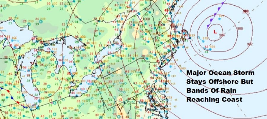
Bands of Rain Moving Southwest From Coastal Storm Offshore
We have a major storm sitting offshore about 150 miles southeast of Cape Cod. This storm has been backing slowly westward since yesterday and is making its closest approach to the coast now. It will then turn southwest and then southward as it completes a counter clockwise loop off our shoreline. The satellite picture shows the sharp dividing line between clouds and sunny skies that are over the Middle and South Atlantic states. Clouds will continue to drop southward through the afternoon. The bands of rain moving southwest will tend to weaken once they reach Southern New Jersey and Southeastern Pennsylvania.
SATELLITE

REGIONAL RADAR

Regional and local radars are picking up on the bands of rain moving southwest. Heavy rain has been confined to parts of Eastern Long Island and especially over Southeastern New England which is closer to the low center. Look for these bands of rain to continue this afternoon though they should start to weaken as we head into this evening and tonight.
LOCAL RADAR NEW YORK CITY

LOCAL RADAR PHILADELPHIA


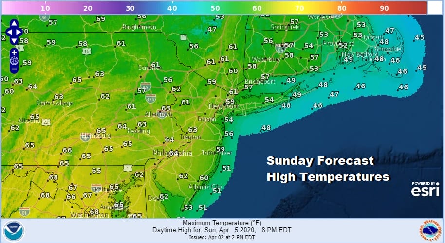
Where it is raining we have temperatures in the 40s with gusty winds from the north and north northwest while in other areas 50s are commonplace. This should continue for the rest of the day. Leftover clouds will be around tonight and for at least the start of Saturday. The storm will be moving away Saturday so temperatures should reach the 50s to near 60. There is a weaker system moving out of the Plains and across the Great Lakes but it will be in the process of falling apart. If we can manage some sunshine on Sunday, highs will reach the 60s away from the ocean.
We don’t see anything major for next week as weather systems seem to be on the weak side. Monday is looking like a dry day with some sunshine. Highs will be in the 60s. That will be the one plus for the first half of next week in that we will see higher temperatures.

Tuesday Wednesday and Thursday will bring weak weather systems along and with that a chance for showers each day but we don’t see whole day washouts and there will be some dry periods in between.
BE SURE TO DOWNLOAD THE FREE METEOROLOGIST JOE CIOFFI WEATHER APP &
ANGRY BEN’S FREE WEATHER APP “THE ANGRY WEATHERMAN!
MANY THANKS TO TROPICAL TIDBITS FOR THE USE OF MAPS
Please note that with regards to any severe weather, tropical storms, or hurricanes, should a storm be threatening, please consult your local National Weather Service office or your local government officials about what action you should be taking to protect life and property.


