
DOWNLOAD MY NEW FREE JOESTRADAMUS WEATHER APP FOR ANDROID
THE APP IS ABSOLUTELY FREE TO ALL BUT CONSIDERING SUBSCRIBING TO PATREON FOR A WEATHER EXPERIENCE FREE OF ADS, EXCLUSIVE VIDEOS FOR MEMBERS ONLY AND MUCH MORE…STARTS AT $2 A MONTH..MESSAGE ME AT ANY TIME
Bad Hair Hat Hair Bitter Cold Air Exits Rain Late Wednesday Thursday
It is another very cold morning though at least temperatures are 5 to 10 degrees higher than they were at this time yesterday. Winds are less harsh but they are still gusting into the 20s. This makes it another bad hair hat hair bitter cold air day. At least highs will reach into the 20s today with a fair amount of sunshine. By this afternoon with the wind easing a bit further it will actually feel a lot better outside.
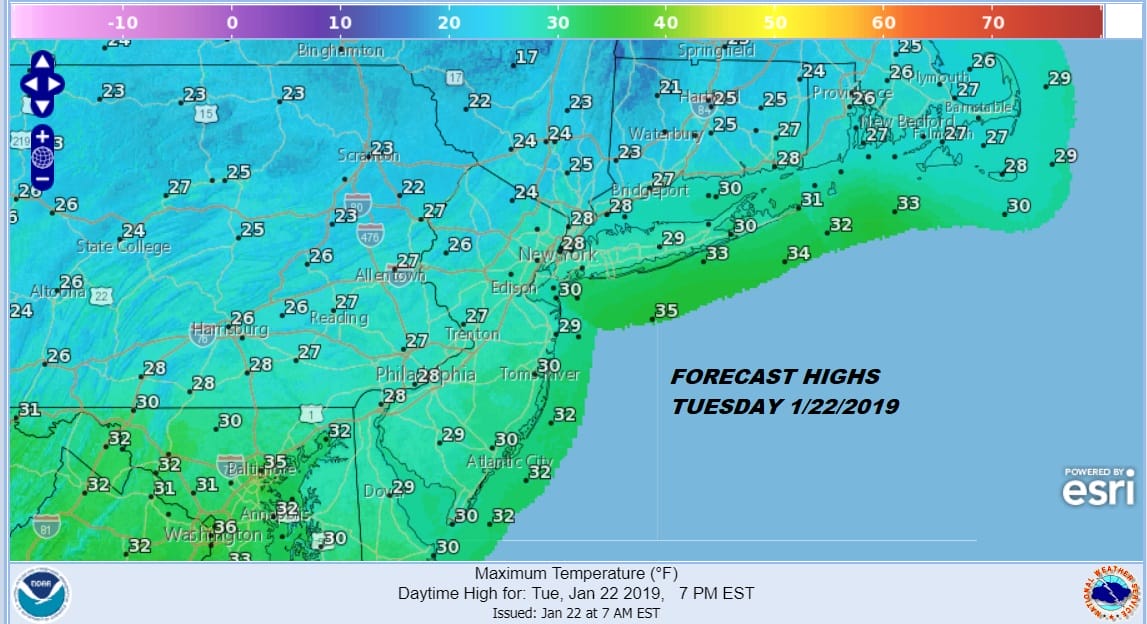
The highs for the day probably won’t be hit until later this evening. As the cold air pulls out and winds start to turn to the southwest we will see temperatures likely hold overnight rather than drop into the teens again. Perhaps some colder spots inland could see temperatures drop into the teens especially if skies are clear and winds are light. Clouds however should come into the scene overnight and into Wednesday morning.
EASTERN SATELLITE

REGIONAL RADAR

Wednesday was viewed as a race between when precipitation arrives and when temperatures go above 32 long enough so that the ground warms. This appears to be the case so we should avoid freezing rain issues Wednesday morning. There is a chance the coldest spots in Northwest New Jersey and Northeast Pennsylvania could see a little icing Wednesday afternoon if the precipitation sneaks in early. For most other areas rain or showers will likely hold off until late in the afternoon or evening on Wednesday. Highs should reach into the 40s.
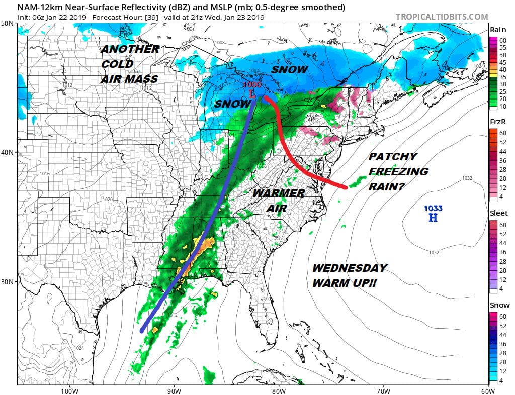
We will have showers Wednesday night into Thursday morning. The front will slow down and another wave will develop on it. That will pass on Thursday. There is an outside chance we could see the rain end as some wet snow on the back end perhaps in Northern New Jersey westward but I don’t think it amounts to anything substantial at this point. Cold air returns Friday and the weekend though we will not see the extreme cold return It will be cold enough though with highs just in the 30s Friday and likely not much out of the 20s on Saturday for high temperatures. Sunday sees a weak system approaching and moving through. There are some models that support the idea for another system moving through on Tuesday. There is nothing that supports the notion of anything major happening at this point. There is quite a bit of chaos regarding how weather models are handling all this so we will just wait a few more days to have the noise settle itself out.
MANY THANKS TO TROPICAL TIDBITS FOR THE USE OF MAPS
Please note that with regards to any tropical storms or hurricanes, should a storm be threatening, please consult your local National Weather Service office or your local government officials about what action you should be taking to protect life and property.


