
Back to Sunshine Into Friday Weekend Brings Onshore Flow Issues
Along With Rain or Showers

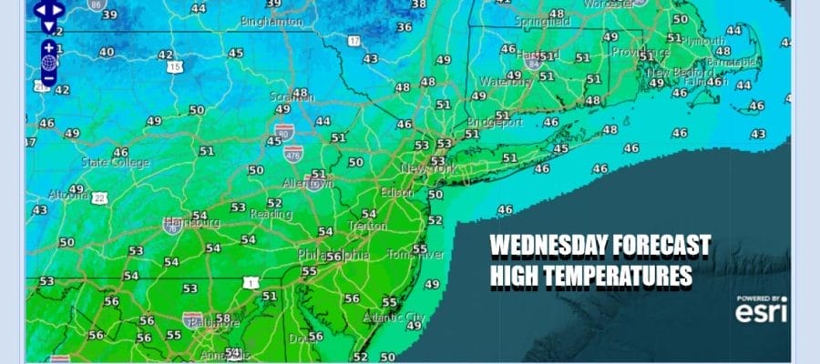
We have a little bit of work to do this morning as low pressure to the east heads out to see. There is an upper trough moving across Upstate NY so there will be some clouds around and there could be a passing shower or two into midday. Once the trough clears the coast we should see decreasing clouds and increasing sun this afternoon. Highs will be generally in the upper 40s to mid 50s. You can see the stick of clouds and some light precipitation on the satellite and radar loops as this slides to the east.
SATELLITE WITH LIGHTNING STRIKES

WEATHER RADAR

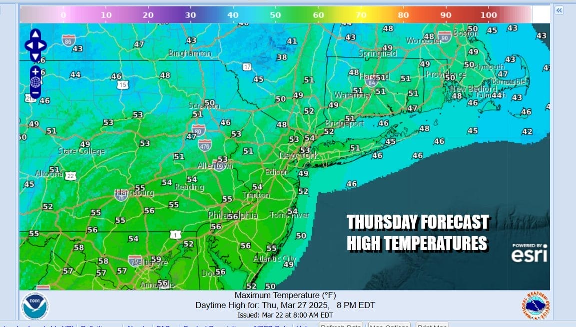
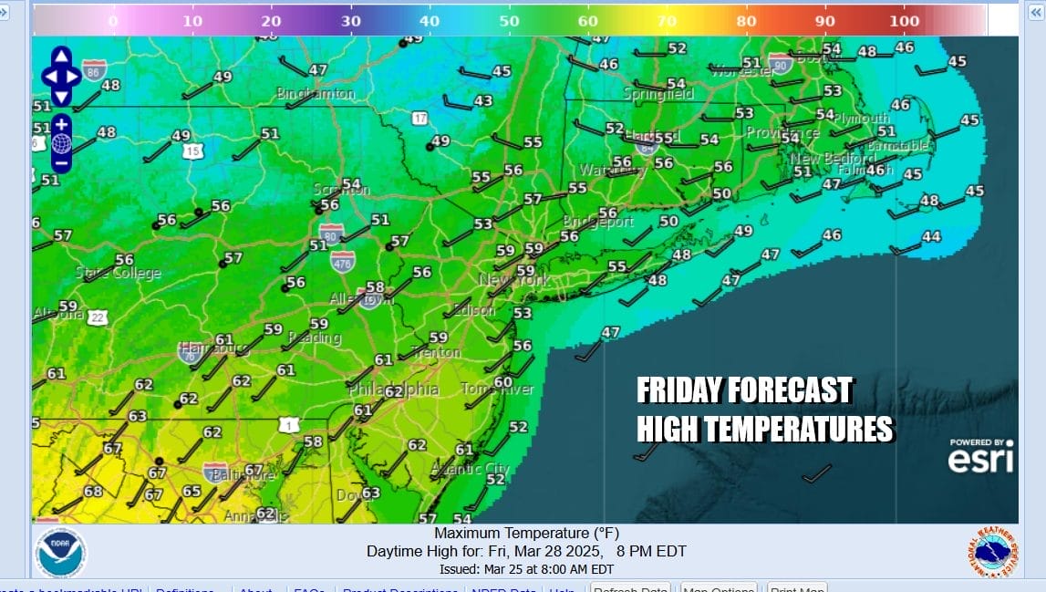
A chilly night lies ahead of us as skies clear. Thursday morning lows will be in the upper 20s and lower 30s. High pressure settles in for Thursday and for Friday. Thursday highs will be in the low to mid 50s. Friday temperatures will be a little higher as west to southwest winds begin to develop Highs Friday will be in the middle 50s to lower 60s. We look for sunshine both days.
The weekend poses a forecast challenge. Low pressure develops in the Plains and heads to the Great Lakes. We will have an east west front that will set up in the Northeast but where? Right now it seems the front will likely set up across Upstate NY and Central New England. As long as that is the case it will mean that Saturday will be a day of sunshine and very warm temperatures. Highs will reach the mid to upper 70s especially inland. Even coastal areas could see highs in the 60s with sea breezes confined mostly to the immediate shore.

Sunday probably be a little lower but still warm with highs in the 70s inland. We will need to see where the frontal boundary lies. Also we will likely see more clouds and the risk risk for scattered showers or possibly a thunderstorm. Showers and thunderstorms will be more numerous Monday as a strong cold front heads eastward through the Ohio Valley & the Appalachians. There could also be some severe weather risk with this weather front as it heads eastward.
BE SURE TO DOWNLOAD THE FREE METEOROLOGIST JOE CIOFFI WEATHER APP &
ANGRY BEN’S FREE WEATHER APP “THE ANGRY WEATHERMAN!
MANY THANKS TO TROPICAL TIDBITS FOR THE USE OF MAPS
Please note that with regards to any severe weather, tropical storms, or hurricanes, should a storm be threatening, please consult your local National Weather Service office or your local government officials about what action you should be taking to protect life and property.


