
Temperature Volatility Over the Weekend 80 Degree Highs Saturday
Severe Weather Risk Monday
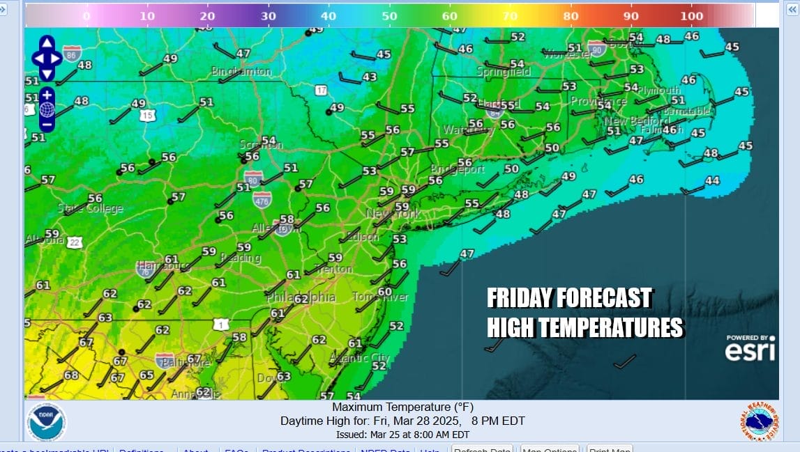
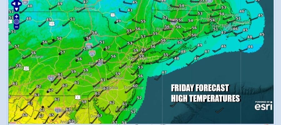
We have arrived at the doorstep of the weekend and the atmosphere is setting up today for a big warm up Saturday and lots of volatility Sunday. It will culminate Monday with thunderstorms later in the day and severe weather risk. First off though we have today where a weather front is going to develop to our north. This will leave us in a zone of sunshine today with some passing clouds. High temperatures today will range from the mid 50s to lower 60s. Local sea breezes will keep coastal locations cooler. Late this evening we will see clouds and maybe a few scattered showers as the warmer air takes control and locks up the front across Upstate NY and into South Central New England. Most lows tonight will be in the mid 40s to lower 50s.
SATELLITE WITH LIGHTNING STRIKES

WEATHER RADAR

Saturday will be a very warm spring day. The front to the north means we will have a west to west southwest wind. Couple that with sunshine and we will see temperatures shoot up quickly. By afternoon you will be in short sleeves and shorts as highs reach into the 80s in many places. Even cooler areas near the coast will see temperatures reach the 70s before any sea breezes take hold.

This time of year it is very hard to string very warm days back to back. The stalled front to the north will drop southward late Saturday and then make its way into Southern New Jersey and Southern Pennsylvania. There it will likely stall out. Winds will shift to the east. Notice that Saturday highs in Southeastern New England will be in the 40s Saturday with clouds and some rain. The cooler air from the ocean will mean that Sunday will see a wide range in temperatures. Sunday highs from NYC and the Hudson Valley with be in the 50s and even some 40s in Eastern Long Island and Southeastern New England with clouds around. To the south in Southern New Jersey and Southern Pennsylvania highs will be in the 70s where there will be more in the way of sun and less of an unfavorable wind direction. Much depends on where the front winds up.

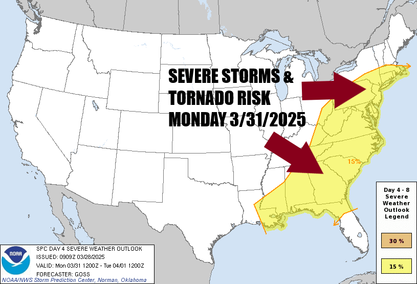
Sunday night the front starts to move back northward. Low pressure in the Central Plains Saturday will spread thunderstorms and severe weather across a large area from the Midwest, Ohio & Tennessee Valleys & the Deep South. Monday the cold front pushes eastward and opens the door for showers and thunderstorms developing later Monday into Monday evening.

The Storm Prediction Center has been indicating severe weather risks for the East Coast in their long range forecast and Monday is day 4 in the long range. In the last few days SPC has been pushing the risk area further north. Much depends on that back door front making its way north into New England. The further north it gets, the higher the severe weather risk.
Winds will turn southwest again Monday so highs will reach the upper 60s across Southern New England to low and middle 70s everywhere else. Temperatures will be a little cooler along the coast. Watch for showers and thunderstorms developing from west to east in the afternoon and evening. Once the front passes colder air returns for Tuesday and Wednesday and we will be back in the 50s both those days next week with some returning sunshine.
BE SURE TO DOWNLOAD THE FREE METEOROLOGIST JOE CIOFFI WEATHER APP &
ANGRY BEN’S FREE WEATHER APP “THE ANGRY WEATHERMAN!
MANY THANKS TO TROPICAL TIDBITS FOR THE USE OF MAPS
Please note that with regards to any severe weather, tropical storms, or hurricanes, should a storm be threatening, please consult your local National Weather Service office or your local government officials about what action you should be taking to protect life and property.


