Autumn Weekend & Next Week
Autumn Weekend & Next Week
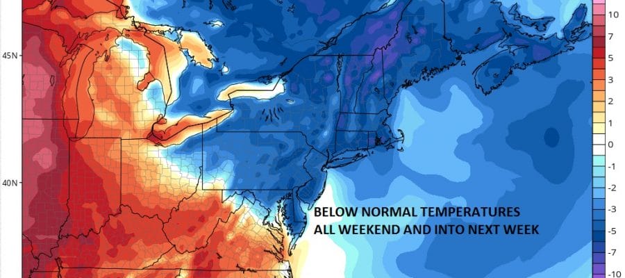
Blocking Pattern Next Week Will Keep Things Cool
Yes Autumn arrives tomorrow. Temperatures however will say otherwise through Friday as we will have some sunshine both days with highs in the 80s. However the get stream is flexing its muscle and a strong storm developing in Northeastern Canada will bring down a chilly flow of air for the weekend and into next week. No rain is forecast other than a passing brief shower Friday evening when the front goes by.

Two things are going on when we look at the satellite loop. First the remnants of Tropical Storm Julia continue to produce some high clouds here but we are beginning to finally see this remnant low move southward so skies should clear out overnight. The second is Tropical Depression Karl in the lower corner of the screen is getting better organized again as the upper low to the west finally weakens and gets out of the way. Karl should become a tropical storm again overnight or on Thursday but it will not have any impact on our area or the US East Coast.


Radars are quiet and should remain so for the most part into next week.
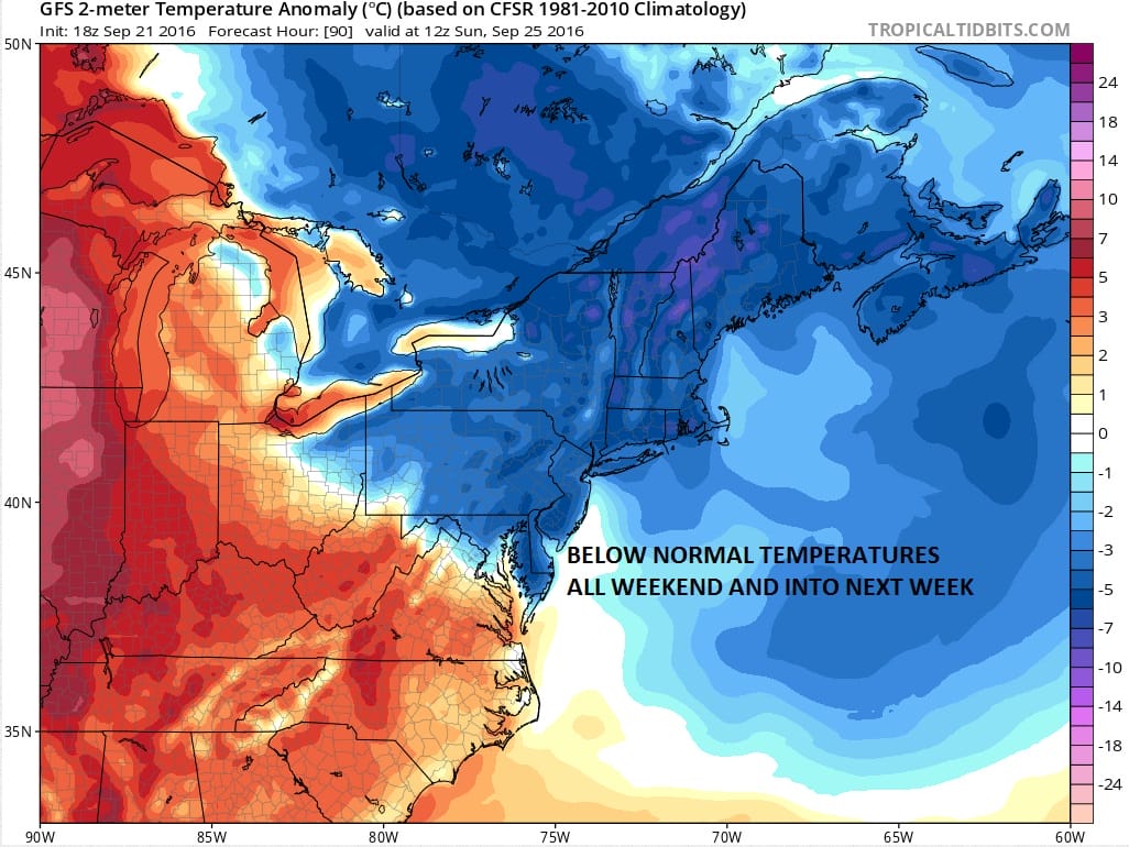
As for temperatures this weekend Saturdays highs will be in the upper 60s to low 70s and we will probably not get out of the 60s in most areas Sunday Monday, and probably Tuesday. Longer term will depend on a blocking pattern which models differ on the outcome later in the week. JOESTRADAMUS has more on this in his latest long range post.
WINTER WEATHER OUTLOOK VIDEOS
In case you missed them I’ve been previewing the upcoming winter in a series of posts and videos. Here are the first 2. More will be coming along. Links to the latest posts are below.
NEW JERSEY
LONG ISLAND AND NEARBY
WINTER 2016-2017 PART 3 NEW JERSEY
WINTER 2016-2017 PART 1 OCEAN WATER TEMPERATURES
WINTER 2016-2017 PART 2 ARCTIC SEA ICE AND SIBERIAN SNOW COVER
FiOS1 News Weather Forecast For Long Island
FiOS1 News Weather Forecast For New Jersey
FiOS1 News Weather Forecast For Hudson Valley
NATIONAL WEATHER SERVICE SNOW FORECASTS
LATEST JOESTRADAMUS ON THE LONG RANGE

Weather App

Don’t be without Meteorologist Joe Cioffi’s weather app. It is really a meteorologist app because you get my forecasts and my analysis and not some automated computer generated forecast based on the GFS model. This is why your app forecast changes every 6 hours. It is model driven with no human input at all. It gives you an icon, a temperature and no insight whatsoever.
It is a complete weather app to suit your forecast needs. All the weather information you need is right on your phone. Android or I-phone, use it to keep track of all the latest weather information and forecasts. This weather app is also free of advertising so you don’t have to worry about security issues with your device. An accurate forecast and no worries that your device is being compromised.
Use it in conjunction with my website and my facebook and twitter and you have complete weather coverage of all the latest weather and the long range outlook. The website has been redone and upgraded. Its easy to use and everything is archived so you can see how well Joe does or doesn’t do when it comes to forecasts and outlooks.
Just click on the google play button or the apple store button on the sidebar for my app which is on My Weather Concierge. Download the app for free. Subscribe to my forecasts on an ad free environment for just 99 cents a month.
Get my forecasts in the palm of your hand for less than the cost of a cup of Joe!

MENTION JOE CIOFFI AND GET A 5% DISCOUNT


