
Atlantic Ocean Weather Forecast: Gale Warnings In Effect
LONG ISLAND COASTAL WATERS…GALE WARNING IN EFFECT THROUGH LATE TONIGHT…
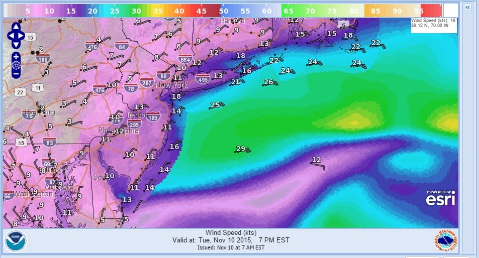
Synopsis: LOW PRES DEVELOPS OFF THE DELMARVA TODAY…AND TRACKS E OF THE WATERS TONIGHT. THE LOW PASSES E OF CAPE COD ON WED. A FRONTAL SYSTEM THEN IMPACTS THE WATERS LATE IN THE WEEK…FOLLOWED BY ANOTHER AREA OF HIGH PRESSURE FOR THE WEEKEND.
Today
E winds around 15 kt with gusts up to 25 kt…increasing to 20 to 25 kt with gusts up to 35 kt late this morning and afternoon. Seas 3 to 5 ft…building to 5 to 8 ft this afternoon. Light rain likely early this morning…then rain late this morning and afternoon.
Tonight
NE winds 20 to 25 kt with gusts up to 35 kt. Seas 7 to 10 ft. Rain.
Wed
N winds 20 to 25 kt…diminishing to 15 to 20 kt in the afternoon. Seas 6 to 8 ft…subsiding to 4 to 7 ft in the afternoon. A chance of light rain.
Wed Night
N winds 5 to 10 kt with gusts up to 20 kt…becoming NE after midnight. Seas 4 to 6 ft.
Thu
SE winds 10 to 15 kt with gusts up to 20 kt…becoming S 15 to 20 kt with gusts up to 30 kt in the afternoon. Seas 4 to 5 ft. Showers likely…mainly in the afternoon.
ATLANTIC OCEAN WEATHER FORECAST FOR NEW JERSEY COASTAL WATERS
…GALE WARNING IN EFFECT THROUGH THIS EVENING…
Synopsis: INTENSIFYING LOW PRESSURE OFF THE DELMARVA WILL MOVE TO THE SOUTHERN NEW JERSEY COAST THIS AFTERNOON THEN SLOWLY EAST TO NEAR CAPE COD EARLY WEDNESDAY. HIGH PRESSURE FOLLOWS LATER WEDNESDAY. THE NEXT LOW WILL LIFT NORTHEAST THROUGH THE GREAT LAKES REGION LATE THIS WEEK, BRINGING A PAIR OF COLD FRONTS TO OUR REGION, FIRST ON THURSDAY, THEN ANOTHER COLD FRONT ON SATURDAY.
Today
E winds 15 to 20 kt…becoming NE 20 to 25 kt this afternoon. Gusts up to 35 kt. Seas 4 to 6 ft… Building to 6 to 9 ft late this morning and afternoon. Mainly in SE swell with a dominant period of 8 seconds. rain. Vsby 1 to 3 nm early this morning.
Tonight
N winds 15 to 20 kt with gusts up to 35 kt this evening. Seas 6 to 10 ft. Mainly in SE swell with a dominant period of 9 seconds. Rain…mainly in the evening.
Wed
N winds 15 to 20 kt…diminishing to 10 to 15 kt late. Seas 5 to 8 ft…subsiding to 4 to 6 ft in the afternoon. Mainly in E swell with a dominant period of 8 seconds.
Wed Night
NE winds 5 to 10 kt…becoming E after midnight. Seas 3 to 5 ft. Mainly in E swell with a dominant period of 8 seconds.
Thu
SE winds 10 to 15 kt…becoming S 15 to 20 kt in the afternoon. Seas 3 to 4 ft…building to 4 to 6 ft in the afternoon. A chance of showers.