Arctic Front Arrives Snow Squalls Possible Today
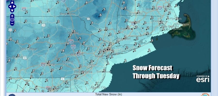
A Couple of Inches of Snow Possible Tuesday
Very Cold Snow Chance Friday Night Saturday

Arctic Front Arrives Snow Squalls Possible Today
A Couple of Inches of Snow Possible Tuesday
Very Cold Snow Chance Friday Night Saturday
Now that we are in a colder winter weather pattern, things that happen in colder patterns are about to happen! Firstly today we have an arctic front that will be coming through and that will trigger off some snow showers and even a possible snow squall which is like a line of heavy showers in the summer time only this will be snow. They last for 15 or 20 minutes from start to finish and sometimes it can snow very hard for brief time leaving a coating of snow or perhaps a bit more.

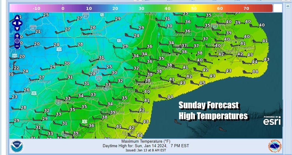
These squalls, if they happen because some of you won’t see them, will probably be in the early to mid afternoon. The arctic boundary will go by. Gusty winds will be occurring on either side of the arctic front today. Look for sunshine giving way to clouds. The front will pass through. High temperatures will be in the mid to upper 30s and then drop into the upper 20s by evening.
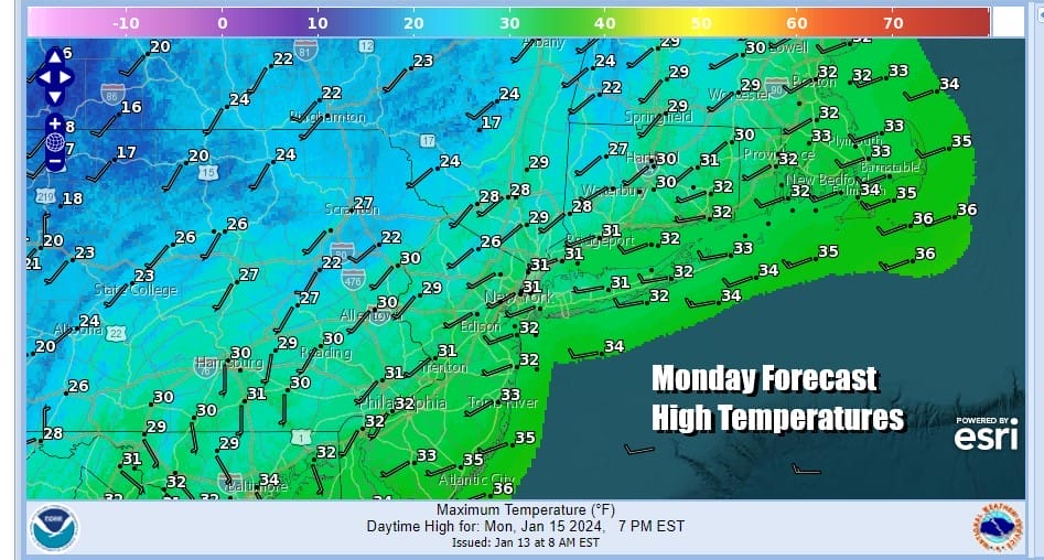
This leads to a cold night tonight and it will be for many the coldest night of the winter season so far. Monday morning lows will be in the teens to near 20 degrees. Monday we will see sunshine and arriving clouds. There might be a little bit of snow in parts of South Jersey and points southward as an extension from low coming out of Tennessee Valley starts to push east.
SATELLITE WITH LIGHTNING STRIKES

WEATHER RADAR

Monday night into Tuesday we will see snow moving up from the south as low pressure develops along the coast and then heads offshore. There isn’t a whole lot to this system as there is a southern stream short wave but not much in the northern stream to really energize this to something that would produce a significant snowfall of say several inches or more.

Snow will spread northward Monday night and probably last into Tuesday afternoon. There might be a little sleet or even some rain mixing in along the immediate coast at times during Tuesday before the low offshore pulls away to the east. As far as snow accumulations are concerened I think there could be anywhere from an inch to as much as 2 or 3 inches in some places but there will be variability from place to place,
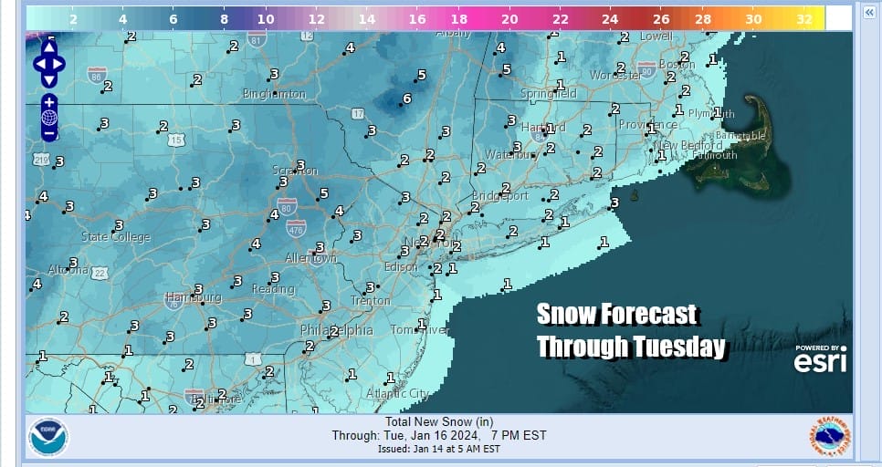
The low pulls away, precipitation ends and temperatures Tuesday will be in the upper 20s inland and low to middle 30s down near the coast. Colder air comes in behind the low and low temperatures Wednesday morning will be in the teens and low 20s. Sunshine but cold conditions are forecast for Wednesday and Thursday with highs both days in the upper 20s and lower 30s.

Another low will be moving across the Deep South Thursday and then turning northeast offshore Thursday night and Friday. This system will have more to it and northern energy will be getting involved. A deep upper trough will rotate from Eastern Canada and rotate southeastward. It appears that the chance for a more significant snow is on the table for Friday into Friday night as this low strengthens offshore. We will be talking more about this tonight on the Joe & Joe Weather Show Podcast at 7:35pm Eastern time on Youtube.
BE SURE TO DOWNLOAD THE FREE METEOROLOGIST JOE CIOFFI WEATHER APP &
ANGRY BEN’S FREE WEATHER APP “THE ANGRY WEATHERMAN!
MANY THANKS TO TROPICAL TIDBITS FOR THE USE OF MAPS
Please note that with regards to any severe weather, tropical storms, or hurricanes, should a storm be threatening, please consult your local National Weather Service office or your local government officials about what action you should be taking to protect life and property.
(Amazon is an affilate of Meteorologist Joe Cioffi & earns commissions on sales.)


