Another Winner of a Day Clouds Arrive Friday Showers Over The Weekend

Weather in 5/Joe & Joe Weather Show Latest Podcast
Another Winner of a Day Clouds Arrive Friday Showers Over The Weekend
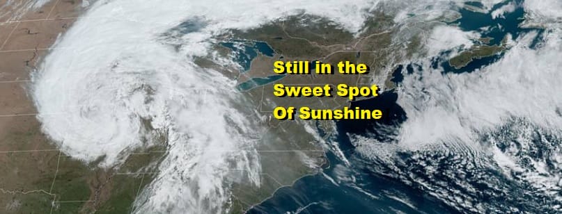
The best weather is often times exactly between two storms and that is exactly where we have been for the last 3 days and we remain in that sweet spot today. The storm to the east has been a very effective block and has kept storm systems to our west from making any eastward progress. The result is another day of clear skies from Western New England southward into the Middle Atlantic states. We have lots of sunshine. Temperatures are reaching the upper 60s to mid 70s just about everywhere. It is another almost picture perfect spring day with not much in the way of wind. Enjoy the afternoon.
SATELLITE

However the stretch ends today because the storm to the east is moving eastward and that is finally going to allow some of that western energy to move east. Clouds move in tonight with lows in the 40s to near 50. Friday look for variable clouds. There might be some breaks of sun. The moisture to the west will actually peak out west of the mountains and there may be nothing more than a stray scattered shower inland on Friday. With less sun and a bit of an onshore wind, highs will just be in the upper 50s along the coast and low to mid 60s inland.
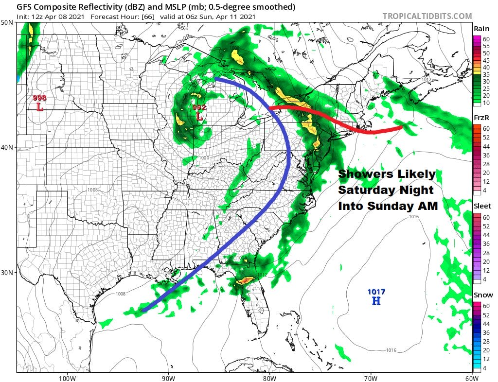
Saturday looks to be the better of the two weekend days. I don’t expect much to happen Saturday other than clouds with some sun at times. Highs will be in the 60s to perhaps near 70 well inland. Another low heads to the Great Lakes Saturday night with a trailing cold front. This system has more support and there will likely be showers moving through Saturday night into Sunday morning. Once the showers end we will likely stay in clouds Sunday with temperatures in the low to mid 60s for highs. A few more showers a possible Sunday night as an upper trough moves through. Next week is a bit tricky as we will have a blocky pattern in a different alignment. This means we could have the chance for showers every day next week but it will be one of those deals where it doesn’t rain all the time and some areas might see showers on one day only to miss them the next. Temperatures also will be kept in check due to clouds and shower chances so highs will be in the seasonal 60s for the most part. The exception may be Monday with a cool flow around an upper low and the chance for showers early in the day. Highs Monday will be in the 50s. No major storms are on the horizon and we don’t see any severe weather threats in the Northeast anytime soon.
BE SURE TO DOWNLOAD THE FREE METEOROLOGIST JOE CIOFFI WEATHER APP &
ANGRY BEN’S FREE WEATHER APP “THE ANGRY WEATHERMAN!
MANY THANKS TO TROPICAL TIDBITS FOR THE USE OF MAPS
Please note that with regards to any severe weather, tropical storms, or hurricanes, should a storm be threatening, please consult your local National Weather Service office or your local government officials about what action you should be taking to protect life and property.


