Another Round of Rain Sunday Slow Improvement Monday

Weather in 5/Joe & Joe Weather Show Latest Podcast
Another Round of Rain Sunday Slow Improvement Monday
Saturday was downright miserable. Cloudy skies, raw conditions, and light rain made for a gloom and doom day but did it have to be so cold? Many areas couldn’t even break 50 degrees. Today we are in the 50s making for another raw gloomy dreary day and yes we have another round of rain to get through. Day 2 of the holiday weekend is a loss. Low pressure developing just offshore the Delaware coast is moving northward this afternoon and evening. The wind could pick up a bit again along the coast for a short time.
SATELLITE

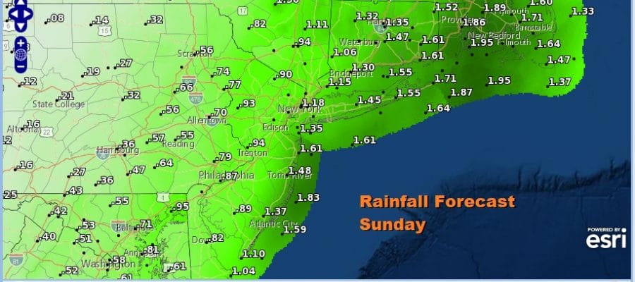
The good news is that the low is moving along to the northeast and that means the rain ends Sunday night. Rainfall amounts from this second low could be in excess of an inch again especially for areas from New Jersey to Southern New England with lesser amounts further inland.

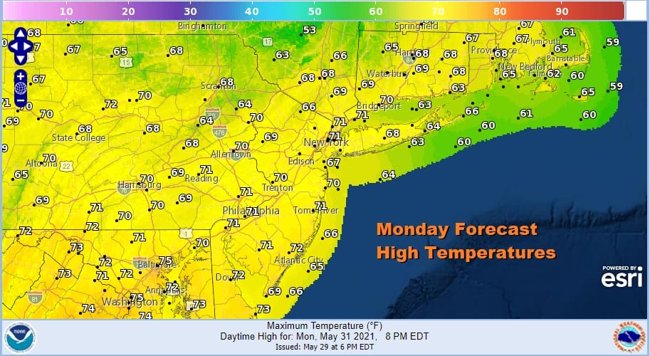
This leaves us with Monday as the one day that will see no rain and gradual improvement should get underway with decreasing clouds and increasing sunshine. Just getting the sun out will warm things up nicely though it will still be cooler than average. Monday highs will be in the 60s to near 70.
Tuesday looks like a nice day with sunshine and highs in the 70s. High pressure moves off the Mid Atlantic coast and we have a warm front cold front combination approaching for Wednesday. First the warm front probably brings in some clouds and maybe some scattered showers or a thunderstorm.
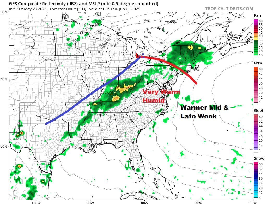
Highs will be in the 70s to near 80 in some spots. Thursday will be warm and humid with highs in the upper 70s and lower 80s. Late in the day Thursday we could see some thunderstorms as a cold front passes.
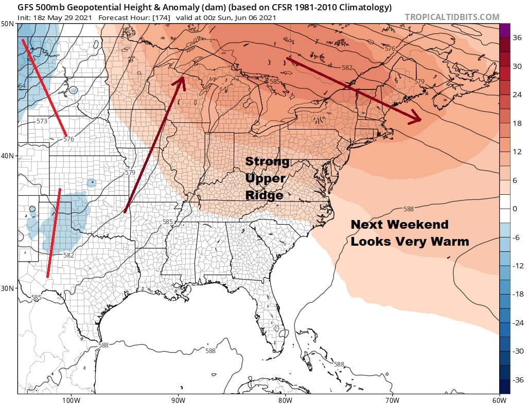
Late next week a strong ridge starts to build in the east from the Atlantic and that means that the weather next weekend will be the exact opposite of this weekend. At the very least temperatures will head for the 80s starting Friday and continue through the weekend. It also appears that next weekend will be dry with no rain. That ridge could hold for quite awhile producing a long spell of very warm to hot weather for the week of June 7th, provided no back door cold fronts surprise us at the last minute.

BE SURE TO DOWNLOAD THE FREE METEOROLOGIST JOE CIOFFI WEATHER APP &
ANGRY BEN’S FREE WEATHER APP “THE ANGRY WEATHERMAN!
MANY THANKS TO TROPICAL TIDBITS FOR THE USE OF MAPS
Please note that with regards to any severe weather, tropical storms, or hurricanes, should a storm be threatening, please consult your local National Weather Service office or your local government officials about what action you should be taking to protect life and property.


