
Another Day of December Springtime
Just a couple of things, JOESTRADAMUS is on YOU TUBE with daily weather long range videos so do subscribe (free of course) Here is last night’s video on the Christmas Eve blast furnace!
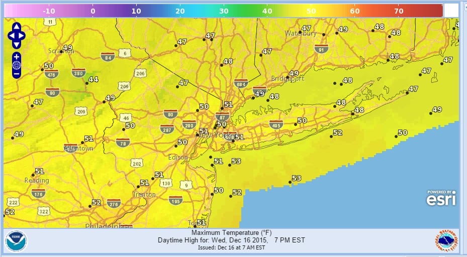
The day starts out with sunshine and we are headed up only into the 50s today (ONLY!!!) which is about 5 to 10 degrees cooler than yesterday and there will be no record highs set today. The satellite loop this morning shows a storm departing off the New England coast and another one heading for the western Great Lakes. It is that system that sets the stage for rain on Thursday and the arrival of colder air for Friday and the weekend. Saturday may wind up being a few degrees below normal and this will be the first day this month that we will have seen that. Every single day this month has been above normal and more than half of those days in double digits. Depending on your location anywhere from 4 to 6 of those days saw record highs set.
The southern part of that front is going to fire up a wave. Winds will become onshore later today and we could see some low clouds statt to move in from east to west. Clouds will definitely increase and thicken up tonight with some spotty drizzle. Temperatures overnight will be in the 40s to near 50.


Thursday a front comes through and stalls. Low pressure develops on it and brings a solid shot of rain up the coast. The further north and west you are the less rain you will see but the hope is that it is a pretty decent shot of moisture. It looks like the wave will be a little slower and that could prolong the rain through much of Thursday night.

Friday the cold air arrives and we should see temperatures in a downtrend..mainly 40s and then it should drop in the 20s to low 30s Saturday morning. Saturday will be the one really cold day with temperatures not out of the 30s with some sunshine and clouds. That is as cold as it gets because after Sunday morning which should be in the 20s to low 30s, temperatures will begin their bounce. And we are on course to possibly an historic Christmas eve where we could see temperatures possibly in the 70s!!!!! Check it all out on my overnight JOESTRADAMUS post.