
Another Day Heat Humidity Thunderstorms Humidity Relief Arrives This Weekend

Weather in 5/Joe & Joe Weather Show Latest Podcast
Another Day Heat Humidity Thunderstorms Humidity Relief Arrives This Weekend
Another steamy day of the brutal combination of heat and humidity. Temperatures this afternoon will reach the mid to upper 90s inland and upper 80s and lower 90s near the coast. Add the humidity factor into the mix and it will feel like it is between 105 and 110.

We have been seeing thunderstorms develop in the late afternoon and evening. Today’s driver will be a cold front that lies to our northwest that is pushing eastward. All the combinations are there for severe weather with a very unstable and juiced up atmosphere.
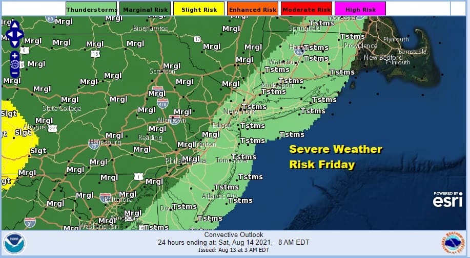
The Storm Prediction Center has a marginal risk for severe weather over most of us today. The main threat from these thunderstorms will be strong gusty winds. The satellite shows skies clear from New England down to the Mid Atlantic states. The clouds in Western NY and Western Pennsylvania are ahead of that cold front that is destined to bring some humidity and even temperature relief over the weekend.
SATELLITE

Radars are quiet for the time being and we don’t expect much to develop until after 3 or 4pm. Most of the thunderstorm activity is inland which is where the severe weather risk exists. The main threat time for most of the area will be from 6 to 10pm with storms weakening after 8pm. Leftover clouds will be here later tonight with most lows in the upper 60s to mid 70s.
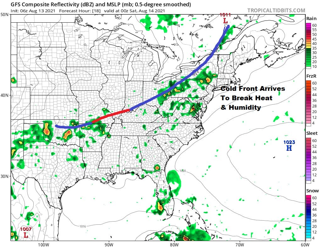
Saturday will still be very warm to hot with highs in the middle 80s to around 90 degrees which is about 7 to 10 degrees lower than today. The day will start out humid because we will have to wait for a second front to pass late in the day. Behind that front dew points will fall.
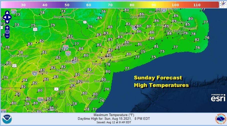
Thunderstorm risks Saturday lie across Southern New Jersey and and southernmost Pennsylvania southward. There should be little if any thunderstorm activity elsewhere. The humidity will plummet Saturday night leaving us with dry and sunny Sunday with low humidity and cooler highs just in the lower 80s.
Low humidity should hang on for Monday before the next high goes offshore and we start to see humidity levels climb on Tuesday. Tropical Storm Fred by then will be inland in the southeast US. Some of the moisture from Fred will stream northward Tuesday introducing the chance for a few downpours later Tuesday into Wednesday. It will not be anything continuous by any means as most of Fred’s rains will play out in the Southeast US and not come up the coast as an identifiable system.
BE SURE TO DOWNLOAD THE FREE METEOROLOGIST JOE CIOFFI WEATHER APP &
ANGRY BEN’S FREE WEATHER APP “THE ANGRY WEATHERMAN!

MANY THANKS TO TROPICAL TIDBITS & F5 WEATHER FOR THE USE OF MAPS
Please note that with regards to any severe weather, tropical storms, or hurricanes, should a storm be threatening, please consult your local National Weather Service office or your local government officials about what action you should be taking to protect life and property.


