Another Beautiful Afternoon of Weather Showers Thunderstorm Early Friday Colder Over The Weekend

Weather in 5/Joe & Joe Weather Show Latest Podcast
Another Beautiful Afternoon of Weather Showers Thunderstorm Early Friday Colder Over The Weekend
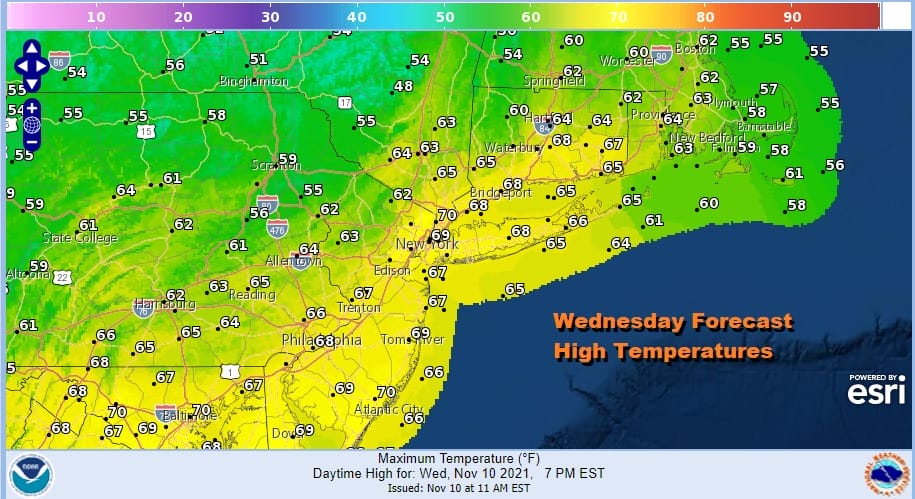
We have another beautiful day of sunshine as a follow up to yesterday. A weak cold front has pushed through as advertised and that has turn the winds to the north but we started out with a decent launching pad this morning. That should take highs to the upper 60s to lower 70s in most places though it will be a little cooler well north and west of the coast. There are hardly any clouds on the satellite picture and the radars are nice and quiet so enjoy the afternoon. We will cool off tonight under clear skies with most lows in the low 40s in the warmer urban areas and in the 30s elsewhere.
SATELLITE

WEATHER RADAR

Things will start to change on Thursday as high pressure moves off the New England coast and our winds will turn more south southeast. The wind off the ocean means that temperatures Thursday probably come to a halt in the upper 50s and lower 60s for highs. We will also have sunshine giving way to arriving clouds as athe next cold front approaches. No rain is forecast through the daytime Thursday into Thursday evening.
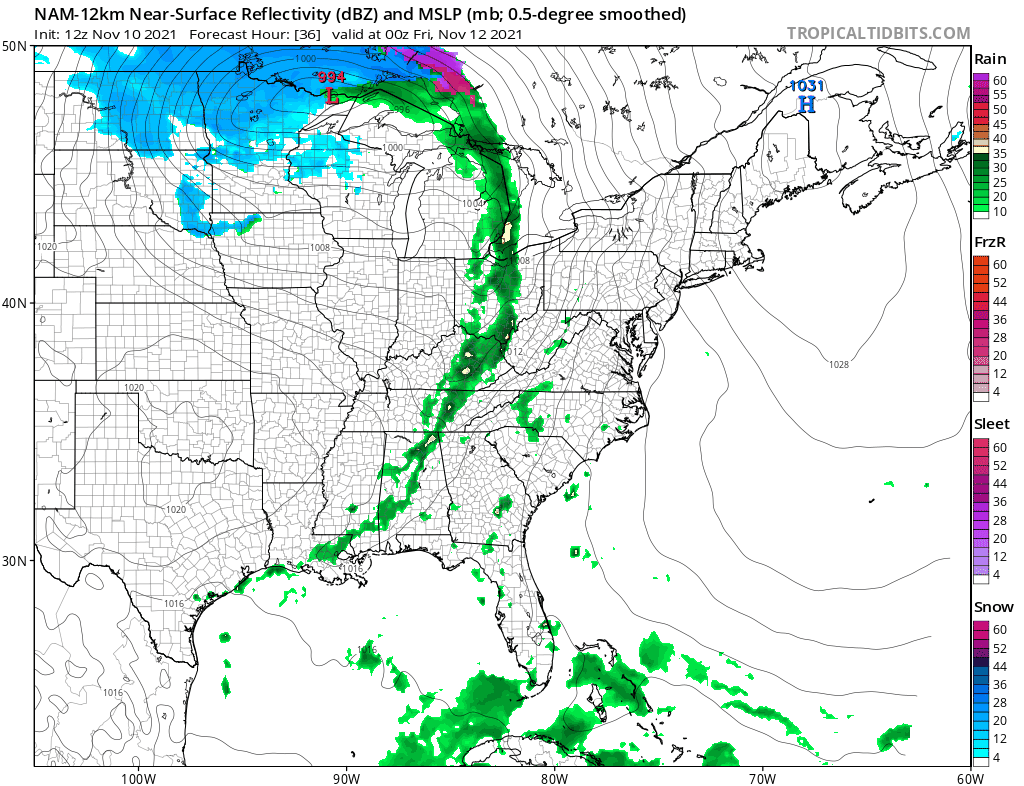
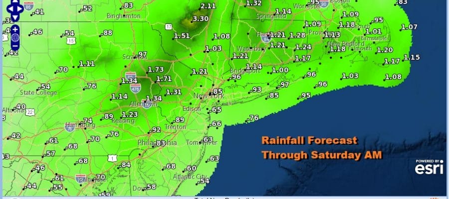
Friday the cold front marches eastward and will see some showers with it and perhaps a thunderstorm. The NAM model is about 6 hours slower than the faster GFS and given that we still have the old coastal storm out to the east, that is keeping the ridge a little stronger and therefore it slows the front down. Friday’s highs will be in the 60s. Most of the showers and thunderstorms should end from west to east during the afternoon Friday so we are slower than the gfs but not as slow as the nam model.
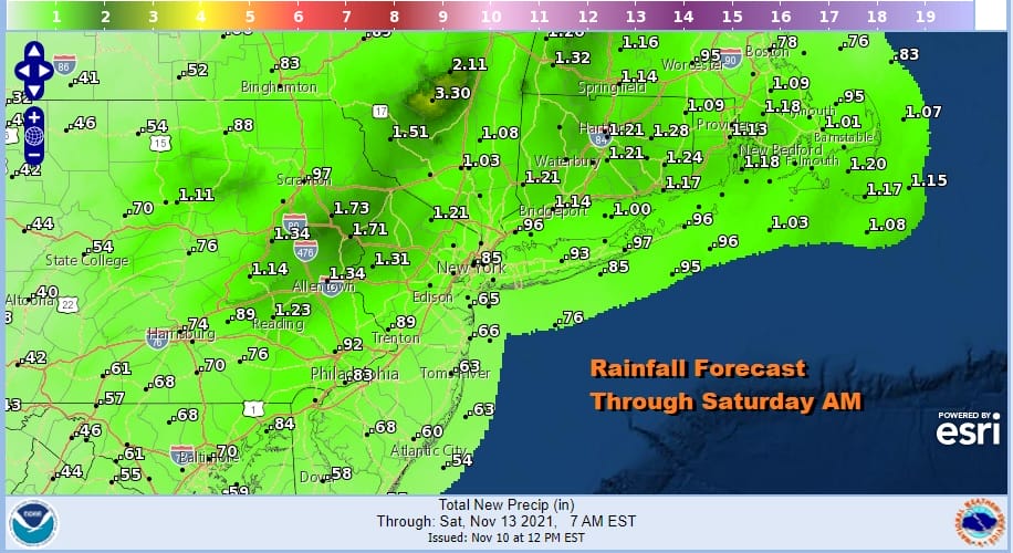
Rainfall from this cold front will be likely in a range three quarters of an inch to and inch with some higher amounts possible with any thunderstorms that are in the mix mainly to the north and northwest across Eastern Pennsylvania and the Catskills.
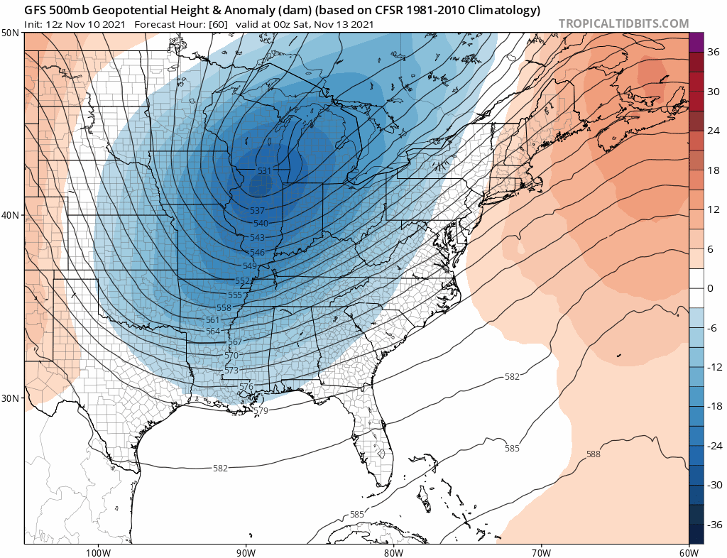
This cold front is running well ahead of the deep upper trough that will be working its way into the east. There are several short waves that will be moving through. The first will be on Saturday so we might see some sun and the start of the day but expect clouds to develop and there could be some showers in the afternoon and evening. Highs will be in the mid to upper 50s.

Each one of these upper troughs will bring colder air behind it so we will see that on Sunday which looks quite chilly though there should be some sun. Highs will be just in the 40s to perhaps near 50 in the warm spots. Monday sees another short wave swinging through with low pressure in the Ohio Valley moving east.
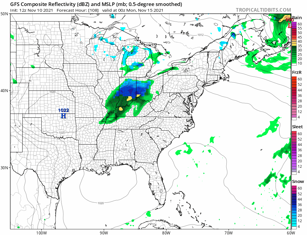
I’m not 100 percent sure how this plays so we will call for clouds and a period of rain Monday. Inland areas well north and northwest of the coast could see some wet snow in the mix as the low reforms offshore. Temperatures at best will be just in the 40s. Finally Tuesday the low moves away leaving us with breezy and cold conditions with some sunshine. Highs again will just be in the 40s. Another warm up follows next Wednesday and Thursday and another cold front follows at the end of the week.
BE SURE TO DOWNLOAD THE FREE METEOROLOGIST JOE CIOFFI WEATHER APP &
ANGRY BEN’S FREE WEATHER APP “THE ANGRY WEATHERMAN!

MANY THANKS TO TROPICAL TIDBITS & F5 WEATHER FOR THE USE OF MAPS
Please note that with regards to any severe weather, tropical storms, or hurricanes, should a storm be threatening, please consult your local National Weather Service office or your local government officials about what action you should be taking to protect life and property.


