All Is Calm All Is Bright Through Christmas Day
What an absolutely terrific we day we had across our neck of the woods with sunshine and highs that reached up in the 50s just about everywhere. Our calm quiet weather pattern continues right through Christmas Day and even through part of Thursday which is Boxing Day. We are going to cool off however as another high builds southward from Southeastern Canada. This is keeping the storm off the Southeast Coast away from us. Several to many inches of rain fell across the Southeast from this storm and that includes heavy rains that occurred over much of Florida.
SATELLITE

REGIONAL RADAR

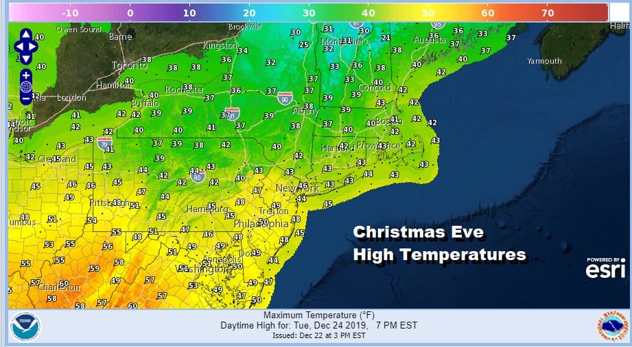
Other than some wisps of high clouds skies will be clear tonight with most lows in the 20s to lower 30s. Dry air covers the most of the Eastern Seaboard for Tuesday Christmas Eve so look for sunshine though temperatures will be lower than today thanks to a chilly northeast breeze. Most highs will be in the 40s.
Tuesday night brings another night of mainly clear skies with most lows in the upper 20s to middle 30s. Christmas Day is more of the same. Look for no worse than partly sunny skies with highs in the low to mid 40s.

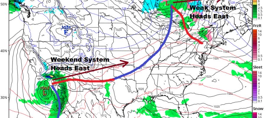
Our weather continues uneventful into Thursday though look for arriving clouds thanks to the night moving out to the northeast and an onshore flow. A weak weather system will move from the Great Lakes to Southeastern Canada and that might trigger off a shower inland or maybe some drizzle Thursday night into Friday morning. The chances are low however.
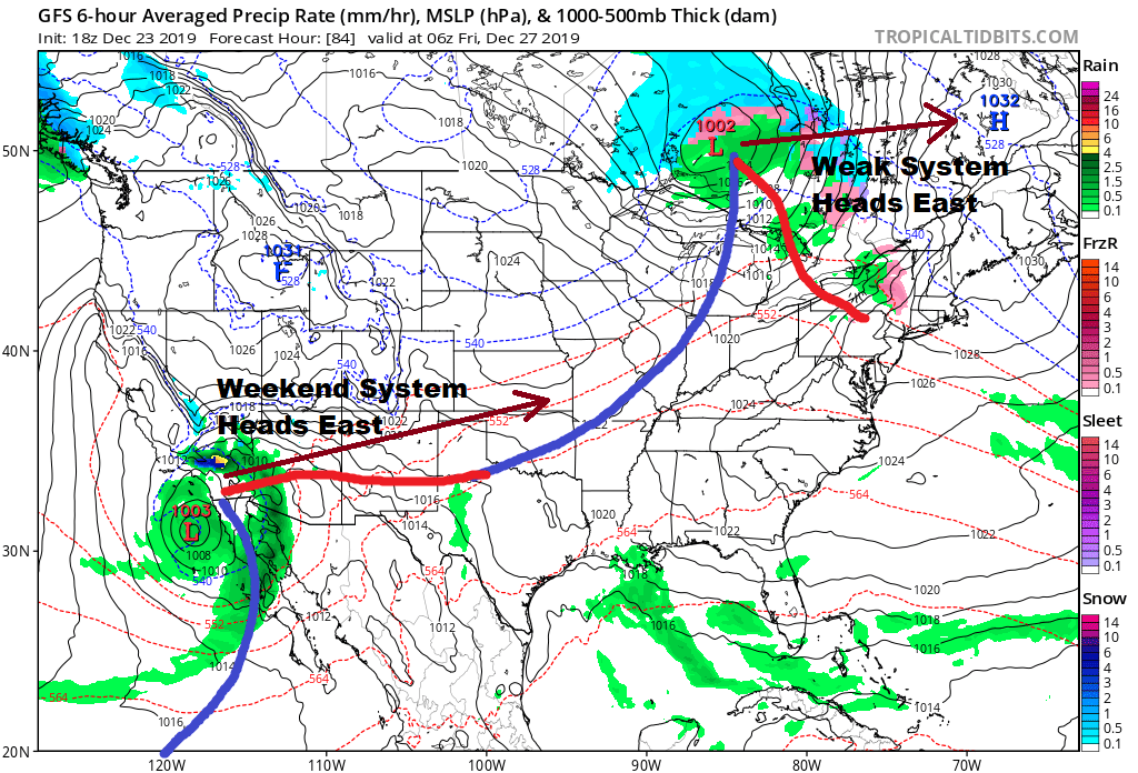
Friday brings that weak cold front trailing from the low through and dry chilly air comes in behind it but it will still be a little above normal temperature wise Friday into Saturday. We should stay mainly dry though there still could be a leftover shower Friday morning. Otherwise clouds will give way to some sun with most highs in the 40s.

The weather system off the coast of Southern California is the next important player in the overall weather pattern as it sends a storm to the Great Lakes on Sunday. The relative quiet and calm weather across the US ends with this storm as we will see snow from the Central Rockies and Plains and then eventually to the Western Great Lakes. For us we know that means a warmer southwest flow with showers likely for Sunday. That storm starts the process of changing the overall pattern again. We have been operating in a regime of 2 to 3 weeks of active stormy weather and a week to 10 days of relative calm. This should open the door to somewhat colder air masses coming into the US as we head into the New Year however for the time being, arctic air will be locked up around Alaska which is where the polar vortex will be . That vortex however will get dislodged and open the door I believe to other possibilities as we head into the month of January. Stay tuned!
BE SURE TO DOWNLOAD THE FREE METEOROLOGIST JOE CIOFFI WEATHER APP &
ANGRY BEN’S FREE WEATHER APP “THE ANGRY WEATHERMAN!
MANY THANKS TO TROPICAL TIDBITS FOR THE USE OF MAPS
Please note that with regards to any severe weather, tropical storms, or hurricanes, should a storm be threatening, please consult your local National Weather Service office or your local government officials about what action you should be taking to protect life and property.


