
A Sunday of Sunshine As The Next Warmup Begins Tuesday
The Search For Rain Continues

A Sunday of Sunshine As The Next Warmup Begins Tuesday
The Search For Rain Continues

After a chilly morning across Eastern Pennsylvania to Southern New England we should warm up a touch this afternoon with plenty of sunshine. There are no weather issues to speak of other than some passing clouds. Temperatures this afternoon should edge up to 60 to 65 for the highs. A dome of high pressure over New England will begin its move to the east and that will start another warm up over the next several days. Radars remain on their long term vacation.
SATELLITE WITH LIGHTNING STRIKES

WEATHER RADAR

Skies should be clear for most of the night though some clouds might develop toward daybreak Temperatures overnight. Most inland lows from Northern New Jersey and Long Island will be in the 30s while areas further north will be in the upper 20s and lower 30s in the Hudson Valley and Southern New England; mostly low and mid 40s South Jersey and points southward.
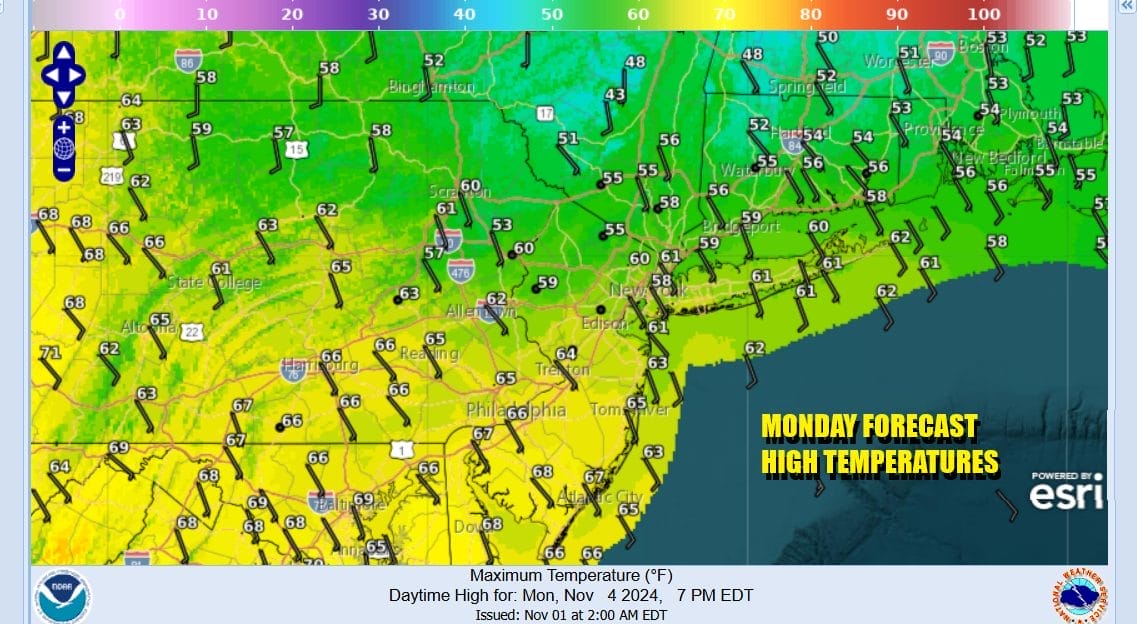
Monday brings with it partly sunny conditions. We will have an onshore flow from the south southeast so between the wind direction and the cloud cover, temperatures will probably be held back a bit. A warm front is setting up to the north so there are no rain or shower issues to worry about. Highs will be mostly in the 60s.
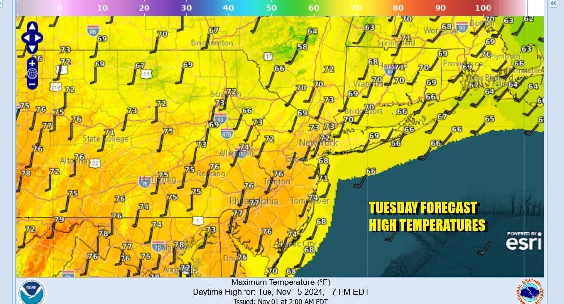
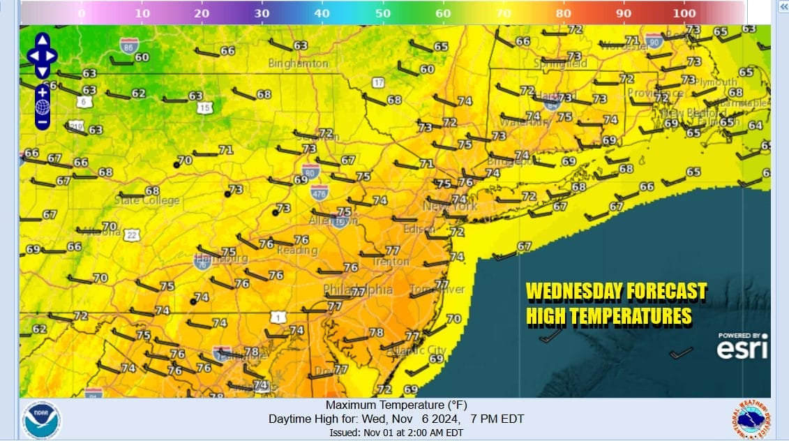
Winds will turn more southwest Tuesday and that will allow temperatures to rise. We will have sunshine and that should take highs up to the low and middle 70s just about everywhere except slightly cooler at the coast. Another cold front will approach and move through during Wednesday and there won’t be much with it other than few clouds. More of a west wind will take highs to the mid and upper 70s Wednesday afternoon and we could see a few record highs challenged.
There is another shot of cooler air to finish off the week so look for Thursday and Friday to be dry sunny days with highs in the upper 60s to lower 70s Thursday and mid to upper 60s Friday. We continue to see indications of some rain chances over next weekend. We also may have a tropical storm coming out of the Caribbean and heading into the Gulf of Mexico late this week and we will have to wait and see whether some of that moisture gets involved with a weather system next weekend.
BE SURE TO DOWNLOAD THE FREE METEOROLOGIST JOE CIOFFI WEATHER APP &
ANGRY BEN’S FREE WEATHER APP “THE ANGRY WEATHERMAN!
MANY THANKS TO TROPICAL TIDBITS FOR THE USE OF MAPS
Please note that with regards to any severe weather, tropical storms, or hurricanes, should a storm be threatening, please consult your local National Weather Service office or your local government officials about what action you should be taking to protect life and property.


