
A Nice Weather Day Before Another Trip Into the Land of Clouds & Rain
Weekend Appears Promising

A Nice Weather Day Before Another Trip Into the Land of Clouds & Rain
Weekend Appears Promising
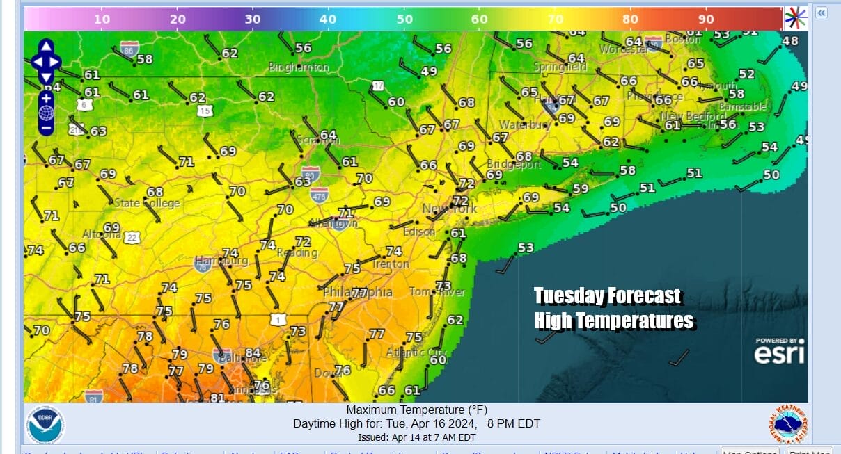
Two nice weather days consecutively has been a bit of a rare occurrence in the Northeast & Northern Mid Atlantic states so far this spring but apparently we are pulling off this rare feat today. Skies on satellite loops are free of clouds across much of the Eastern US and we will have a day of sunshine. Temperatures will reach the upper 60s to middle 70s in most places with slightly cooler highs along south and east facing shorelines thanks to local sea breezes. Radars are nice and quiet and we have no rain issues to worry about today.
SATELLITE WITH LIGHTNING STRIKES

WEATHER RADAR

We will likely remain rain free tonight and much of the daytime Wednesday. We should stay mainly clear overnight and start Wednesday off with some sunshine. However a warm front will be laying to our south as low pressure heads to the Great Lakes. A trailing cold front will be pushing east and it is likely that we will see rain or showers arriving late Wednesday afternoon and evening.

Winds during the day Wednesday will be more onshore and that plus the increasing cloud cover likely knocks off a few degrees off the highs. Temperatures will likely top off in the 60s. The frontal boundary to the south struggles to move northward and we probably see the weakening Great Lakes low reform off the Delaware coast Wednesday night into Thursday. This likely puts into a quick trip down to the land of gloom and doom Wednesday night and through the day Thursday.
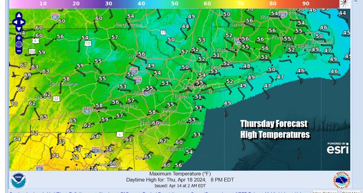
Temperatures Thursday will be in the raw upper 40s to lower 50s. Rainfall amounts Wednesday night and Thursday do not look to be exceptionally high. We are talking a half to three quarters of an inch at most which is manageable. The system will move along and that is key to getting improving weather conditions to settle in Friday and then lead us to a nice weekend.

Even though we see a wave developing on a stalled weather front Friday in the Gulf States that wave looks to pass weel to the southeast as large high pressure builds southward from Eastern Canada. As long as this remains the case we will have a nice weekend but a rather cool weekend with at least some sunshine both days. Highs Saturday will be in the upper 50s and lower 60s and Sunday highs probably will be mostly in the 50s.
BE SURE TO DOWNLOAD THE FREE METEOROLOGIST JOE CIOFFI WEATHER APP &
ANGRY BEN’S FREE WEATHER APP “THE ANGRY WEATHERMAN!
MANY THANKS TO TROPICAL TIDBITS FOR THE USE OF MAPS
Please note that with regards to any severe weather, tropical storms, or hurricanes, should a storm be threatening, please consult your local National Weather Service office or your local government officials about what action you should be taking to protect life and property.
(Amazon is an affilate of Meteorologist Joe Cioffi & earns commissions on sales.)


