A Good Looking Weather Day Ends Another Follows Wednesday
After last night’s cold front went by it got us back into a cooler dry air mass with seasonal temperatures. It was a very nice day with just some patchy clouds around and a fair amount of sunshine. An upper trough is swinging through the Northeast this evening which is why we have clouds in upstate NY and in the interior of New England. That trough will be moving offshore tonight and setting us up for a beautiful day on Wednesday.
SATELLITE
REGIONAL RADAR
Regional radar is showing a few showers moving southeastward across Central and Northern New England. The local radars are showing some blips aloft moving southeastward. Other than clouds there are no worries this evening. In fact the radars may be silent into the first part of Saturday!
LOCAL RADAR NEW YORK CITY
LOCAL RADAR PHILADELPHIA

Skies will be clear tonight and temperatures will be cool. Away from warmer urban areas which will settle close to 60, lows will be in the 50s with 40s in the coolest spots north and west of the coast. Wednesday we should see wall to wall sunshine with low humidity and highs in the mid to upper 70s.
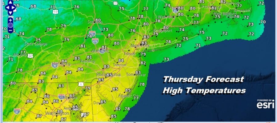
A cold front will be moving through Thursday evening but with so little moisture around and the Atlantic Ocean moisture source completely cut off as well as the Gulf of Mexico cut off as well, the front comes through with nothing more than some passing clouds and a wind shift from the southwest to the northwest. Highs will reach the low to mid 80s Thursday afternoon. The humidity will be higher Thursday but not unreasonable.
Friday we are back to dry air and sunshine to finish off the week. Highs will be mostly in the 70s. The see saw continues with the next cold front approaching on Saturday. This one might have a couple of showers with it when it passes through. Skies should be partly sunny with highs back into the 80s before the front passes.
Sunday brings a big high building in Eastern Canada and a northeast wind. The front pushes south into Virginia/North Carolina which should be far enough south to allow for sunshine. Temperatures Sunday will be on the cool side with most highs in the low 70s with 60s in cooler spots to the north and northeast. The long range next week will be all about a big ridge of high pressure aloft building into the east which should set us up for warmer weather next week. Monday look for sunshine with highs in the 70s. followed by 80s Tuesday into Thursday. By Thursday a more important cold front will be approaching and this should begin to change the weather pattern in the East with shots of cooler air coming with some regularity. We say this cautiously knowing the volatility of the long range.
MANY THANKS TO TROPICAL TIDBITS FOR THE USE OF MAPS
Please note that with regards to any tropical storms or hurricanes, should a storm be threatening, please consult your local National Weather Service office or your local government officials about what action you should be taking to protect life and property.


