A Gloom & Doom Day Of Clouds Rain & Raw Conditions,
Slow Improvement Next Several Days

A Gloom & Doom Day Of Clouds Rain & Raw Conditions,
Slow Improvement Next Several Days
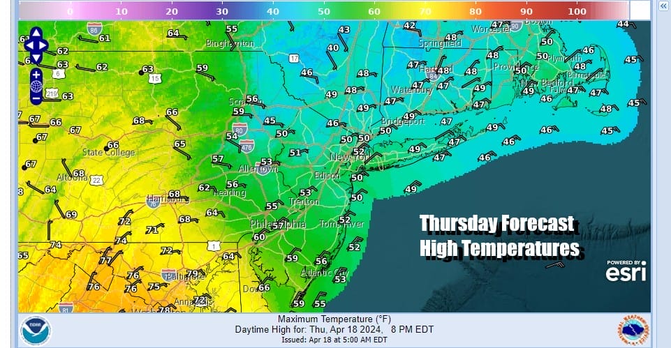
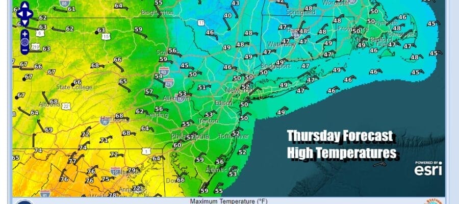
Spring is known for getting into these gloom & doom type weather patterns with clouds, rain, raw & damp conditions that can last for many days. This stretch will be shorter than most and unlike recent history, it doesn’t come with a major storm. A slow moving front today and a weak low developing east of Delaware is keeping areas from New Jersey to Southeastern New England in an onshore flow. This means it will be a cloudy day with showery rain at times. Northeast winds off the ocean will mean temperatures that will likely be in the upper 40s to mid 50s for highs from north to south.
SATELLITE WITH LIGHTNING STRIKES

WEATHER RADAR

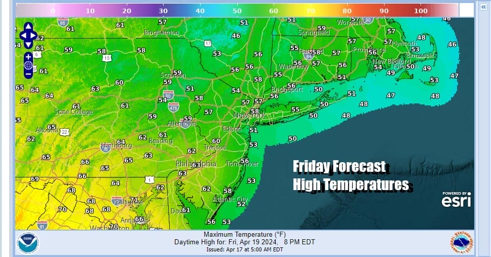
Rain won’t get out of hand nor do we see much upside here since we are talking about a relatively weak set up with little chance for upside. Much of the rain should be done by evening and we will have leftover clouds overnight with lows mostly in the 40s. Friday will be a day of changeable skies as a one system leaves to the east and another low runs northeast to Southeastern Canada.

We will probably see a few showers late Friday into Friday night but they should be mostly scattered in nature. As far as temperatures are concerned for Friday, we should be a little higher than Thursday as the onshore flow relaxes. High temperatures will reach the mid 50s to lower 60s.
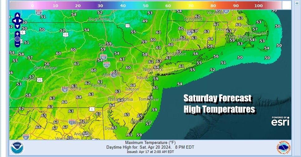
The front will move along to the east though it will do so slowly. We also have an upper trough that will be moving through Saturday so we are setting up for a weekend where Sunday is likely to be the better day. Saturday looks to be a day of changeable sky conditions (clouds to some sun) and the risk for some scattered showers. Highs will be in the mid 50s to lower 60s.
Things should settle down for Sunday but it will be on the chilly side as a colder flow of air sets up from Eastern Canada and will lead to a stretch of below average temperatures into next week. Sunshine should be more plentiful Sunday but it will be breezy and most highs will just be in the 50s. Next week looks to start dry with a chance for midweek showers but no major storms and no severe weather is forecast.
BE SURE TO DOWNLOAD THE FREE METEOROLOGIST JOE CIOFFI WEATHER APP &
ANGRY BEN’S FREE WEATHER APP “THE ANGRY WEATHERMAN!
MANY THANKS TO TROPICAL TIDBITS FOR THE USE OF MAPS
Please note that with regards to any severe weather, tropical storms, or hurricanes, should a storm be threatening, please consult your local National Weather Service office or your local government officials about what action you should be taking to protect life and property.
(Amazon is an affilate of Meteorologist Joe Cioffi & earns commissions on sales.)


