A Few Scattered Showers Around Sunday Sunshine Onshore Flow Arrives Next Week
Clouds rolled in on schedule as a weak cold front approaches the coast. The skies did look threatening at times but the amount of showers were few and far between as the regional and local radars indicate. The vast majority didn’t see a drop. Temperatures are holding in the 70s. As the front approaches tonight there will likely be a line of showers and a few thunderstorms that will move through from west to east but that will be in the early morning hours while you are asleep. They should be long gone by daybreak.
SATELLITE

REGIONAL RADAR

Radar is showing a few scattered showers with one cluster moving from the Catskills to the Hudson Valley north of Route 84. South of there we see a few light blips. Other showers are scattered in Eastern Pennsylvania south of Route 78 and moving east. Other than these no serious issues this evening and then we wait for what comes through after midnight and before dawn.
LOCAL RADAR NEW YORK CITY

LOCAL RADAR PHILADELPHIA


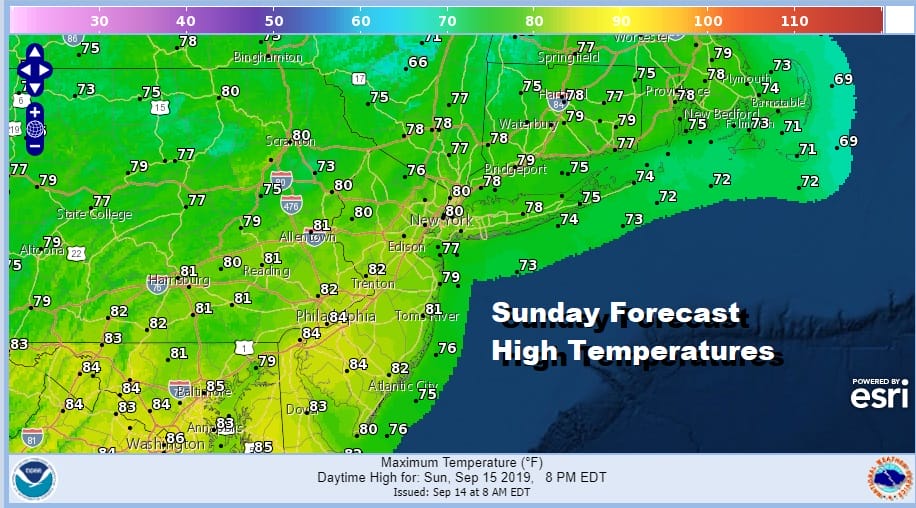
Sunday morning we should go partly to mostly sunny rather quickly. Temperatures will reach the upper 70s to lower 80s. The air behind it is actually warmer than the air ahead of it since it is air from the Plains and Ohio Valley. The humidity will be higher than it has been but it won’t be unreasonable. South Jersey southward the dew points will be in the upper 60s so there it will be a bit unreasonable.

The next cold front arrives Monday and the set up is very similar to what we went through last week. The front will pass Monday afternoon with a shower or thunderstorm . Temperatures Monday will reach 80 to 85 before the winds shift to the northeast. Then it is back to a cool by dry onshore flow for much of next week.
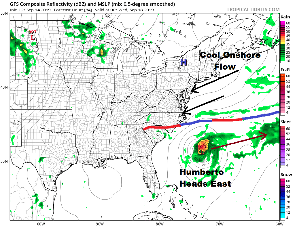
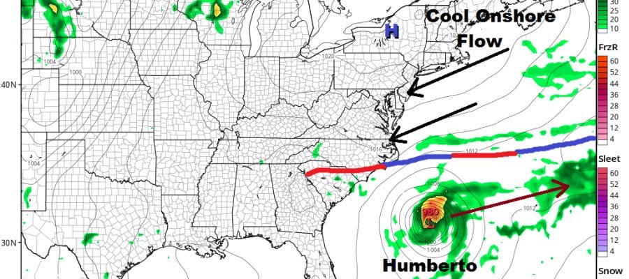
While we will be enjoying sunshine for Tuesday and Wednesday Tropical Storm Humberto will likely be a hurricane by Tuesday however the upper air flow along the east coast is NOT conducive for a storm to move northward but rather a storm to move eastward toward Bermuda.
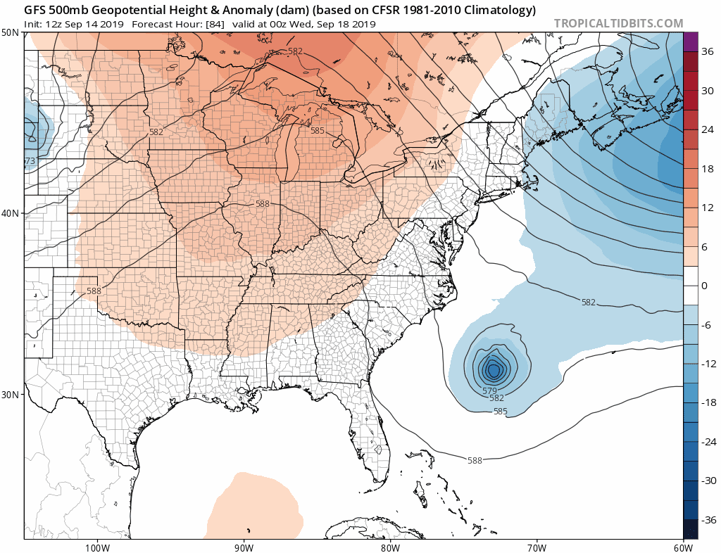
Watch the upper air trough on the upper right send down a short wave trough that literally scoops up Humberto and kicks it away to the northeast. Over the last few days models have actually gotten stronger with this feature. You can’t get a storm to move up the east coast if the upper air winds that drive steering are from the north! In the end it is not our concern and it is more nice dry September weather that is likely to last all of next week.
MANY THANKS TO TROPICAL TIDBITS FOR THE USE OF MAPS
Please note that with regards to any tropical storms or hurricanes, should a storm be threatening, please consult your local National Weather Service office or your local government officials about what action you should be taking to protect life and property.


