
Weekend Begins Transition Warmer More Humid Weather Into Monday
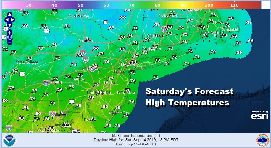
We are looking at clouds this morning just inland of the coast. This is the transition over into a warmer and more humid air mass but the humidity is not going to be anything oppressive. In the transition there could be a spot shower or two this afternoon and this evening, but for most of us and the vast majority of the area you probably won’t see a thing. Temperatures today will be in the 70s as winds shift around to the south and eventually the southwest. It won’t be picture perfect today but doable.
SATELLITE

REGIONAL RADAR

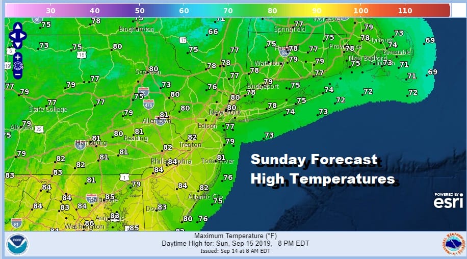
Tonight with an upper trough moving through we might see a shower or thunderstorm pass through during the early morning hours. Any showers will be gone by daybreak and we will see partly to mostly sunny skies on Sunday. It will be a warm day and maybe even a late summer beach day with highs reaching the upper 70s to low 80s with higher humidity but not unreasonable.
Monday brings the next cold front with another high behind it that will build into the Northeast for much of this week. Ahead of it look for clouds and some sun with highs into the 80s with the chance for a few midday or afternoon showers. Then it turns cooler for Monday night.

That high in Southeastern Canada will take a couple of days to slide off the New England coast leading to two nice weather days for Tuesday and Wednesday before the high starts to move offshore. This is very nice dry stretch of weather we are enjoying and it is doubly good because it is a pattern that is NOT favorable for tropical systems to move up the east coast. Tropical Storm Humberto is near Grand Abaco Island in the Bahamas this morning. Most of the rain and wind is east of the center.
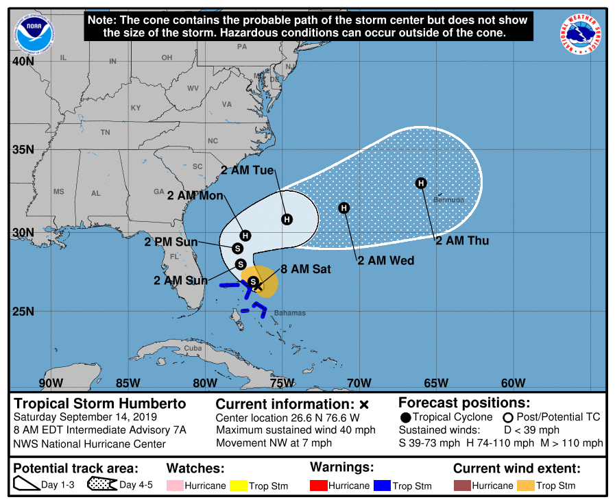
The forecast track from the National Hurricane Center lines up with what is going in the upper atmosphere. Upper air winds across the Northeast into the Middle Atlantic states will be mainly from the northwest. A system south of New Foundland that brings our next cold front will pull Humberto to the east. It may eventually be a threat to Bermuda around the middle of next week. However for the US there is no way a storm can move up the East Coast with west or northwest winds in the upper atmosphere. Our late summer/early autumn weather will just roll on with mainly dry conditions into the middle of next week.
MANY THANKS TO TROPICAL TIDBITS FOR THE USE OF MAPS
Please note that with regards to any tropical storms or hurricanes, should a storm be threatening, please consult your local National Weather Service office or your local government officials about what action you should be taking to protect life and property.


