A Cloudy Rainy Afternoon & Evening, Severe Weather Threat Reduced Further
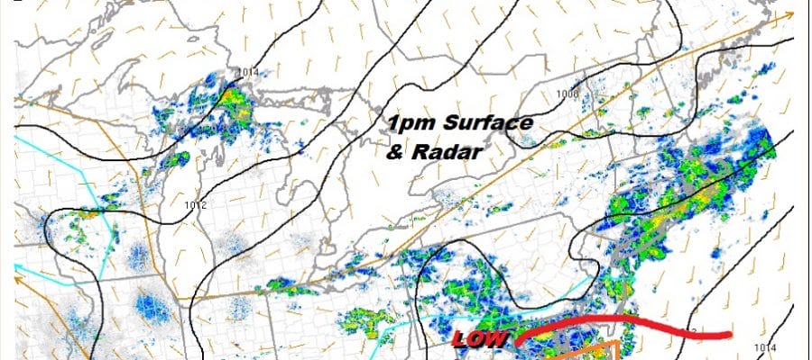
Looking at the surface map this afternoon we can say that the possibility of severe weather is minimal and the best chance for a strong thunderstorm would be in Southern New Jersey south into Maryland & Delaware. Unlike the last several severe weather outbreaks we are obviously not getting any daytime heating at all today. Temperatures are in the 70s. Winds are mostly south to south east. The warm sector never set up anywhere close and you will likely have to go down into Southern Virginia to find any severe weather issues today.
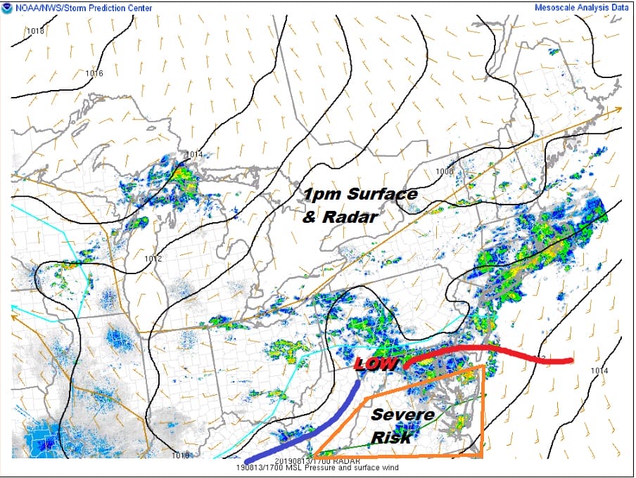
The warm sector set up well south of us thanks to the weak wave tracking along the Pennsylvania West Virginia border as opposed to tracking across Northern Pennsylvania or upstate NY. The warm sector is weak and is set up from Delaware south. Downpours meanwhile are occurring north and northeast of the warm front and the low. It leaves us in a muggy humid mess of on and off downpours and maybe the odd thunderstorm but we do not expect anything that is unmanageable.
SATELLITE

REGIONAL RADAR

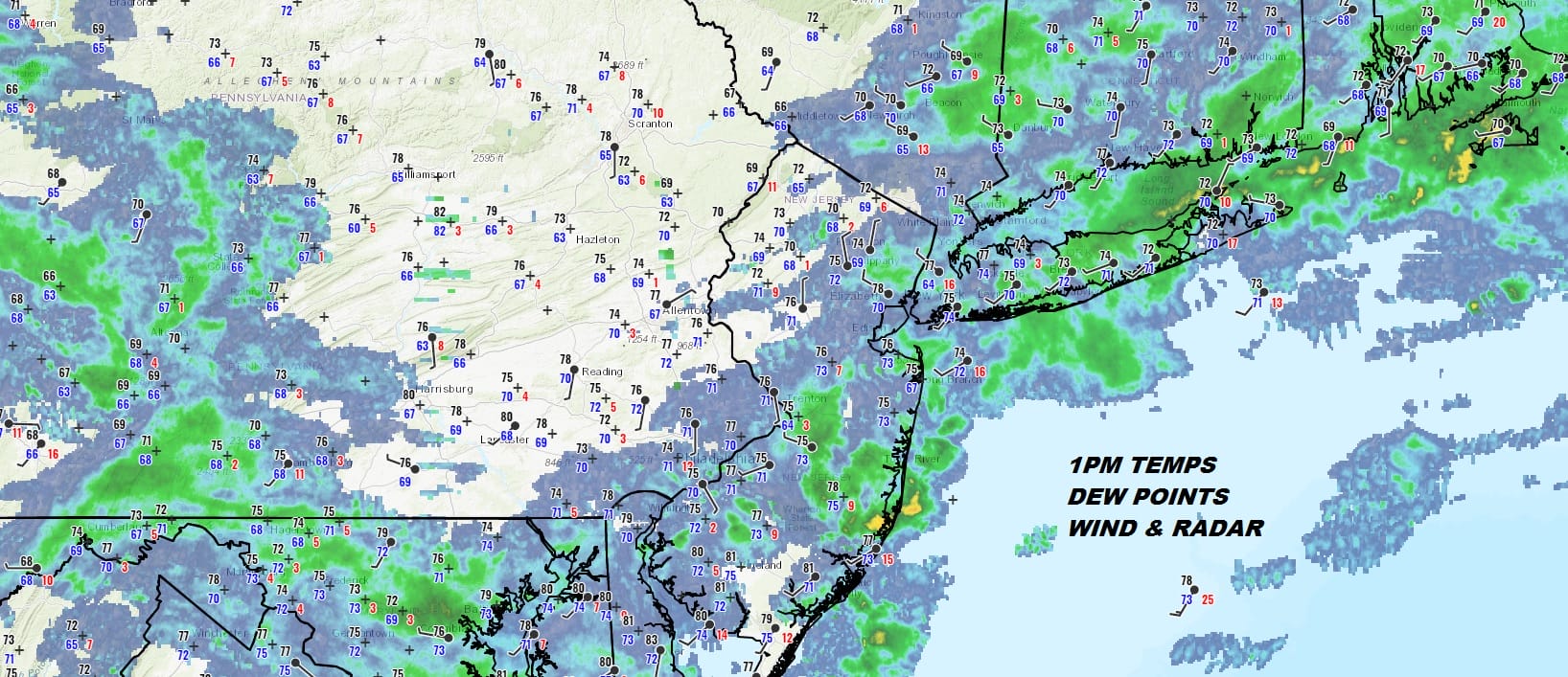
The regional radar as well as the local radars show mostly rain with some patches of heavier downpours in the mix. Everything is moving from west to east. Even in areas to the south in the Middle Atlantic states we aren’t seeing much in convective development at the moment. The Storm prediction center has further reduced the severe weather risk today confining it to Southern Virginia and North Carolina.
LOCAL RADAR NEW YORK CITY

LOCAL RADAR PHILADELPHIA 

We will likely see some downpours though this evening though it will be mostly uneven and some areas will get away with very little in the way of rain. Then it all moves out to the east overnight with leftover clouds and lows in the 60s to near 70.

The next three days (Wednesday through Friday) we see a mix of clouds with some breaks of sunshine. The frontal boundary stalls far enough to the south to spare us any downpours other than the odd pop up shower that could appear. Temperatures by day will be in the upper 70s and lower 80s with nights in the 60s. The humidity will come down somewhat from the Hudson Valley to about NYC Wednesday into Thursday but everywhere else it will remain stubbornly high.
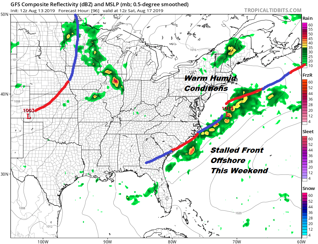
There doesn’t appear to be any big issue for the weekend. The stalled frontal boundary offshore remains. Not much appears to be moving in the atmosphere. This leaves us with very warm and humid conditions for Saturday and Sunday with sun and clouds, very warm and humid conditions with the chance for the odd pop up shower or thunderstorm. Highs will be in the mid to upper 80s with lows mostly in the 60s to lower 70s. This looks like typical dog days of August setting up. The next cold front doesn’t look to arrive until late Monday with the chance for late day showers or thunderstorms. At the moment this doesn’t appear to be a severe weather set up for us.
MANY THANKS TO TROPICAL TIDBITS FOR THE USE OF MAPS
Please note that with regards to any tropical storms or hurricanes, should a storm be threatening, please consult your local National Weather Service office or your local government officials about what action you should be taking to protect life and property.


