
A Chilly But Sunny Sunday Week Ahead Brings Cold Front Showers Wednesday

A Chilly But Sunny Sunday Week Ahead Brings Cold Front Showers Wednesday
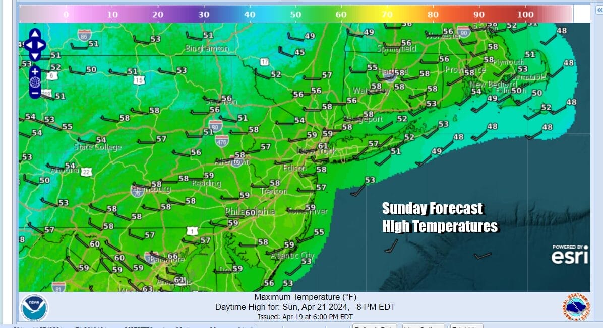
We are sitting in a good spot today. Low pressure is moving across the Gulf States and heading offshore. Rain is falling today from Southern Virginia south to the Gulf States. However that rain will slide to the east and other than some high clouds, we should be no worse than partly sunny today across Eastern Pennsylvania to Southern New England. High temperatures with be in the chilly 50s to around 60 degrees. Radars locally are quiet and we expect local radars to stay quiet through at least Tuesday.
SATELLITE WITH LIGHTNING STRIKES

WEATHER RADAR

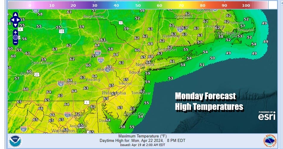
Tonight should be nice and clear with morning lows in the mid 30s to lower 40s. Some cold spots could see some frost well inland. Monday looks to be a nice day with plenty of sunshine. Temperatures should move a little higher with afternoon highs reaching the low and middle 60s in most places.
We will make it 3 in a row for Tuesday with sunshine again and highs again mostly in the 60s. Three days in a row of sunshine is a rare occurrence these days. Wednesday we will see some changes as low pressure moves southeast out of Canada and across the Great Lakes and New England, bringing with it a trailing cold front that will move through later in the day Wednesday.

We are likely to see a few showers Wednesday and even the outside chance for a thunderstorm as the front passes. It doesn’t rain all day and it is likely that the first part of Wednesday will be dry. Once the front passes we are going to see a quick shot of chilly air arrive. Ahead of the front high temperatures Wednesday will be in the 60s.
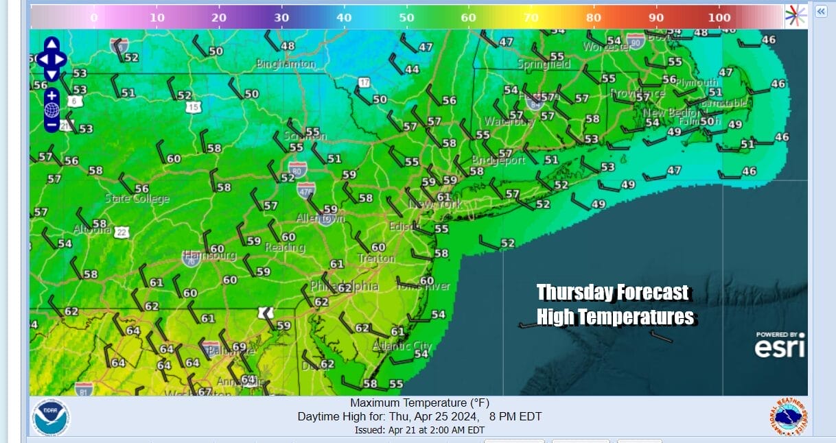
Thursday will be a chilly day with a gusty northwest wind along with a mix of sun and clouds. Thursday highs will be mostly in the 50s but in a wide range from low 50s north and northeast of NYC into Southern New England, and upper 50s to near 60 across Southern New Jersey and points south. Friday will be nice and sunny with highs back into the 60s. Another cold front will approach next weekend when we do see some shower risks later Saturday into Sunday.
BE SURE TO DOWNLOAD THE FREE METEOROLOGIST JOE CIOFFI WEATHER APP &
ANGRY BEN’S FREE WEATHER APP “THE ANGRY WEATHERMAN!
MANY THANKS TO TROPICAL TIDBITS FOR THE USE OF MAPS
Please note that with regards to any severe weather, tropical storms, or hurricanes, should a storm be threatening, please consult your local National Weather Service office or your local government officials about what action you should be taking to protect life and property.
(Amazon is an affilate of Meteorologist Joe Cioffi & earns commissions on sales.)


