
Dry Into Early Wednesday Before Cold Front & Showers Arrive,
Then Dry Thursday & Friday

Dry Into Early Wednesday Before Cold Front & Showers Arrive,
Then Dry Thursday & Friday
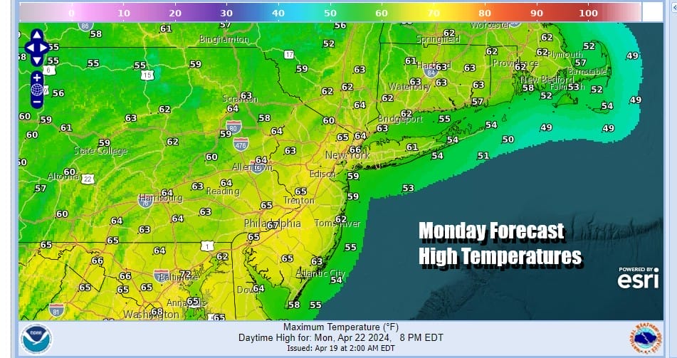
The work week begins with some nice weather. Sunday we wound up getting overwhelmed by high clouds from low pressure moving off the Southeast US Coast. This system is now long gone to the east and we are left with nice, mostly cloudy free weather with sunshine. We started the day with frosty conditions especially away from warmer urban areas but we are on the road to recovery. Temperatures today will respond to the sun and head back into the 60s just about everywhere. Radars are nice and quiet with no issues with rain through Tuesday night.
SATELLITE WITH LIGHTNING STRIKES

WEATHER RADAR

Skies will be clear tonight with most lows in the 30s. This morning inland fo were low enough to produce frost issues for much of Eastern Pennsylvania to Southern New England (away from warmer urban areas). We probably see a repeat performance tonight. Tuesday will be a nice sunny day with highs mostly in the mid to upper 60s.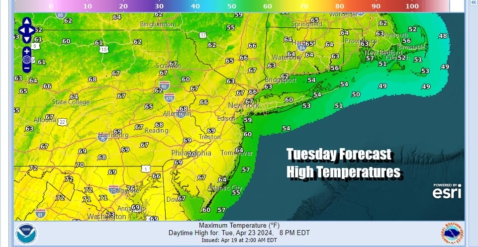
A cold front approaches Tuesday night and Wednesday and we will see clouds ahead of it along with some showers possible though it won’t be an all day affair. This front marks the leading edge of a quick shot of chilly air dropping southeast from Eastern Canada. Wednesday highs will be in the 60s.

Most of the weather action this week will shift to the Western half of the US beginning Thursday when we see the risk for severe weather breaking out in the Plains and then spreading into the Mississippi & Missouri River Valleys Friday. In the Eastern US however high pressure will be in control for Thursday and Friday keeping things on the dry side.

Thursday will be a chilly day with sunshine and clouds and highs in the 50s. Friday we will see sunshine and warmer temperatures back into the 60s. This weekend we will see a warm front approach Saturday with some shower risk. It does lead us to a warmer overall pattern over the weekend and into next week though whether it will be dry or not is another matter. For now we will lean optimistic after the warm front goes by. At least widespread rain is not in the cards for the next 7 days or longer.
BE SURE TO DOWNLOAD THE FREE METEOROLOGIST JOE CIOFFI WEATHER APP &
ANGRY BEN’S FREE WEATHER APP “THE ANGRY WEATHERMAN!
MANY THANKS TO TROPICAL TIDBITS FOR THE USE OF MAPS
Please note that with regards to any severe weather, tropical storms, or hurricanes, should a storm be threatening, please consult your local National Weather Service office or your local government officials about what action you should be taking to protect life and property.
(Amazon is an affilate of Meteorologist Joe Cioffi & earns commissions on sales.)


