90 Degree Highs Give Way to Cooler Temperatures Next 3 Days
Hot spots today in New Jersey and parts of NYC got to 90 degrees today possibly for the last time. We saw a good deal of sunshine for most of the day and we maximized the daytime heating at a time of year of shrinking daylight and longer nights. We have seen a few clusters of thunderstorms blow up over Pennsylvania this evening but they appear to be weakening as they head eastward. A cold front is dropping slowly southward from upstate NY and will set the stage for a significant cool down over the next few days. Lows tonight will be warm though in the 60s with warmer urban centers bottoming out near or above 70.
SATELLITE

REGIONAL RADAR

Regional radar shows some strong thunderstorms that have developed across Virginia with clusters of storms across Pennsylvania. Some of those clusters are showing up on the local radars below. Most of the activity will disappear after sunset but some other storms could develop during the early morning hours in a few places from Eastern Pennsylvania to Southern New England.
LOCAL RADAR NEW YORK CITY

LOCAL RADAR PHILADELPHIA


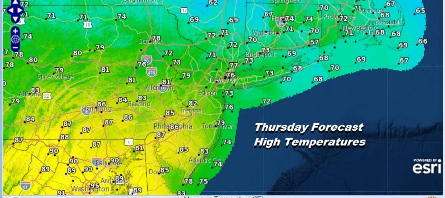
Thursday is going to be a tricky day with a cold front dropping southward. Areas north and east of NYC will get into the cooler air early on in the day so they will see their highs reached early on and then temperatures will actually fall off during the afternoon hours. In areas to the south in Southern New Jersey won’t see the front until later in the afternoon so highs there will reach the middle 80s before cooling off.
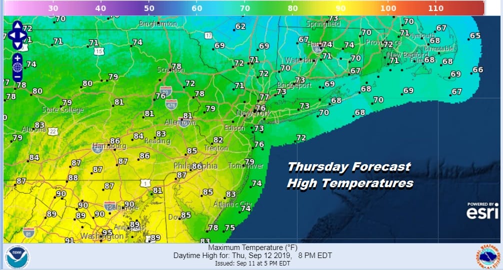
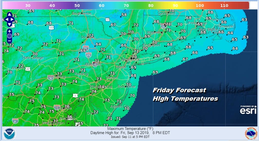
There is the risk for another shower or thunderstorm Thursday early on in areas north of NYC and later in the day to the south, all of this timing with the cold front. Once the front passes a fresh northeast to east wind will take over as high pressure builds south from New England. This will bring partly to in some cases mostly sunny skies for Friday but it will be cool. Most highs will be in the upper 60s to lower 70s.
The onshore flow begins to relax on Saturday as winds go to the south. This is essentially a replay of what we went through earlier in the week. Saturday we will see lots of clouds and the risk for a shower with highs in the 70s. Sunday and Monday will be very warm and humid with some sunshine. HIghs will be in the 80s. Then Monday brings another front and another round of onshore winds developing for Tuesday into Wednesday of next week. It’s a fairly straight forward pattern with no big storms and not much rain. In fact much of the time over the next 7 days the weather will be reflective of a calm September pattern.
MANY THANKS TO TROPICAL TIDBITS FOR THE USE OF MAPS
Please note that with regards to any tropical storms or hurricanes, should a storm be threatening, please consult your local National Weather Service office or your local government officials about what action you should be taking to protect life and property.


