4th Of July Weekend Travel Weather
4th Of July Weekend Travel Weather
No Serious Travel Issues Through Mid Afternoon

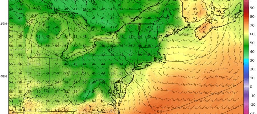
At least into early afternoon weather conditions across the area from Northeastern Pennsylvania through New Jersey, New York City, Long Island and Southern New England are okay. We are seeing an increase in cloud cover and around midday some localized downpours could develop but they should not be widespread at all. Radar loops below aren’t showing anything to worry about for now. The main threat time will be from 4pm to 10pm when the cold front arrives. Later this afternoon we will evaluate the situation regarding the threat for severe weather during that time frame. The risk is there but it doesn’t necessarily mean that severe weather will materialize. We continue to suggest avoid travel in that time frame so as not to have thunderstorms added to what will already be a very heavy traffic situation as folks head to there vacation spots.


4TH OF JULY WEEKEND WEATHER OUTLOOK
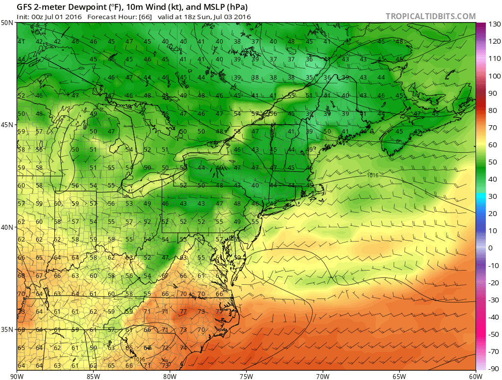
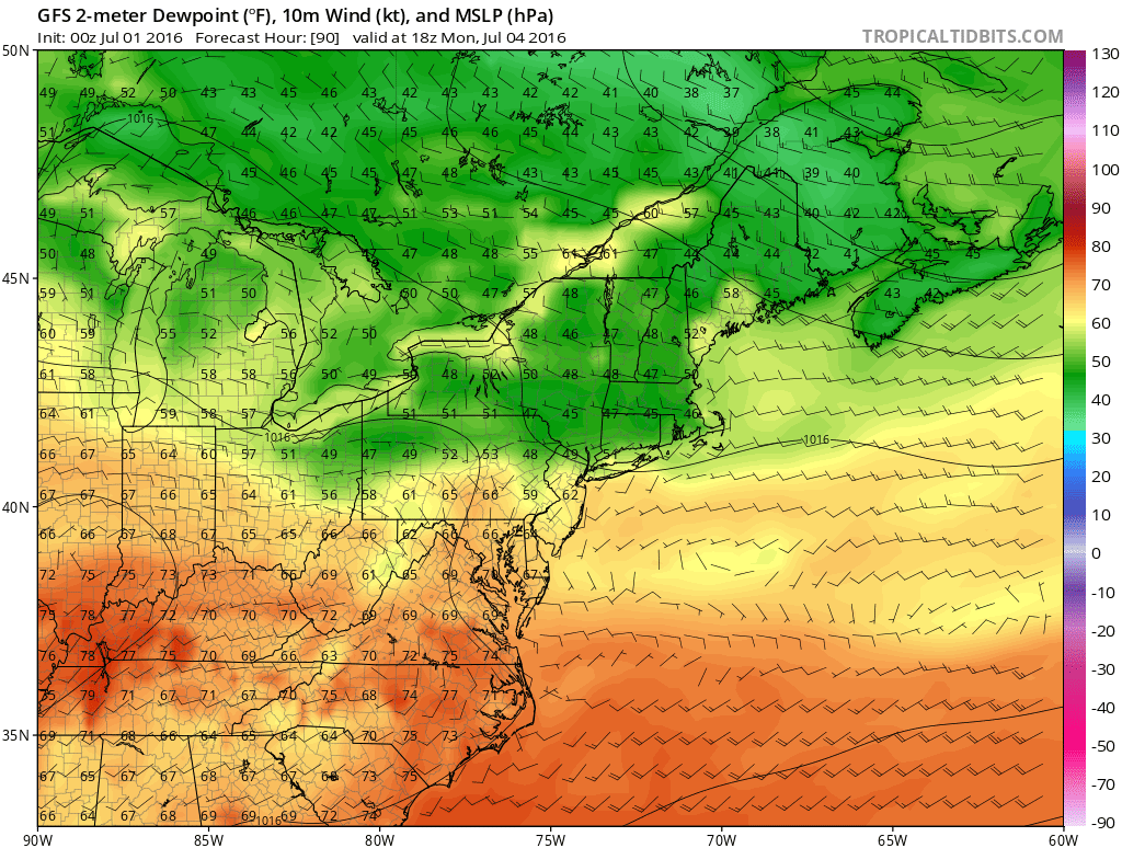
Saturday through Monday we will see sunshine each day with nothing more than a few passing clouds. What will stand out will be the very low humidity through the entire three days with daytime highs into the 80s each day. Take a look a the dew points forecast by the GFS model for each of the next three days. The air will be unusually bone dry with relative humidity levels running in the 20 to 30 percent range during the afternoon!!

Nights will be comfortable and in some cases cool with lows in the 60s and even 50s in many areas away from the coast and warmer urban locations. No rain is forecast through Monday night. It is a pretty simple and straight forward forecast. Some clouds may be an issue in Southern New Jersey over the weekend but even there there is no rain forecast through Monday.
FiOS1 News Weather Forecast For Long Island
FiOS1 News Weather Forecast For New Jersey
FiOS1 News Weather Forecast For Hudson Valley
NATIONAL WEATHER SERVICE SNOW FORECASTS
LATEST JOESTRADAMUS ON THE LONG RANGE
Weather App

Don’t be without Meteorologist Joe Cioffi’s weather app. It is really a meteorologist app because you get my forecasts and my analysis and not some automated computer generated forecast based on the GFS model. This is why your app forecast changes every 6 hours. It is model driven with no human input at all. It gives you an icon, a temperature and no insight whatsoever.
It is a complete weather app to suit your forecast needs. All the weather information you need is right on your phone. Android or I-phone, use it to keep track of all the latest weather information and forecasts. This weather app is also free of advertising so you don’t have to worry about security issues with your device. An accurate forecast and no worries that your device is being compromised.
Use it in conjunction with my website and my facebook and twitter and you have complete weather coverage of all the latest weather and the long range outlook. The website has been redone and upgraded. Its easy to use and everything is archived so you can see how well Joe does or doesn’t do when it comes to forecasts and outlooks.
Just click on the google play button or the apple store button on the sidebar for my app which is on My Weather Concierge. Download the app for free. Subscribe to my forecasts on an ad free environment for just 99 cents a month.
Get my forecasts in the palm of your hand for less than the cost of a cup of Joe!

MENTION JOE CIOFFI AND GET A 5% DISCOUNT


