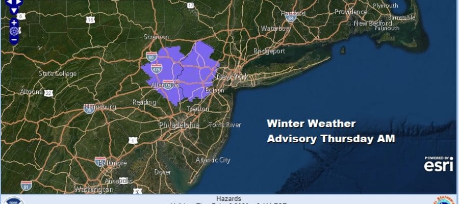
Winter Weather Advisory NW New Jersey NE Pa Thursday Morning Rain Later Tonight
We are waiting for a cold front to approach and move through tonight and ahead of it we see showers moving across Pennsylvania. Those showers will move through late tonight as the front passes southward in the morning. Behind it colder air will move but only temporarily as it settles southward into New Jersey Pennsylvania and down to Maryland. Winter Weather Advisories are posted for freezing rain and sleet that will move during Wednesday night and last into the morning commute on Thursday.

Additional Winter Weather Advisories for inland areas will likely be added for parts of Eastern Pennsylvania, the Hudson Valley and Connecticut by the local National Weather Service offices tomorrow for Thursday morning
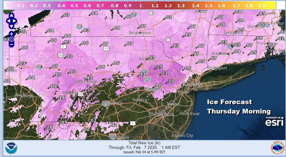
I’m not expecting major ice accumulations out of this system but enough to cause slippery conditions Thursday morning during the commute so caution is advised. Eventually temperatures will move above freezing Thursday morning and icing will diminish rather quickly. There won’t be much in the way of snow out of this system as the bulk of any accumulation will be upstate and north. Ice accumulations will be generally a tenth of an inch or less though there will be some isolated spots reaching as much as a quarter of an inch.
SATELLITE

REGIONAL RADAR

Clouds are still with us this evening and the radar is showing rain and showers to the west moving eastward. Rain or showers will be moving through overnight and they should soon start to show up on the local radars as well.
LOCAL RADAR NEW YORK CITY

LOCAL RADAR PHILADELPHIA


Showers will move out Wednesday morning and then we will have lots of leftover clouds around. Temperatures will be settling in the 30s to low 40s by days end and then drop below freezing inland at least for a good chunk of the overnight to set up the round of sleet and freezing rain for early Thursday morning.
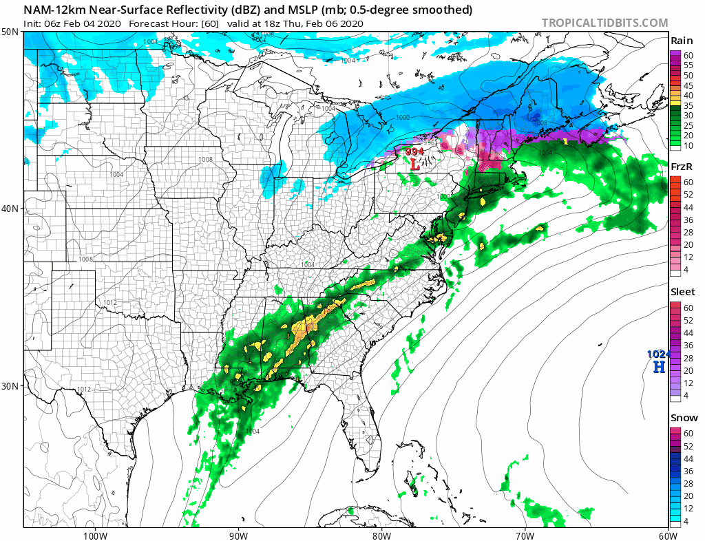
The first round of rain moves out Thursday morning only to start up again Thursday night as a second stronger wave moves up the coast. Rain will be heavy at times Thursday night into Friday morning and there could even be a few thunderstorms in the mix. Rain should end early on Friday with improving weather conditions later in the day. Temperatures will settle in the 40s or even rise into the 50s Thursday night into Friday morning especially along the coast.

We are still looking for rainfall amounts exceeding 2 inches in many places especially south of NYC. Some local flooding is possible as well. We will see a break in our weather on Saturday with some sunshine and arriving clouds with highs in the 30s. A weak low looks to bring an area of snow or a mix of snow and rain Saturday night into Sunday morning. We will address this in greater detail on tonight’s Joe & Joe Weather Show as well as on our weather platform on Patreon.
BE SURE TO DOWNLOAD THE FREE METEOROLOGIST JOE CIOFFI WEATHER APP &
ANGRY BEN’S FREE WEATHER APP “THE ANGRY WEATHERMAN!
MANY THANKS TO TROPICAL TIDBITS FOR THE USE OF MAPS
Please note that with regards to any severe weather, tropical storms, or hurricanes, should a storm be threatening, please consult your local National Weather Service office or your local government officials about what action you should be taking to protect life and property.


