Winter Weather Advisory Northeast Pennsylvana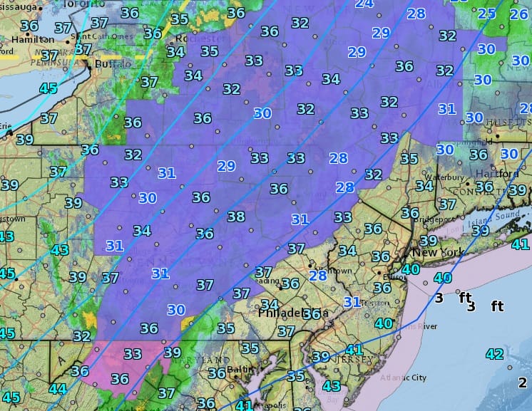
Winter Weather Advisory Northeast Pennsylvania Catskills NY
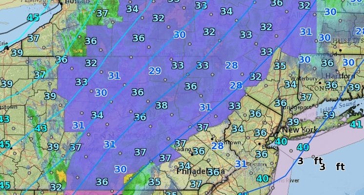
We have winter weather advisory posted for a good chunk of Northeastern Pennsylvania and extending northward into upstate NY this morning as a warm front goes by. Most temperatures area above freezing so I can’t imagine there is too much difficulty here with some sleet and maybe a few flakes of wet snow, especially since much of this area got 2 feet or more of snow last week. Satellite and radar show the area of precipitation moving east. Clouds have taken over for the day and won’t break up until the warm front goes by. For our area a passing shower is possible as all of this moisture will tend to weaken and shift northward as it moves east. There could be some ice pellets or a wet snowflake or two mixed in but other than that this is no big deal.
SATELLITE LOOP

REGIONAL RADAR

LOCAL RADAR NEW YORK CITY

LOCAL RADAR PHILADELPHIA


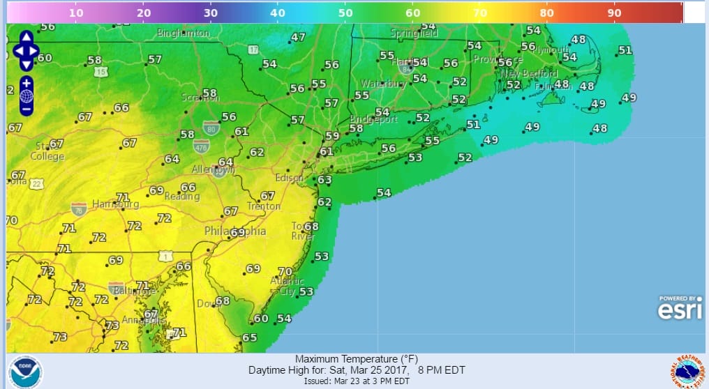
Once we get through this, we will see warmer temperatures into Saturday but we will be watching wind direction, a back door cold front to the north, and an area of rain that will develop north of the front later in the day Saturday. This means areas to the north and northeast of NYC will be in the 50s most of the day..while areas to the south and west will be in the 60s with some warm spots in Southeast Pennsylvania and Southern New Jersey touching 70.
That back door front drops southward Saturday evening and that sets us up for rain drizzle and a very chilly ocean wind. 40s will be common on Sunday for highs with 50s only as you go further south where the marine influence will be less. The front will try and come back up as a warm front Sunday night and Monday but how successful it is remains to be seen. Showers will be around as well Sunday night into Monday and another low pressure area will bring some rain here on Tuesday.
 GET JOE A CIGAR IF YOU LIKE

SNOW REMOVAL COMPANIES FOR YOUR WINTER NEEDS
LONG ISLAND ROCKLAND COUNTY Connecticut

![]()

ROCKLAND COUNTY TRI STATE SNOW REMOVAL JOHNSTOWN PA


FiOS1 News Weather Forecast For Long Island
FiOS1 News Weather Forecast For New Jersey
FiOS1 News Weather Forecast For Hudson Valley
NATIONAL WEATHER SERVICE SNOW FORECASTS
LATEST JOESTRADAMUS ON THE LONG RANGE
Weather App

Don’t be without Meteorologist Joe Cioffi’s weather app. It is really a meteorologist app because you get my forecasts and my analysis and not some automated computer generated forecast based on the GFS model. This is why your app forecast changes every 6 hours. It is model driven with no human input at all. It gives you an icon, a temperature and no insight whatsoever.
It is a complete weather app to suit your forecast needs. All the weather information you need is right on your phone. Android or I-phone, use it to keep track of all the latest weather information and forecasts. This weather app is also free of advertising so you don’t have to worry about security issues with your device. An accurate forecast and no worries that your device is being compromised.
Use it in conjunction with my website and my facebook and twitter and you have complete weather coverage of all the latest weather and the long range outlook. The website has been redone and upgraded. Its easy to use and everything is archived so you can see how well Joe does or doesn’t do when it comes to forecasts and outlooks.
Just click on the google play button or the apple store button on the sidebar for my app which is on My Weather Concierge. Download the app for free. Subscribe to my forecasts on an ad free environment for just 99 cents a month.
Get my forecasts in the palm of your hand for less than the cost of a cup of Joe!


